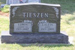
Edwin R Tieszen
| Birth | : | 11 Jul 1915 Marion, Turner County, South Dakota, USA |
| Death | : | 30 Apr 2007 Marion, Turner County, South Dakota, USA |
| Burial | : | Rawtenstall Cemetery, Rawtenstall, Rossendale Borough, England |
| Coordinate | : | 53.7060200, -2.2847500 |
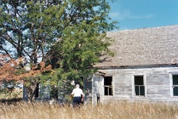
| Description | : | Known to everyone as "Eddie R.," he was born and raised on the Tieszen family farm, a couple of miles north and west of Marion, SD. After spending his youth in SD, he moved to California and worked as a carpenter. It was there that he met the love of his live, Laleta "Lee" Somerby. They were married on 11/13/1956, and lived for the next 4 decades in Southern California. They returned to Marion, SD, in 1996, where they spent the rest of their days surrounded by loving friends and family. His passing was the... Read More |
frequently asked questions (FAQ):
-
Where is Edwin R Tieszen's memorial?
Edwin R Tieszen's memorial is located at: Rawtenstall Cemetery, Rawtenstall, Rossendale Borough, England.
-
When did Edwin R Tieszen death?
Edwin R Tieszen death on 30 Apr 2007 in Marion, Turner County, South Dakota, USA
-
Where are the coordinates of the Edwin R Tieszen's memorial?
Latitude: 53.7060200
Longitude: -2.2847500
Family Members:
Parent
Spouse
Siblings
Flowers:
Nearby Cemetories:
1. Rawtenstall Cemetery
Rawtenstall, Rossendale Borough, England
Coordinate: 53.7060200, -2.2847500
2. Unitarian Chapel Burial Ground
Rossendale, Rossendale Borough, England
Coordinate: 53.7024380, -2.2856290
3. Longholme Methodist Cemetery
Rawtenstall, Rossendale Borough, England
Coordinate: 53.7009730, -2.2865000
4. Friends Burial Ground
Rossendale, Rossendale Borough, England
Coordinate: 53.7091000, -2.2757160
5. Broadleys Garden
Rawtenstall, Rossendale Borough, England
Coordinate: 53.7176321, -2.2904764
6. Burnley Road Cemetery, Reedsholme, Rossendale
Rossendale Borough, England
Coordinate: 53.7178398, -2.2904316
7. Crawshawbooth Quaker Burial Ground
Crawshawbooth, Rossendale Borough, England
Coordinate: 53.7242420, -2.2879400
8. Bethlehem Chapel Graveyard
Newchurch, Rossendale Borough, England
Coordinate: 53.6976970, -2.2522620
9. St. Nicholas Churchyard
Newchurch, Rossendale Borough, England
Coordinate: 53.6972220, -2.2524660
10. Saint Anne's Churchyard Edgeside
Waterfoot, Rossendale Borough, England
Coordinate: 53.7031600, -2.2482700
11. Newchurch Methodist Churchyard
Newchurch, Rossendale Borough, England
Coordinate: 53.6983460, -2.2501260
12. Ebenezer Baptist Chapel Chapelyard
Haslingden, Rossendale Borough, England
Coordinate: 53.7053960, -2.3230070
13. King Street Methodist Chapel Chapelyard
Haslingden, Rossendale Borough, England
Coordinate: 53.7066710, -2.3231330
14. St James Churchyard
Haslingden, Rossendale Borough, England
Coordinate: 53.7084000, -2.3259550
15. St. Mary and All Saints Churchyard
Goodshaw, Rossendale Borough, England
Coordinate: 53.7315270, -2.2828940
16. Saint Michael on the Hill Churchyard
Lumb, Rossendale Borough, England
Coordinate: 53.7201000, -2.2479300
17. Goodshaw Particular Baptist Chapel Graveyard
Goodshaw, Rossendale Borough, England
Coordinate: 53.7328210, -2.2815530
18. Lumb Baptist Church Cemetery
Waterfoot, Rossendale Borough, England
Coordinate: 53.7229340, -2.2455170
19. Rehoboth Chapel
Goodshaw, Rossendale Borough, England
Coordinate: 53.7355870, -2.2914730
20. Saint Thomas Churchyard
Helmshore, Rossendale Borough, England
Coordinate: 53.6870400, -2.3300000
21. Edenfield Parish Churchyard
Ramsbottom, Metropolitan Borough of Bury, England
Coordinate: 53.6742799, -2.3069304
22. Holden Hall Cemetery
Haslingden, Rossendale Borough, England
Coordinate: 53.6989870, -2.3427780
23. Haslingden Cemetery
Haslingden, Rossendale Borough, England
Coordinate: 53.6989500, -2.3427700
24. Providence Free United Methodist Graveyard
Crawshawbooth, Rossendale Borough, England
Coordinate: 53.7442070, -2.2825700


