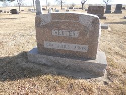
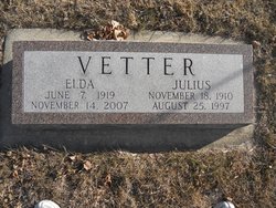
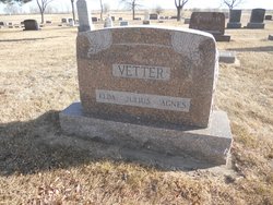
Elda Christina Schoppert Vetter
| Birth | : | 7 Jun 1919 Freeman, Hutchinson County, South Dakota, USA |
| Death | : | 14 Nov 2007 Sioux Falls, Minnehaha County, South Dakota, USA |
| Burial | : | Saint Peter Greenfield Cemetery, Vermillion, Clay County, USA |
| Coordinate | : | 42.8608017, -96.8644028 |
| Description | : | Elda (Schoppert) Vetter, 88 June 7, 1919 - November 14, 2007 Funeral services for Elda C. Vetter were held Monday, Nov. 19, 2007, at First American Lutheran Church, Tripp, with the Rev. Michael J. Jacobson officiating. Interment was made in the Gracehill Cemetery with Goglin Funeral Home, Tripp, in charge of the arrangements. Casketbearers were Paul Bauder, Dean Kommes, Garrett Kommes, Brad Tiede, Jamey Wermers and John Wermers. Elda Christina Vetter was born on Saturday, June 7, 1919, in Hutchinson County near Freeman. Her parents were Edward and Louise (Mutschelknaus) Schoppert. She attended high... Read More |
frequently asked questions (FAQ):
-
Where is Elda Christina Schoppert Vetter's memorial?
Elda Christina Schoppert Vetter's memorial is located at: Saint Peter Greenfield Cemetery, Vermillion, Clay County, USA.
-
When did Elda Christina Schoppert Vetter death?
Elda Christina Schoppert Vetter death on 14 Nov 2007 in Sioux Falls, Minnehaha County, South Dakota, USA
-
Where are the coordinates of the Elda Christina Schoppert Vetter's memorial?
Latitude: 42.8608017
Longitude: -96.8644028
Family Members:
Flowers:
Nearby Cemetories:
1. Saint Peter Greenfield Cemetery
Vermillion, Clay County, USA
Coordinate: 42.8608017, -96.8644028
2. Clay Point Cemetery
Prairie Center Township, Clay County, USA
Coordinate: 42.8987700, -96.9065600
3. Saint Mary Cemetery
Union County, USA
Coordinate: 42.8520584, -96.7877502
4. Spirit Mound Cemetery
Clay County, USA
Coordinate: 42.8885994, -96.9424973
5. Saint Agnes Cemetery
Vermillion, Clay County, USA
Coordinate: 42.7872009, -96.8499985
6. Rockfield Cemetery
Clay County, USA
Coordinate: 42.9397011, -96.8302994
7. Clay Creek Cemetery
Clay County, USA
Coordinate: 42.8516998, -96.9788971
8. Ahlsborg Lutheran Cemetery
Union County, USA
Coordinate: 42.8228000, -96.7612000
9. Dalesburg Lutheran Cemetery
Vermillion, Clay County, USA
Coordinate: 42.9389424, -96.9242594
10. Dowlin Cemetery
Burbank, Clay County, USA
Coordinate: 42.7789001, -96.8107986
11. Bluff View Cemetery
Vermillion, Clay County, USA
Coordinate: 42.7714000, -96.9056000
12. Saint Agnes Calvary Cemetery
Vermillion, Clay County, USA
Coordinate: 42.7715900, -96.9072100
13. Brule Creek Cemetery
Spink Township, Union County, USA
Coordinate: 42.8346510, -96.7324350
14. Pleasant Hill Cemetery Old
Spink, Union County, USA
Coordinate: 42.8588462, -96.7215592
15. Olbue Lerseth Cemetery
Beresford, Union County, USA
Coordinate: 42.9281100, -96.7516100
16. Roseni Lutheran Church Cemetery
Beresford, Union County, USA
Coordinate: 42.9388000, -96.7639000
17. Dalesburg Baptist Cemetery
Dalesburg, Clay County, USA
Coordinate: 42.9675102, -96.8850403
18. Mortvedt Cemetery
Clay County, USA
Coordinate: 42.9169006, -97.0028000
19. Pleasant Valley Cemetery
Westerville, Clay County, USA
Coordinate: 42.9247017, -97.0124969
20. Pleasant Hill Cemetery
Spink, Union County, USA
Coordinate: 42.8741000, -96.6876000
21. First Brule Creek Cemetery
Elk Point, Union County, USA
Coordinate: 42.7943993, -96.7069016
22. Nora Cemetery
Union County, USA
Coordinate: 42.9314003, -96.7061005
23. Old Lodi Cemetery
Lodi, Clay County, USA
Coordinate: 42.9757996, -96.9907990
24. Union County Poor Farm Cemetery
Union County, USA
Coordinate: 42.7649210, -96.7077580


