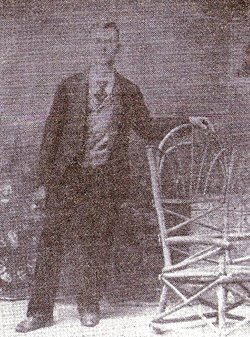
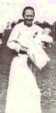
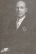
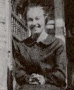
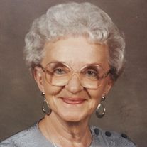
Elias Toliver Bellamy
| Birth | : | 1 May 1876 Callaway County, Missouri, USA |
| Death | : | 23 Feb 1927 Versailles, Morgan County, Missouri, USA |
| Burial | : | Green Haven Memorial Gardens, Canfield, Mahoning County, USA |
| Coordinate | : | 41.0625340, -80.7594670 |
| Description | : | Son of John William and Mary Lucille (Ball) Bellamy. His mother died in Proctor, Morgan County, in 1901. Burial is unknown. Much of his and Anna's married life is listed on her Bio, linked to him. I am going to add the story of how they met and married. The closest neighbors to the Albert Frisk family were the Wilford Robertson family. They lived about 1/2 mile east of the Frisk farm, and became close friends. One day a blue eyed blond rode up to the Robertson farm. His name was Elias Toliver Bellamy of Proctor, Missouri (now under the Lake... Read More |
frequently asked questions (FAQ):
-
Where is Elias Toliver Bellamy's memorial?
Elias Toliver Bellamy's memorial is located at: Green Haven Memorial Gardens, Canfield, Mahoning County, USA.
-
When did Elias Toliver Bellamy death?
Elias Toliver Bellamy death on 23 Feb 1927 in Versailles, Morgan County, Missouri, USA
-
Where are the coordinates of the Elias Toliver Bellamy's memorial?
Latitude: 41.0625340
Longitude: -80.7594670
Family Members:
Parent
Spouse
Siblings
Children
Nearby Cemetories:
1. Green Haven Memorial Gardens
Canfield, Mahoning County, USA
Coordinate: 41.0625340, -80.7594670
2. Pet Haven Memorial Gardens
Canfield, Mahoning County, USA
Coordinate: 41.0647840, -80.7579190
3. Smith Corners Cemetery
Austintown, Mahoning County, USA
Coordinate: 41.0689011, -80.7613983
4. Infirmary Cemetery
Canfield, Mahoning County, USA
Coordinate: 41.0482500, -80.7792950
5. Old North Cemetery
Canfield, Mahoning County, USA
Coordinate: 41.0393982, -80.7600021
6. Old Brunstetter Cemetery
Austintown, Mahoning County, USA
Coordinate: 41.0946007, -80.7788696
7. Ohev Tzedek Cemetery
Canfield, Mahoning County, USA
Coordinate: 41.0607986, -80.7118988
8. Cornersburg Cemetery
Cornersburg, Mahoning County, USA
Coordinate: 41.0608900, -80.7117400
9. Sharethora Cemetery
Mahoning County, USA
Coordinate: 41.0567017, -80.7121964
10. Brunstetter Cemetery
Austintown, Mahoning County, USA
Coordinate: 41.0957830, -80.7788540
11. Cotton Family Cemetery
Austintown, Mahoning County, USA
Coordinate: 41.0988312, -80.7556000
12. Boardman Zion Cemetery
Boardman, Mahoning County, USA
Coordinate: 41.0566700, -80.7106730
13. Canfield Village Cemetery
Canfield, Mahoning County, USA
Coordinate: 41.0242830, -80.7536270
14. Dean Hill Cemetery
Canfield, Mahoning County, USA
Coordinate: 41.0353012, -80.7957993
15. Lanterman Moherman Cemetery
Austintown, Mahoning County, USA
Coordinate: 41.1018890, -80.7315540
16. Covenanter Cemetery
North Jackson, Mahoning County, USA
Coordinate: 41.0687270, -80.8201110
17. Resurrection Cemetery
Austintown, Mahoning County, USA
Coordinate: 41.1076584, -80.7328415
18. Rider Farm Cemetery
Youngstown, Mahoning County, USA
Coordinate: 41.0744930, -80.6937680
19. Saint Mary Catholic Cemetery
Youngstown, Mahoning County, USA
Coordinate: 41.1002350, -80.7004720
20. New Four Mile Cemetery
Austintown, Mahoning County, USA
Coordinate: 41.1177902, -80.7313004
21. Calvary Cemetery
Youngstown, Mahoning County, USA
Coordinate: 41.0971985, -80.6932983
22. Geeburg Methodist Church Cemetery
Ellsworth, Mahoning County, USA
Coordinate: 41.0487850, -80.8380010
23. Disciple Church Cemetery
Austintown, Mahoning County, USA
Coordinate: 41.1202621, -80.7321396
24. Hugh Baird Cemetery
Youngstown, Mahoning County, USA
Coordinate: 41.0714390, -80.6737550

