
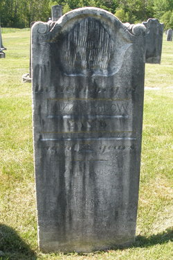

Elizabeth M “Lizzie” Dow
| Birth | : | 26 Nov 1862 |
| Death | : | 20 Sep 1883 |
| Burial | : | Desert Lawn Memorial Park, Palmdale, Los Angeles County, USA |
| Coordinate | : | 34.5525890, -118.0900880 |
frequently asked questions (FAQ):
-
Where is Elizabeth M “Lizzie” Dow's memorial?
Elizabeth M “Lizzie” Dow's memorial is located at: Desert Lawn Memorial Park, Palmdale, Los Angeles County, USA.
-
When did Elizabeth M “Lizzie” Dow death?
Elizabeth M “Lizzie” Dow death on 20 Sep 1883 in
-
Where are the coordinates of the Elizabeth M “Lizzie” Dow's memorial?
Latitude: 34.5525890
Longitude: -118.0900880
Family Members:
Parent

Siblings


Flowers:


Nearby Cemetories:
1. Desert Lawn Memorial Park
Palmdale, Los Angeles County, USA
Coordinate: 34.5525890, -118.0900880
2. Palmdale Cemetery
Palmdale, Los Angeles County, USA
Coordinate: 34.5592003, -118.0916977
3. Acton Community Cemetery
Acton, Los Angeles County, USA
Coordinate: 34.4791985, -118.2007980
4. Mount Gleason Ranch Cemetery
Acton, Los Angeles County, USA
Coordinate: 34.4410480, -118.1980720
5. Joshua Memorial Park
Lancaster, Los Angeles County, USA
Coordinate: 34.6958008, -118.1141968
6. Lancaster Cemetery
Lancaster, Los Angeles County, USA
Coordinate: 34.6977806, -118.1286087
7. Good Shepherd Catholic Cemetery
Lancaster, Los Angeles County, USA
Coordinate: 34.6656400, -118.2541300
8. Vasquez Rocks Natural Area County Park Burial Site
Agua Dulce, Los Angeles County, USA
Coordinate: 34.4886600, -118.3214500
9. Loomis Family Cemetery
Mount Wilson, Los Angeles County, USA
Coordinate: 34.3470200, -118.0488700
10. Saint Andrews Abbey Cemetery
Valyermo, Los Angeles County, USA
Coordinate: 34.4521217, -117.8681335
11. Llano Del Rio Cemetery
Llano, Los Angeles County, USA
Coordinate: 34.4851000, -117.8092100
12. Colby Ranch Cemetery
Palmdale, Los Angeles County, USA
Coordinate: 34.2986200, -118.1115100
13. Mitchell-Dyer Family Cemetery
Santa Clarita, Los Angeles County, USA
Coordinate: 34.4210200, -118.4309600
14. Sand Canyon Ranch Burial Site
Santa Clarita, Los Angeles County, USA
Coordinate: 34.3766880, -118.4105940
15. Verdugo Hills Cemetery
Tujunga, Los Angeles County, USA
Coordinate: 34.2619019, -118.2822037
16. Glen Haven Memorial Park
Sylmar, Los Angeles County, USA
Coordinate: 34.3085130, -118.3768380
17. Brown Mountain Grave Site
Altadena, Los Angeles County, USA
Coordinate: 34.2161400, -118.1612160
18. Sholom Memorial Park
Sylmar, Los Angeles County, USA
Coordinate: 34.3051630, -118.3763500
19. Islamic Cemetery and Masjid
Rosamond, Kern County, USA
Coordinate: 34.8385340, -118.3402240
20. Saint Georges Church Peace Garden
La Cañada Flintridge, Los Angeles County, USA
Coordinate: 34.2021700, -118.1960800
21. Mountain View Cemetery and Mausoleum
Altadena, Los Angeles County, USA
Coordinate: 34.1861000, -118.1481018
22. Pioneer Memorial Cemetery
Sylmar, Los Angeles County, USA
Coordinate: 34.3209305, -118.4481125
23. Ruiz-Perea Family Cemetery
Santa Clarita, Los Angeles County, USA
Coordinate: 34.4889170, -118.5458940
24. Mater Dolorosa Passionist Retreat Center Cemetery
Sierra Madre, Los Angeles County, USA
Coordinate: 34.1709633, -118.0647049