
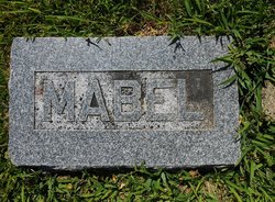

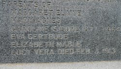
Elizabeth Mabel McCready Dort
| Birth | : | 21 Nov 1881 Nebraska, USA |
| Death | : | 23 Sep 1921 Lincoln, Lancaster County, Nebraska, USA |
| Burial | : | Pawnee City Cemetery, Pawnee City, Pawnee County, USA |
| Coordinate | : | 40.1109009, -96.1608810 |
| Plot | : | W 106- 10 |
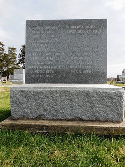
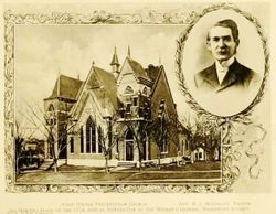
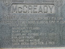
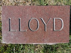
| Description | : | Daughter of Robert J. & Margaret Edna Yost McCready. Married Jan. 1, 1907 to Charles Lloyd Dort in Pawnee Co., NE. (Pawnee Library, book with obits in Pawnee Republican.) TABLE ROCK ARGUS,Table Rock, Nebraska.Jan. 3, 1907.(pg.5) Lloyd Dort and Miss Mabel McCready were united in marriage at the First United Presbyterian Church in Pawnee City on Tuesday, the bride's father officiating. TABLE ROCK ARGUS, Table Rock, Nebr., Sept. 30, 1921, (Page 8) The wife of C. L. Dort, deputy attorney general of Nebraska, son of J. C. Dort, of Pawnee City, died at the home in... Read More |
frequently asked questions (FAQ):
-
Where is Elizabeth Mabel McCready Dort's memorial?
Elizabeth Mabel McCready Dort's memorial is located at: Pawnee City Cemetery, Pawnee City, Pawnee County, USA.
-
When did Elizabeth Mabel McCready Dort death?
Elizabeth Mabel McCready Dort death on 23 Sep 1921 in Lincoln, Lancaster County, Nebraska, USA
-
Where are the coordinates of the Elizabeth Mabel McCready Dort's memorial?
Latitude: 40.1109009
Longitude: -96.1608810
Family Members:
Parent
Spouse
Siblings
Children
Flowers:


Nearby Cemetories:
1. Pawnee City Cemetery
Pawnee City, Pawnee County, USA
Coordinate: 40.1109009, -96.1608810
2. East Amish Cemetery
Table Rock, Pawnee County, USA
Coordinate: 40.1310000, -96.0854000
3. Evergreen Cemetery
Pawnee County, USA
Coordinate: 40.0485992, -96.1417007
4. Pleasant Valley Cemetery
Pawnee County, USA
Coordinate: 40.0299988, -96.1554794
5. Table Rock Cemetery
Table Rock, Pawnee County, USA
Coordinate: 40.1791400, -96.1037400
6. Prairie Star Pioneer Cemetery
Du Bois, Pawnee County, USA
Coordinate: 40.0293000, -96.1041000
7. Beranek Cemetery
Table Rock, Pawnee County, USA
Coordinate: 40.2042007, -96.1607971
8. Pleasant Ridge Cemetery
Du Bois, Pawnee County, USA
Coordinate: 40.0156000, -96.1494000
9. West Branch Cemetery
Pawnee County, USA
Coordinate: 40.0787940, -96.2797160
10. Saint Anthonys Cemetery
Steinauer, Pawnee County, USA
Coordinate: 40.2075005, -96.2189026
11. Johnson Creek Cemetery
Pawnee City, Pawnee County, USA
Coordinate: 40.0270000, -96.2465000
12. Clear Creek Cemetery
Table Rock, Pawnee County, USA
Coordinate: 40.2193985, -96.1391983
13. Bohemian Cemetery
Table Rock, Pawnee County, USA
Coordinate: 40.1786003, -96.0374985
14. Saint Peters Evangelican Cemetery
Du Bois, Pawnee County, USA
Coordinate: 40.0010000, -96.1095000
15. Dry Branch Pioneer Cemetery
Richardson County, USA
Coordinate: 40.1292000, -96.0100021
16. DuBois Cemetery
Du Bois, Pawnee County, USA
Coordinate: 40.0231018, -96.0488968
17. Bohemian Cemetery
Richardson County, USA
Coordinate: 40.1175003, -95.9955978
18. Saint Johns Cemetery
Table Rock, Pawnee County, USA
Coordinate: 40.2148000, -96.0657000
19. Salems Cemetery
Steinauer, Pawnee County, USA
Coordinate: 40.2166000, -96.2555000
20. McCaffrey Cemetery
Nemaha County, USA
Coordinate: 39.9827100, -96.1474500
21. Madden Cemetery
Axtell, Marshall County, USA
Coordinate: 39.9866800, -96.2490300
22. Friedens United Church of Christ Cemetery
Bern, Nemaha County, USA
Coordinate: 39.9929008, -96.0529480
23. Saint Peters Lutheran Church Cemetery
Steinauer, Pawnee County, USA
Coordinate: 40.2555000, -96.1801000
24. Cincinnati Cemetery
Du Bois, Pawnee County, USA
Coordinate: 40.0042000, -96.0274963