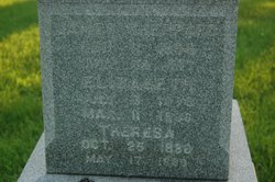
Ella G. Sheppard Maloney
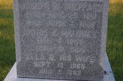
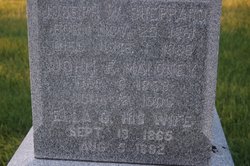
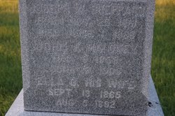
| Birth | : | 13 Sep 1865 Clinton, Clinton County, Iowa, USA |
| Death | : | 5 Aug 1892 Clinton, Clinton County, Iowa, USA |
| Burial | : | Baltimore Pike Cemetery, Cincinnati, Hamilton County, USA |
| Coordinate | : | 39.1397018, -84.5681000 |
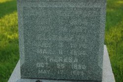
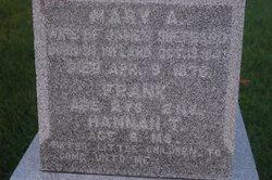
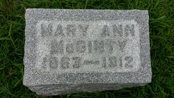
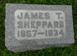
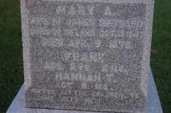
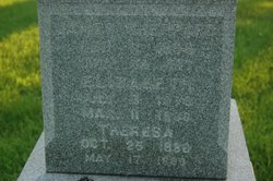
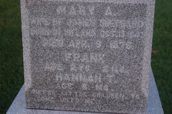
| Description | : | "Death of Mrs. John Maloney Mrs. John Maloney died of consumption at 10:45 o'clock this morning at her late home on Seventh avenue, near Seventh street. She leaves a husband and one small child. Funeral arrangements have not been made." Ella G. "Ellen" Sheppard Maloney was the wife of John F. Maloney and the mother of Robert F. Maloney. Son Robert died in Chicago in 1947. Ella's parents were James T. and Mary Ann Savage Sheppard. Her brothers and sister were Joseph, Mary Ann, John F., James and Hannah. |
frequently asked questions (FAQ):
-
Where is Ella G. Sheppard Maloney's memorial?
Ella G. Sheppard Maloney's memorial is located at: Baltimore Pike Cemetery, Cincinnati, Hamilton County, USA.
-
When did Ella G. Sheppard Maloney death?
Ella G. Sheppard Maloney death on 5 Aug 1892 in Clinton, Clinton County, Iowa, USA
-
Where are the coordinates of the Ella G. Sheppard Maloney's memorial?
Latitude: 39.1397018
Longitude: -84.5681000
Family Members:
Parent
Spouse
Siblings
Children
Flowers:
Nearby Cemetories:
1. Baltimore Pike Cemetery
Cincinnati, Hamilton County, USA
Coordinate: 39.1397018, -84.5681000
2. Martini United Church of Christ Cemetery
Fairmount, Hamilton County, USA
Coordinate: 39.1296272, -84.5664902
3. Price Hill United Jewish Cemetery
Price Hill, Hamilton County, USA
Coordinate: 39.1238380, -84.5806830
4. Third Quaker Cemetery (Defunct)
Cincinnati, Hamilton County, USA
Coordinate: 39.1542400, -84.5523720
5. Montefiore Cemetery
Price Hill, Hamilton County, USA
Coordinate: 39.1209800, -84.5850500
6. Beth Tefyla Schachnus Cemetery
Cincinnati, Hamilton County, USA
Coordinate: 39.1206100, -84.5854300
7. Judah Touro Cemetery
Cincinnati, Hamilton County, USA
Coordinate: 39.1195910, -84.5853280
8. Adath Israel Cemetery
Price Hill, Hamilton County, USA
Coordinate: 39.1186300, -84.5839100
9. Spanish-Hebrew Sephardic Beth Shalom Cemetery
Price Hill, Hamilton County, USA
Coordinate: 39.1186300, -84.5839100
10. Love Brothers Cemetery
Cincinnati, Hamilton County, USA
Coordinate: 39.1180620, -84.5826940
11. Hirsch Hoffert Cemetery
Price Hill, Hamilton County, USA
Coordinate: 39.1192400, -84.5861600
12. Chesed Chel Emmes Cemetery
Price Hill, Hamilton County, USA
Coordinate: 39.1183586, -84.5853424
13. Wesleyan Cemetery
Cincinnati, Hamilton County, USA
Coordinate: 39.1599998, -84.5468979
14. Potters Field
Cincinnati, Hamilton County, USA
Coordinate: 39.1197014, -84.5899963
15. Clifton United Jewish Cemetery
Cincinnati, Hamilton County, USA
Coordinate: 39.1470871, -84.5292816
16. Saint Joseph Irish Cemetery
Price Hill, Hamilton County, USA
Coordinate: 39.1075050, -84.5740940
17. Hillside Chapel Crematory and Columbarium
Cincinnati, Hamilton County, USA
Coordinate: 39.1393509, -84.5247192
18. Union Baptist Cemetery
Cincinnati, Hamilton County, USA
Coordinate: 39.1180000, -84.6025009
19. Saint Joseph Cemetery
Cincinnati, Hamilton County, USA
Coordinate: 39.1035995, -84.5757980
20. Cheviot Cemetery (Defunct)
Green Township, Hamilton County, USA
Coordinate: 39.1563050, -84.6117890
21. Westwood Baptist Cemetery
Cheviot, Hamilton County, USA
Coordinate: 39.1566400, -84.6116700
22. Second Quaker Cemetery (Defunct)
Cincinnati, Hamilton County, USA
Coordinate: 39.1153090, -84.5305240
23. American Beneficial Cemetery
Covedale, Hamilton County, USA
Coordinate: 39.1292200, -84.6152400
24. Golf Manor No 1 Cemetery
Covedale, Hamilton County, USA
Coordinate: 39.1286600, -84.6150400

