
| Memorials | : | 87 |
| Location | : | Cincinnati, Hamilton County, USA |
| Phone | : | (513) 961-0178 |
| Website | : | www.jcemcin.org |
| Coordinate | : | 39.1470871, -84.5292816 |
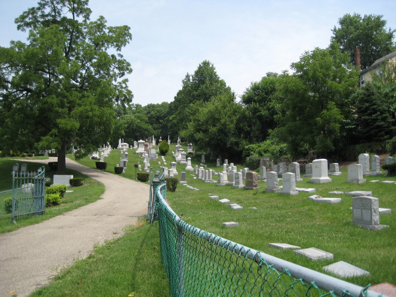
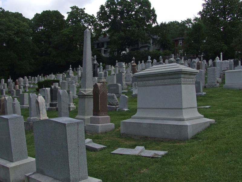
| Description | : | In 1848, Charles Kahn purchased the 1.3 acre parcel that the cemetery sits on. After his neighbors indicated that they would prefer he not build his house there, he sold the land to the Ahabeth Achim Congregation (which later became the Sherith Israel Congregation) for use as a cemetery. In 1931, Sherith Israel merged with Wise Temple, bringing the cemetery into the United Jewish Cemeteries. The cemetery is a Reform Jewish cemetery and is still active. The cemetery is owned and operated by: Jewish Cemeteries of Greater Cincinnati 3400 Montgomery Road Cincinnati, OH 45027 Phone: 513-961-0178 Fax: 513-961-2021 On their website under... Read More |
frequently asked questions (FAQ):
-
Where is Clifton United Jewish Cemetery?
Clifton United Jewish Cemetery is located at 730 (Old) Ludlow Avenue Cincinnati, Hamilton County ,Ohio , 45220USA.
-
Clifton United Jewish Cemetery cemetery's updated grave count on graveviews.com?
85 memorials
-
Where are the coordinates of the Clifton United Jewish Cemetery?
Latitude: 39.1470871
Longitude: -84.5292816


Nearby Cemetories:
1. Hillside Chapel Crematory and Columbarium
Cincinnati, Hamilton County, USA
Coordinate: 39.1393509, -84.5247192
2. Vine Street Hill Cemetery
Cincinnati, Hamilton County, USA
Coordinate: 39.1516991, -84.5091019
3. Spring Grove Cemetery
Cincinnati, Hamilton County, USA
Coordinate: 39.1647900, -84.5231500
4. Wesleyan Cemetery
Cincinnati, Hamilton County, USA
Coordinate: 39.1599998, -84.5468979
5. Third Quaker Cemetery (Defunct)
Cincinnati, Hamilton County, USA
Coordinate: 39.1542400, -84.5523720
6. Saint John Cemetery
Saint Bernard, Hamilton County, USA
Coordinate: 39.1643982, -84.5053024
7. Methodist Protestant Cemetery (Defunct)
Cincinnati, Hamilton County, USA
Coordinate: 39.1324770, -84.4983160
8. Baltimore Pike Cemetery
Cincinnati, Hamilton County, USA
Coordinate: 39.1397018, -84.5681000
9. Second Quaker Cemetery (Defunct)
Cincinnati, Hamilton County, USA
Coordinate: 39.1153090, -84.5305240
10. First German Protestant Cemetery
Avondale, Hamilton County, USA
Coordinate: 39.1492004, -84.4863968
11. Martini United Church of Christ Cemetery
Fairmount, Hamilton County, USA
Coordinate: 39.1296272, -84.5664902
12. Christ Church Cemetery
Over-The-Rhine, Hamilton County, USA
Coordinate: 39.1126480, -84.5157623
13. Saint Mary Cemetery
Saint Bernard, Hamilton County, USA
Coordinate: 39.1664009, -84.4880981
14. Lincoln Park Potters Field (Defunct)
Cincinnati, Hamilton County, USA
Coordinate: 39.1097710, -84.5346450
15. Christ Episcopal Churchyard (Defunct)
Cincinnati, Hamilton County, USA
Coordinate: 39.1100520, -84.5177220
16. Potters Field
Cincinnati, Hamilton County, USA
Coordinate: 39.1094440, -84.5188890
17. Walnut Hills Cemetery
Cincinnati, Hamilton County, USA
Coordinate: 39.1355950, -84.4809040
18. Presbyterian Burying Ground
Cincinnati, Hamilton County, USA
Coordinate: 39.1082510, -84.5175720
19. Thomas Williams Cemetery (Defunct)
Cincinnati, Hamilton County, USA
Coordinate: 39.1085060, -84.5146050
20. Chestnut Street Cemetery
Over-The-Rhine, Hamilton County, USA
Coordinate: 39.1071610, -84.5212210
21. Catherine Street Burying Ground
Cincinnati, Hamilton County, USA
Coordinate: 39.1067490, -84.5252700
22. Enon Baptist Church Burying Ground (Defunct)
Cincinnati, Hamilton County, USA
Coordinate: 39.1065420, -84.5238110
23. Catherine Street Methodist Cemetery (Defunct)
Cincinnati, Hamilton County, USA
Coordinate: 39.1064840, -84.5243150
24. Walnut Hills Jewish Cemetery
Evanston, Hamilton County, USA
Coordinate: 39.1403700, -84.4731300