Elmer P. Cole
| Birth | : | 31 Jan 1921 Brule, Keith County, Nebraska, USA |
| Death | : | 16 Apr 2011 Ogallala, Keith County, Nebraska, USA |
| Burial | : | Brule Cemetery, Brule, Keith County, USA |
| Coordinate | : | 41.1060982, -101.8822021 |
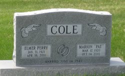
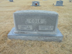
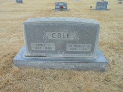
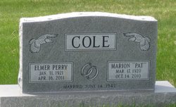
| Description | : | Elmer P. Cole, 90, lifetime resident of Brule, died Saturday, April 16, 2011 at Indian Hills Manor in Ogallala. Elmer was born January 31, 1921 in Brule, the son of Earle V. and Catherine Perry Cole. After graduating from Brule High School in 1937, he graduated from Pomana College at Claremont, Cal. On June 14, 1942 Elmer married Marion "Pat" Gratz at Claremont. Elmer enlisted in the military service on August 20, 1942 and served in the Army Air Corp infantry divisions as a bandsman, with the 19th Special Service Company. His service included overseas deployment in France... Read More |
frequently asked questions (FAQ):
-
Where is Elmer P. Cole's memorial?
Elmer P. Cole's memorial is located at: Brule Cemetery, Brule, Keith County, USA.
-
When did Elmer P. Cole death?
Elmer P. Cole death on 16 Apr 2011 in Ogallala, Keith County, Nebraska, USA
-
Where are the coordinates of the Elmer P. Cole's memorial?
Latitude: 41.1060982
Longitude: -101.8822021
Family Members:
Parent
Spouse
Flowers:
Nearby Cemetories:
1. Brule Cemetery
Brule, Keith County, USA
Coordinate: 41.1060982, -101.8822021
2. Ogallala Cemetery
Ogallala, Keith County, USA
Coordinate: 41.1286011, -101.7472000
3. Boot Hill Cemetery
Ogallala, Keith County, USA
Coordinate: 41.1324997, -101.7256012
4. Big Springs Cemetery
Big Springs, Deuel County, USA
Coordinate: 41.0592003, -102.0931015
5. Lemoyne Cemetery
Lemoyne, Keith County, USA
Coordinate: 41.2723000, -101.8123000
6. Trinity Lutheran Cemetery
Grant, Perkins County, USA
Coordinate: 40.9605000, -101.7478000
7. Day Cemetery
Deuel County, USA
Coordinate: 41.1921997, -102.1331024
8. Zion Cemetery
Deuel County, USA
Coordinate: 41.1641998, -102.1530991
9. Saint John's Lutheran Church Cemetery
Ogallala, Keith County, USA
Coordinate: 41.0617000, -101.5983000
10. Ash Hollow Cemetery
Lewellen, Garden County, USA
Coordinate: 41.3083000, -102.1252975
11. Plum Creek Cemetery
Garden County, USA
Coordinate: 41.3469009, -102.0828018
12. Fairview Cemetery
Grant, Perkins County, USA
Coordinate: 40.8372002, -101.7391968
13. Hillside Cemetery
Julesburg, Sedgwick County, USA
Coordinate: 40.9692001, -102.2406006
14. Ash Creek Cemetery
Lewellen, Garden County, USA
Coordinate: 41.3521996, -102.1205978
15. Pickard Cemetery
Keith County, USA
Coordinate: 41.0482240, -101.4809320
16. Durham Cemetery
Garden County, USA
Coordinate: 41.3314018, -102.2074966
17. Green Cemetery
Julesburg, Sedgwick County, USA
Coordinate: 40.8650000, -102.2284090
18. Berea Lutheran Cemetery
Chappell, Deuel County, USA
Coordinate: 41.2008900, -102.3439080
19. Fairview Cemetery
Garden County, USA
Coordinate: 41.4524994, -102.0233002
20. Madrid Cemetery
Madrid, Perkins County, USA
Coordinate: 40.8371510, -101.5380900
21. Venango Cemetery
Venango, Perkins County, USA
Coordinate: 40.7416992, -102.0175018
22. Ovid Cemetery
Ovid, Sedgwick County, USA
Coordinate: 40.9756012, -102.3632965
23. Mennonite Cemetery
Chappell, Deuel County, USA
Coordinate: 41.1244011, -102.3993988
24. Paxton Cemetery
Paxton, Keith County, USA
Coordinate: 41.1088982, -101.3569031


