
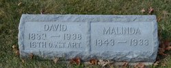
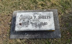
| Birth | : | 5 Jan 1881 Clark County, Ohio, USA |
| Death | : | 18 Sep 1940 Springfield, Clark County, Ohio, USA |
| Burial | : | Vale Cemetery, Springfield, Clark County, USA |
| Coordinate | : | 39.9371986, -83.8846970 |
frequently asked questions (FAQ):
-
Where is Emma Geer Sheets Rader's memorial?
Emma Geer Sheets Rader's memorial is located at: Vale Cemetery, Springfield, Clark County, USA.
-
When did Emma Geer Sheets Rader death?
Emma Geer Sheets Rader death on 18 Sep 1940 in Springfield, Clark County, Ohio, USA
-
Where are the coordinates of the Emma Geer Sheets Rader's memorial?
Latitude: 39.9371986
Longitude: -83.8846970
Family Members:
Parent

Spouse

Siblings
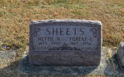
Children
Flowers:


Nearby Cemetories:
1. Vale Cemetery
Springfield, Clark County, USA
Coordinate: 39.9371986, -83.8846970
2. Callison Cemetery
Springfield, Clark County, USA
Coordinate: 39.9516983, -83.8822021
3. Frantz-Ebersole Cemetery
Clark County, USA
Coordinate: 39.9180820, -83.9014680
4. Huffman House
Clark County, USA
Coordinate: 39.9133490, -83.8910650
5. Masonic Home Cemetery
Springfield, Clark County, USA
Coordinate: 39.9178009, -83.8621979
6. Sims Chapel Cemetery
Lawrenceville, Clark County, USA
Coordinate: 39.9664860, -83.8997620
7. Bethel Baptist Church Cemetery
New Carlisle, Clark County, USA
Coordinate: 39.9386711, -83.9274292
8. New Boston Cemetery
Clark County, USA
Coordinate: 39.9070000, -83.9060000
9. Keifer Cemetery
Clark County, USA
Coordinate: 39.9120000, -83.9160000
10. Ferncliff Cemetery
Springfield, Clark County, USA
Coordinate: 39.9375000, -83.8218994
11. Lawrenceville Cemetery
Lawrenceville, Clark County, USA
Coordinate: 39.9860000, -83.8730000
12. Minnich Graveyard
Donnelsville, Clark County, USA
Coordinate: 39.9054160, -83.9346180
13. Donnelsville Cemetery
Donnelsville, Clark County, USA
Coordinate: 39.9216995, -83.9471970
14. Old Donnelsville Cemetery
Donnelsville, Clark County, USA
Coordinate: 39.9233932, -83.9521561
15. Mount Zion Cemetery
Springfield, Clark County, USA
Coordinate: 39.9811880, -83.8418690
16. Ream Cemetery
North Hampton, Clark County, USA
Coordinate: 39.9843890, -83.9225640
17. Columbia Street Cemetery
Springfield, Clark County, USA
Coordinate: 39.9263992, -83.8131027
18. Wildason Animal Cemetery
Donnelsville, Clark County, USA
Coordinate: 39.9193993, -83.9546967
19. Knob Prairie Cemetery
Enon, Clark County, USA
Coordinate: 39.8895150, -83.9252960
20. Saint Bernard Cemetery
Springfield, Clark County, USA
Coordinate: 39.9528008, -83.8107986
21. Flick Cemetery
North Hampton, Clark County, USA
Coordinate: 39.9931410, -83.9127000
22. Myers Cemetery
North Hampton, Clark County, USA
Coordinate: 39.9688988, -83.9511032
23. Christ Episcopal Church Columbarium
Springfield, Clark County, USA
Coordinate: 39.9226150, -83.8037060
24. Glen Haven Memorial Gardens
New Carlisle, Clark County, USA
Coordinate: 39.9183006, -83.9653015