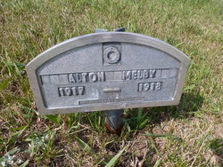
Ernest Alton Melby
| Birth | : | 17 Apr 1917 Noonan, Divide County, North Dakota, USA |
| Death | : | 18 Apr 1918 Divide County, North Dakota, USA |
| Burial | : | Saint Louis de Gonzague, Richibucto, Kent County, Canada |
| Coordinate | : | 46.6882680, -64.8624160 |
| Description | : | Noonan Miner • April 25, 1918 The little infant which came to gladden the hearts of Mrs. and Mrs. Albert Melby on Wednesday, April 17th, passed away Sunday morning. The little one was taken suddenly ill with convulsions, which was the cause of his death. Funeral services were held Monday afternoon at the Zion church south of Noonan, interment was made in the cemetery adjoining. Mr. and Mrs. Melby have the sympathy of the entire community in their hour of bereavement. Contributor: LjBJ (48065439) |
frequently asked questions (FAQ):
-
Where is Ernest Alton Melby's memorial?
Ernest Alton Melby's memorial is located at: Saint Louis de Gonzague, Richibucto, Kent County, Canada.
-
When did Ernest Alton Melby death?
Ernest Alton Melby death on 18 Apr 1918 in Divide County, North Dakota, USA
-
Where are the coordinates of the Ernest Alton Melby's memorial?
Latitude: 46.6882680
Longitude: -64.8624160
Family Members:
Parent
Siblings
Flowers:
Nearby Cemetories:
1. Saint Louis de Gonzague
Richibucto, Kent County, Canada
Coordinate: 46.6882680, -64.8624160
2. Richibucto Protestant Cemetery
Richibucto, Kent County, Canada
Coordinate: 46.6730300, -64.8677700
3. Aldouane Roman Catholic Cemetery
Aldouane, Kent County, Canada
Coordinate: 46.7098670, -64.8985700
4. Saint Andrew's United Church Cemetery
Rexton, Kent County, Canada
Coordinate: 46.6478700, -64.8724000
5. Immaculate Conception Roman Catholic Cemetery
Rexton, Kent County, Canada
Coordinate: 46.6400100, -64.8712200
6. Galloway Cemetery
West Galloway, Kent County, Canada
Coordinate: 46.6124320, -64.8520750
7. St. Charles Roman Catholic Cemetery
Saint-Charles, Kent County, Canada
Coordinate: 46.6689480, -64.9729100
8. Saint Antoine de Padoue
Richibucto, Kent County, Canada
Coordinate: 46.6568030, -64.7537160
9. Saint-Louis-de-Kent Catholic Cemetery
Saint-Louis de Kent, Kent County, Canada
Coordinate: 46.7284860, -64.9799050
10. Methodist Point Cemetery
Rexton, Kent County, Canada
Coordinate: 46.6042300, -64.9165060
11. Chapel Point Cemetery
Richibucto, Kent County, Canada
Coordinate: 46.5966300, -64.9202300
12. Saint Anne's Roman Catholic Cemetery
Big Cove, Kent County, Canada
Coordinate: 46.5854736, -64.9864107
13. Kingdom Hall of Jehovah's Witnesses Cemetery
West Branch, Kent County, Canada
Coordinate: 46.5497546, -64.9345299
14. Saint Anne Roman Catholic Cemetery
Sainte-Anne-de-Kent, Kent County, Canada
Coordinate: 46.5509000, -64.7738340
15. West Branch Presbyterian Cemetery
West Branch, Kent County, Canada
Coordinate: 46.5410340, -64.9480820
16. Saint John's United Church Cemetery
West Branch, Kent County, Canada
Coordinate: 46.5339660, -64.9571180
17. Knox Presbyterian Cemetery
Kouchibouguac, Kent County, Canada
Coordinate: 46.7938700, -65.0578100
18. Kouchibouguac Roman Catholic Cemetery
Kouchibouguac, Kent County, Canada
Coordinate: 46.7966100, -65.0563800
19. St. Stephens United Church Cemetery
Molus River, Kent County, Canada
Coordinate: 46.5763290, -65.0817130
20. St. Bartholomew's Roman Catholic Cemetery
Molus River, Kent County, Canada
Coordinate: 46.5739550, -65.0830720
21. Old MacIntosh Hill Burial Ground
Kent County, Canada
Coordinate: 46.5031240, -64.7459570
22. St. Mark's Presbyterian Cemetery
Bass River, Kent County, Canada
Coordinate: 46.5424130, -65.0894630
23. Saint Bartholomew Roman Catholic Cemetery
Bass River, Kent County, Canada
Coordinate: 46.5539410, -65.1073140
24. (New) Bouctouche Roman Catholic Cemetery
Bouctouche, Kent County, Canada
Coordinate: 46.5104850, -64.6827398


