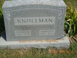
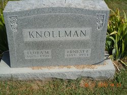
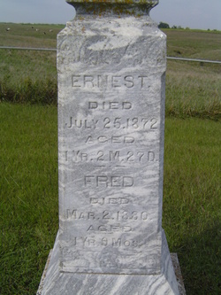
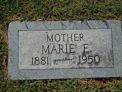
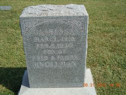
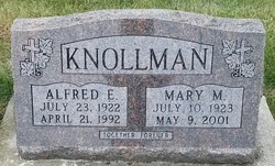
Ernest Frederich “Fred” Knollman
| Birth | : | 17 Aug 1883 Easton, Leavenworth County, Kansas, USA |
| Death | : | 24 Dec 1954 Leavenworth, Leavenworth County, Kansas, USA |
| Burial | : | Saint Johns Lutheran Cemetery, Millwood, Leavenworth County, USA |
| Coordinate | : | 39.4042015, -95.1386032 |
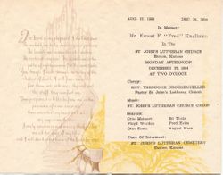
| Description | : | Potter Kansan, 30 December 1954, page 1, column 3. 'Fred' Knollman Funeral Monday Ernest F. Knollman, 71, died at 2 p.m. Friday [Dec 24] at Cushing Memorial Hospital. "Fred" Knollman was a well known farmer and stockman of the Millwood community whose home was on RR 2, Easton. Mr. Knollman had been in fairly good health until the first part of November when he became ill. He entered the hospital in mid-November, staying for three weeks. He again entered the hospital Dec. 18 when his condition became critical. Mr. Knollman was born on the farm on which he lived his entire life. He was... Read More |
frequently asked questions (FAQ):
-
Where is Ernest Frederich “Fred” Knollman's memorial?
Ernest Frederich “Fred” Knollman's memorial is located at: Saint Johns Lutheran Cemetery, Millwood, Leavenworth County, USA.
-
When did Ernest Frederich “Fred” Knollman death?
Ernest Frederich “Fred” Knollman death on 24 Dec 1954 in Leavenworth, Leavenworth County, Kansas, USA
-
Where are the coordinates of the Ernest Frederich “Fred” Knollman's memorial?
Latitude: 39.4042015
Longitude: -95.1386032
Family Members:
Parent
Spouse
Siblings
Children
Flowers:
Nearby Cemetories:
1. Saint Johns Lutheran Cemetery
Millwood, Leavenworth County, USA
Coordinate: 39.4042015, -95.1386032
2. Evergreen Cemetery
Millwood, Leavenworth County, USA
Coordinate: 39.3833008, -95.1333008
3. Fairview Cemetery
Potter, Atchison County, USA
Coordinate: 39.4239006, -95.1613998
4. Oak Hill Cemetery
Millwood, Leavenworth County, USA
Coordinate: 39.3833008, -95.0943985
5. Langley Cemetery
Easton, Leavenworth County, USA
Coordinate: 39.3616982, -95.1611023
6. Old Young Cemetery
Potter, Atchison County, USA
Coordinate: 39.4480782, -95.1176071
7. Mount Pleasant Cemetery
Potter, Atchison County, USA
Coordinate: 39.4520187, -95.1412964
8. Round Prairie Cemetery
Lowemont, Leavenworth County, USA
Coordinate: 39.4122009, -95.0738983
9. Hays Cemetery
Oak Mills, Atchison County, USA
Coordinate: 39.4370300, -95.0883700
10. Springhill Cemetery
Potter, Atchison County, USA
Coordinate: 39.4303589, -95.2025375
11. Saint Lawrence Cemetery
Easton, Leavenworth County, USA
Coordinate: 39.3443985, -95.1335983
12. Easton Cemetery
Easton, Leavenworth County, USA
Coordinate: 39.3395882, -95.1237793
13. Saint Patrick Cemetery
Saint Pats, Atchison County, USA
Coordinate: 39.4689713, -95.1242523
14. Ashcraft Cemetery
Saint Pats, Atchison County, USA
Coordinate: 39.4695396, -95.1479034
15. Round Mound Cemetery
Cummings, Atchison County, USA
Coordinate: 39.4646988, -95.1908035
16. Mount Gillin Cemetery
Port Williams, Atchison County, USA
Coordinate: 39.4598618, -95.0670776
17. Corpus Christi Cemetery
Winchester, Jefferson County, USA
Coordinate: 39.3908005, -95.2394028
18. Pleasant Ridge Cemetery
Lowemont, Leavenworth County, USA
Coordinate: 39.3792000, -95.0344009
19. Sacks Family Cemetery
Oak Mills, Atchison County, USA
Coordinate: 39.4216800, -95.0316000
20. Stranger Creek Cemetery
Easton, Leavenworth County, USA
Coordinate: 39.3211100, -95.1016700
21. Mount Olivet Cemetery
Easton, Leavenworth County, USA
Coordinate: 39.3385010, -95.0582962
22. Hull Grove Cemetery
Winchester, Jefferson County, USA
Coordinate: 39.3630981, -95.2435989
23. Hightower and Cook Cemetery
Port Williams, Atchison County, USA
Coordinate: 39.4573100, -95.0421900
24. DeWeese Cemetery (Defunct)
Port Williams, Atchison County, USA
Coordinate: 39.4627500, -95.0473400

