
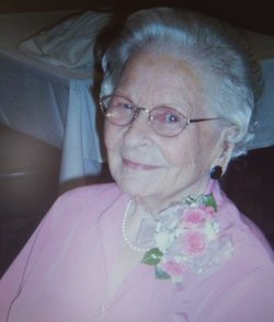

Esther Margaret Hartland Quimby
| Birth | : | 2 Jul 1920 Fort Pierre, Stanley County, South Dakota, USA |
| Death | : | 13 Sep 2015 La Mesa, San Diego County, California, USA |
| Burial | : | Scotty Philip Cemetery, Fort Pierre, Stanley County, USA |
| Coordinate | : | 44.4019012, -100.4036026 |
| Plot | : | Section 4 Lot 2 Grave 6 |
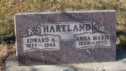
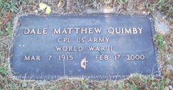
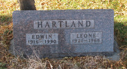
| Description | : | Born on the family ranch to Edward Hartland and Anna Mary Schwabauer attending 1-room school's and graduating from Pierre High. Esther met her husband Dale "Mike" Quimby and they moved to Los Angeles, CA and was employed working on B-17 Bombers. Dale was drafted into the Army and was sent to Japan at the end of WWII. After the war they went back to Pierre and lived there until 1959. Moved to El Cajon, CA and lived there the rest of their lives in 1986. (C) EastCountyMortuary 2015 |
frequently asked questions (FAQ):
-
Where is Esther Margaret Hartland Quimby's memorial?
Esther Margaret Hartland Quimby's memorial is located at: Scotty Philip Cemetery, Fort Pierre, Stanley County, USA.
-
When did Esther Margaret Hartland Quimby death?
Esther Margaret Hartland Quimby death on 13 Sep 2015 in La Mesa, San Diego County, California, USA
-
Where are the coordinates of the Esther Margaret Hartland Quimby's memorial?
Latitude: 44.4019012
Longitude: -100.4036026
Family Members:
Parent

Spouse
Siblings
Flowers:


Nearby Cemetories:
1. Scotty Philip Cemetery
Fort Pierre, Stanley County, USA
Coordinate: 44.4019012, -100.4036026
2. Fort Pierre Chouteau Cemetery
Fort Pierre, Stanley County, USA
Coordinate: 44.3908700, -100.3878300
3. Mount Calvary Cemetery
Pierre, Hughes County, USA
Coordinate: 44.4197006, -100.3557968
4. South Dakota State Capitol Grounds
Pierre, Hughes County, USA
Coordinate: 44.3660100, -100.3448000
5. Cedar Hill Cemetery
Fort Pierre, Stanley County, USA
Coordinate: 44.3356018, -100.3964005
6. Riverside Cemetery
Pierre, Hughes County, USA
Coordinate: 44.3608017, -100.3071976
7. Byron Township Cemetery
Blunt, Hughes County, USA
Coordinate: 44.4979200, -100.1904700
8. Fort Sully Post Cemetery
Sully County, USA
Coordinate: 44.5866480, -100.6087530
9. Meers Cemetery
Stanley County, USA
Coordinate: 44.4116970, -100.7360760
10. Mathews Family Cemetery
Stanley County, USA
Coordinate: 44.1816040, -100.5581080
11. Okobojo Cemetery
Sully County, USA
Coordinate: 44.6568985, -100.3647003
12. Canning Cemetery
Hughes County, USA
Coordinate: 44.3986890, -100.0278460
13. Holy Name Episcopal Cemetery
Fort Pierre, Stanley County, USA
Coordinate: 44.2694960, -100.0357300
14. Holy Name Chapel Cemetery
Fort Pierre, Stanley County, USA
Coordinate: 44.2694292, -100.0356989
15. Pleasant Hill Cemetery
Blunt, Hughes County, USA
Coordinate: 44.5135994, -100.0156021
16. Fort Bennett Post Cemetery
Stanley County, USA
Coordinate: 44.6716500, -100.6404200
17. Immanuel Lutheran Cemetery
Van Metre, Jones County, USA
Coordinate: 44.0958800, -100.7263300
18. Mission Ridge Cemetery
Mission Ridge, Stanley County, USA
Coordinate: 44.6960983, -100.7716980
19. Onida Cemetery
Onida, Sully County, USA
Coordinate: 44.7147000, -100.0650000
20. Chapelle Cemetery
Hughes County, USA
Coordinate: 44.3025017, -99.8653030
21. Holy Faith Cemetery
Lyman County, USA
Coordinate: 44.1356010, -99.9878006
22. Blair Cemetery
Sully County, USA
Coordinate: 44.8027992, -100.4199982
23. Sansarc Cemetery
Hayes, Stanley County, USA
Coordinate: 44.5153008, -101.0342026
24. Draper Cemetery
Draper, Jones County, USA
Coordinate: 43.9322014, -100.5475006