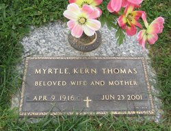
| Birth | : | 12 Nov 1932 USA |
| Death | : | 22 Jul 2009 Lancaster, Fairfield County, Ohio, USA |
| Burial | : | Spring Hill Cemetery, Montgomery County, USA |
| Coordinate | : | 37.1235600, -95.6595500 |
| Description | : | Ethel Irene (Beatty) Henderly LANCASTER: Ethel Irene (Beatty) Henderly, nicknamed Penny, 76, of Lancaster, passed away Wednesday, July 22, 2009 at the Fairfield Medical Center. She was born on November 12, 1932 to the late Charles and Myrtle (Delong) Beatty. Ethel was a member of the Gloryland Nazarene Church, a member of the VFW Post 1380 Auxiliary and also of the Olivedale Senior Citizens. She was a life-long democrat of Fairfield County and enjoyed politics. She is survived by children, Deborah Sue (Jeff) Dale of Lancaster, Carolyn Jean (Henderly) McCamon of OK, Edward Lee (Karen)... Read More |
frequently asked questions (FAQ):
-
Where is Ethel Irene “Penny” Beatty Henderly's memorial?
Ethel Irene “Penny” Beatty Henderly's memorial is located at: Spring Hill Cemetery, Montgomery County, USA.
-
When did Ethel Irene “Penny” Beatty Henderly death?
Ethel Irene “Penny” Beatty Henderly death on 22 Jul 2009 in Lancaster, Fairfield County, Ohio, USA
-
Where are the coordinates of the Ethel Irene “Penny” Beatty Henderly's memorial?
Latitude: 37.1235600
Longitude: -95.6595500
Family Members:
Parent
Spouse
Siblings
Flowers:
Nearby Cemetories:
1. Spring Hill Cemetery
Montgomery County, USA
Coordinate: 37.1235600, -95.6595500
2. Hinton Cemetery
Liberty, Montgomery County, USA
Coordinate: 37.1384900, -95.6101000
3. Liberty Cemetery
Liberty, Montgomery County, USA
Coordinate: 37.1581890, -95.6001580
4. Thompson Homestead Cemetery
Liberty, Montgomery County, USA
Coordinate: 37.1767000, -95.6183100
5. Montgomery County Poor Farm Cemetery
Liberty, Montgomery County, USA
Coordinate: 37.1888590, -95.6493690
6. Calvary Cemetery
Coffeyville, Montgomery County, USA
Coordinate: 37.0567017, -95.6502991
7. Fairview Cemetery
Coffeyville, Montgomery County, USA
Coordinate: 37.0546989, -95.6536026
8. Restlawn Memorial Park Cemetery
Coffeyville, Montgomery County, USA
Coordinate: 37.0527992, -95.6493988
9. Jefferson Cemetery
Montgomery County, USA
Coordinate: 37.1039009, -95.7469025
10. All Saints Cemetery
Liberty, Montgomery County, USA
Coordinate: 37.1542015, -95.5757980
11. Kalloch Cemetery
Coffeyville, Montgomery County, USA
Coordinate: 37.0682983, -95.5867004
12. Chapel of Resurrection Columbarium
Coffeyville, Montgomery County, USA
Coordinate: 37.0373300, -95.6187200
13. West Brown Cemetery
Dearing, Montgomery County, USA
Coordinate: 37.0549800, -95.7475000
14. Robbins Cemetery
Coffeyville, Montgomery County, USA
Coordinate: 37.0339012, -95.7192001
15. Elmwood Cemetery
Coffeyville, Montgomery County, USA
Coordinate: 37.0236015, -95.6188965
16. Shelton Mausoleum
Liberty, Montgomery County, USA
Coordinate: 37.1857760, -95.5490630
17. Pratt Cemetery
Montgomery County, USA
Coordinate: 37.2324982, -95.6557999
18. Union Cemetery
Montgomery County, USA
Coordinate: 37.0630989, -95.5408020
19. Westralia Cemetery
Coffeyville, Montgomery County, USA
Coordinate: 37.0232100, -95.5811800
20. Harmony Cemetery
Cherryvale, Montgomery County, USA
Coordinate: 37.2324982, -95.5950012
21. Mount Hope Cemetery
Independence, Montgomery County, USA
Coordinate: 37.2413300, -95.7060050
22. Harrisonville Cemetery
Bolton, Montgomery County, USA
Coordinate: 37.1315100, -95.8146800
23. Pumpkin Creek Cemetery
Montgomery County, USA
Coordinate: 37.0415400, -95.5411500
24. Saint Josaphat Cemetery
Coffeyville, Montgomery County, USA
Coordinate: 36.9993900, -95.6281000


