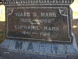
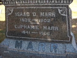
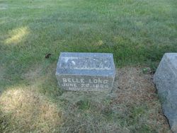
Euphamie Draper Marr
| Birth | : | 1841 |
| Death | : | 1906 |
| Burial | : | Evergreen Cemetery, Sabula, Jackson County, USA |
| Coordinate | : | 42.0966682, -90.1913910 |
| Description | : | Born in Pelham, Welland County, Canada West. Married Isaac Marr in Iowa Township, Jackson County, Iowa, in 1858. |
frequently asked questions (FAQ):
-
Where is Euphamie Draper Marr's memorial?
Euphamie Draper Marr's memorial is located at: Evergreen Cemetery, Sabula, Jackson County, USA.
-
When did Euphamie Draper Marr death?
Euphamie Draper Marr death on 1906 in
-
Where are the coordinates of the Euphamie Draper Marr's memorial?
Latitude: 42.0966682
Longitude: -90.1913910
Family Members:
Parent
Spouse
Siblings
Children
Flowers:
Nearby Cemetories:
1. Evergreen Cemetery
Sabula, Jackson County, USA
Coordinate: 42.0966682, -90.1913910
2. Saint Peters Cemetery
Sabula, Jackson County, USA
Coordinate: 42.0844002, -90.1988983
3. Dickinson Cemetery
Jackson County, USA
Coordinate: 42.1077995, -90.2369003
4. Canada Hollow Cemetery
Miles, Jackson County, USA
Coordinate: 42.0553017, -90.2193985
5. Savanna Township Cemetery
Savanna, Carroll County, USA
Coordinate: 42.0791702, -90.1297226
6. Sterling Cemetery
Sterling, Jackson County, USA
Coordinate: 42.0766983, -90.2528000
7. Saint John the Baptist Catholic Cemetery
Savanna, Carroll County, USA
Coordinate: 42.0793991, -90.1280975
8. Fairview Cemetery
Sterling, Jackson County, USA
Coordinate: 42.0992012, -90.2863998
9. Spring Lake Cemetery
Savanna, Carroll County, USA
Coordinate: 42.0503235, -90.1111069
10. Free Family Cemetery
Mount Carroll Township, Carroll County, USA
Coordinate: 42.0907590, -90.0767000
11. Saint Peters Lutheran Cemetery
Savanna, Carroll County, USA
Coordinate: 42.1758900, -90.1486210
12. Reeseville Cemetery
Green Island, Jackson County, USA
Coordinate: 42.1293983, -90.3016968
13. Miles Cemetery
Miles, Jackson County, USA
Coordinate: 42.0485000, -90.3107000
14. Watts Farm Cemetery
Van Buren, Jackson County, USA
Coordinate: 42.0706000, -90.3252000
15. Teeds Grove Cemetery
Clinton County, USA
Coordinate: 42.0031013, -90.2621994
16. Hauntown Cemetery
Elk River Junction, Clinton County, USA
Coordinate: 41.9889153, -90.1973505
17. Center Hill Cemetery
Center Hill, Carroll County, USA
Coordinate: 42.0813904, -90.0425034
18. Buckeye Cemetery
Preston, Jackson County, USA
Coordinate: 42.0910988, -90.3443985
19. Hickory Grove Cemetery
Mount Carroll, Carroll County, USA
Coordinate: 42.0578651, -90.0461960
20. Old Van Buren Cemetery
Van Buren, Jackson County, USA
Coordinate: 42.0740000, -90.3435000
21. Zion Cemetery
Mount Carroll, Carroll County, USA
Coordinate: 42.1841698, -90.0847168
22. Lost Mound Cemetery
Hanover, Jo Daviess County, USA
Coordinate: 42.2042007, -90.2619019
23. Smith Cemetery
Clinton County, USA
Coordinate: 41.9742012, -90.1949997
24. Andover Cemetery
Andover, Clinton County, USA
Coordinate: 41.9750000, -90.2530000

