
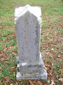
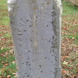
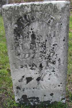
Ezekiel Johnson
| Birth | : | 1 Jul 1806 Ohio, USA |
| Death | : | 30 Jul 1881 Guernsey County, Ohio, USA |
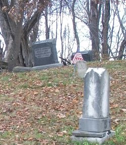
| Burial | : | Antioch Cemetery, Jacket, McDonald County, USA |
| Coordinate | : | 36.5177900, -94.1172400 |
| Description | : | Son of Ephraim Johnson, who was born 1770 in Maryland and died 1835 in Guernsey County, Ohio and Catherine Bridgewater, who was born 1775 in Maryland and died in 1850 in Guernsey County, Ohio. Ezekiel married Mary Ann Eagle on January 4, 1827 in Guernsey County, Ohio. They had eleven children. Ezekiel was a farmer. |
frequently asked questions (FAQ):
-
Where is Ezekiel Johnson's memorial?
Ezekiel Johnson's memorial is located at: Antioch Cemetery, Jacket, McDonald County, USA.
-
When did Ezekiel Johnson death?
Ezekiel Johnson death on 30 Jul 1881 in Guernsey County, Ohio, USA
-
Where are the coordinates of the Ezekiel Johnson's memorial?
Latitude: 36.5177900
Longitude: -94.1172400
Family Members:
Parent
Spouse
Siblings
Children

Flowers:


Nearby Cemetories:
1. Antioch Cemetery
Jacket, McDonald County, USA
Coordinate: 36.5177900, -94.1172400
2. Gates To Heaven Cemetery
McDonald County, USA
Coordinate: 36.5133000, -94.1082000
3. Burnett Cemetery
Jacket, McDonald County, USA
Coordinate: 36.5154300, -94.1321700
4. Dent Cemetery
Jacket, McDonald County, USA
Coordinate: 36.5012100, -94.0781000
5. Banks Cemetery
Benton County, USA
Coordinate: 36.4869003, -94.0950012
6. Simsberry Cemetery
Arnett, McDonald County, USA
Coordinate: 36.5487300, -94.1838700
7. Pea Ridge Cemetery
Pea Ridge, Benton County, USA
Coordinate: 36.4536018, -94.1200027
8. Twelve Corners Cemetery
Pea Ridge, Benton County, USA
Coordinate: 36.4700012, -94.0622025
9. Foster Cemetery
Benton County, USA
Coordinate: 36.4611015, -94.1577988
10. Roller Cemetery
Powell, McDonald County, USA
Coordinate: 36.5810547, -94.1393204
11. Patterson Cemetery
Pea Ridge, Benton County, USA
Coordinate: 36.4453011, -94.1055984
12. Scott Cemetery
Garfield, Benton County, USA
Coordinate: 36.4822006, -94.0314026
13. Buttram Chapel Cemetery
Pea Ridge, Benton County, USA
Coordinate: 36.4411011, -94.0886765
14. Summit Cemetery
Bella Vista, Benton County, USA
Coordinate: 36.4613650, -94.1904300
15. Potts Cemetery
Garfield, Benton County, USA
Coordinate: 36.4873620, -94.0228990
16. Hickman Cemetery
Pea Ridge, Benton County, USA
Coordinate: 36.4317017, -94.1324997
17. Cargile Cemetery
Washburn, Barry County, USA
Coordinate: 36.5598000, -94.0210000
18. Miser Family Homestead Cemetery
Pea Ridge, Benton County, USA
Coordinate: 36.4307133, -94.0875982
19. Ford Cemetery
Benton County, USA
Coordinate: 36.4557991, -94.0261002
20. Wardlaw Cemetery
Pea Ridge, Benton County, USA
Coordinate: 36.4193400, -94.0768120
21. Paces Chapel Cemetery
Benton County, USA
Coordinate: 36.4372940, -94.0350770
22. Henson Jennings Cemetery
Garfield, Benton County, USA
Coordinate: 36.4373300, -94.0347000
23. Pratt Cemetery
Garfield, Benton County, USA
Coordinate: 36.4375000, -94.0335999
24. Post Oak Cemetery
Bentonville, Benton County, USA
Coordinate: 36.4238760, -94.1831220