
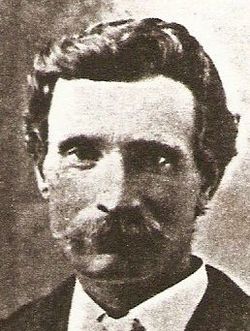
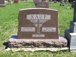
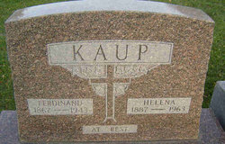

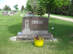
Ferdinand Kaup
| Birth | : | 27 May 1867 Germany |
| Death | : | 22 Sep 1943 Hoven, Potter County, South Dakota, USA |
| Burial | : | Allentown Methodist Cemetery, Allentown, Monmouth County, USA |
| Coordinate | : | 40.1809578, -74.5833359 |
| Description | : | Taken from an Obit from Potter County Library, Gettysburg, SD Ferdinand Kaup 9-30-43 Ferdinand Kaup was born Mary 27, 1867 in Rosenbeck, Westfalin, Germany and passed away at 3:45 P.M/ Wednesday Sept. 22, 1943 from a lingering illness at the age of 76 years and 4 months. He came to this country when he was 17 years old. He Lived in Nebraska. In 1887 he cam to South Dakota and worked for Dan Curl, a year later he filed on a homestead 6 ½ miles south of Hoven where he, with his wife and family lived until 1939... Read More |
frequently asked questions (FAQ):
-
Where is Ferdinand Kaup's memorial?
Ferdinand Kaup's memorial is located at: Allentown Methodist Cemetery, Allentown, Monmouth County, USA.
-
When did Ferdinand Kaup death?
Ferdinand Kaup death on 22 Sep 1943 in Hoven, Potter County, South Dakota, USA
-
Where are the coordinates of the Ferdinand Kaup's memorial?
Latitude: 40.1809578
Longitude: -74.5833359
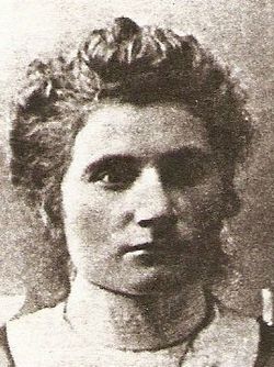
Family Members:
Spouse
Children
Flowers:


Nearby Cemetories:
1. Allentown Methodist Cemetery
Allentown, Monmouth County, USA
Coordinate: 40.1809578, -74.5833359
2. Hamilton Street Cemetery
Allentown, Monmouth County, USA
Coordinate: 40.1801200, -74.5846800
3. Old Christ Episcopal Burial Ground
Allentown, Monmouth County, USA
Coordinate: 40.1765300, -74.5844000
4. Allentown Presbyterian Church Cemetery
Allentown, Monmouth County, USA
Coordinate: 40.1737518, -74.5862503
5. Saint Johns Cemetery
Allentown, Monmouth County, USA
Coordinate: 40.1742363, -74.5923615
6. Princeton Memorial Park and Mausoleum
Robbinsville, Mercer County, USA
Coordinate: 40.2107900, -74.5800700
7. Sharon Methodist Episcopal Cemetery
Robbinsville, Mercer County, USA
Coordinate: 40.2046180, -74.5526530
8. Old Ellisdale Cemetery
Ellisdale, Burlington County, USA
Coordinate: 40.1300125, -74.5839996
9. Crosswicks Community Cemetery
North Crosswicks, Mercer County, USA
Coordinate: 40.1627007, -74.6472015
10. Crosswicks Methodist Cemetery
Crosswicks, Burlington County, USA
Coordinate: 40.1506195, -74.6428375
11. Crosswicks Friends Meetinghouse Cemetery
Crosswicks, Burlington County, USA
Coordinate: 40.1518580, -74.6471970
12. Chesterfield Friends Burial Ground
Crosswicks, Burlington County, USA
Coordinate: 40.1519320, -74.6477880
13. Arneytown Cemetery
Wrightstown, Burlington County, USA
Coordinate: 40.1202000, -74.5769800
14. Windsor United Methodist Church Cemetery
Windsor, Mercer County, USA
Coordinate: 40.2431297, -74.5825348
15. Cream Ridge Cemetery
Cream Ridge, Monmouth County, USA
Coordinate: 40.1349068, -74.5234375
16. Groveville Cemetery
Groveville, Mercer County, USA
Coordinate: 40.1714900, -74.6717800
17. East Windsor Cemetery
Hightstown, Mercer County, USA
Coordinate: 40.2336121, -74.5236130
18. Hamilton Square Baptist Church Cemetery
Hamilton Square, Mercer County, USA
Coordinate: 40.2273600, -74.6531700
19. First Presbyterian Churchyard
Hamilton Square, Mercer County, USA
Coordinate: 40.2297600, -74.6602700
20. Ye Olde Robbins Burial Place
Imlaystown, Monmouth County, USA
Coordinate: 40.1892300, -74.4810200
21. Hamilton Square Methodist Episcopal Churchyard
Hamilton Square, Mercer County, USA
Coordinate: 40.2312400, -74.6629600
22. Upper Freehold Friends Burying Ground
Arneytown, Monmouth County, USA
Coordinate: 40.1014709, -74.5658340
23. East Branch Friends Burial Ground
Imlaystown, Monmouth County, USA
Coordinate: 40.1887500, -74.4742900
24. Yellow Meeting House Cemetery
Red Valley, Monmouth County, USA
Coordinate: 40.1694500, -74.4726410