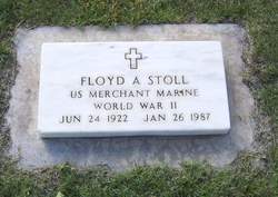
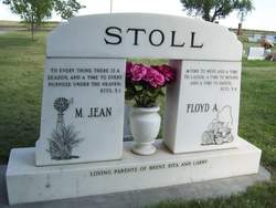
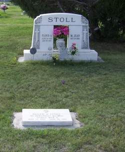
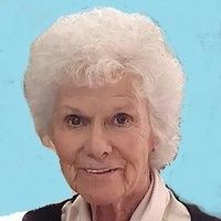
Floyd A. Stoll
| Birth | : | 24 Jun 1922 |
| Death | : | 26 Jan 1987 |
| Burial | : | Camellia Memorial Lawn Cemetery, Sacramento, Sacramento County, USA |
| Coordinate | : | 38.5242004, -121.3097000 |
| Description | : | Floyd Arthur Stoll, the son of Arthur and Amelia Miltner Stoll, was born June 24, 1922 at the family farm north of Lodgepole. He attended the Goodview Consolidated School, graduating in 1939. After graduation, he moved to California. He served in the Merchant Marines from September, 1942 to April, 1946. On January 27, 1946, he was united in marriage to Miriam Jean Earnhart at Chappell, Nebraska. In June of 1946, they moved to a farm north of Lodgepole. Floyd drove the Good-view School bus for several years. He was a member of the United Methodist Church, Golden Rod Lodge #306... Read More |
frequently asked questions (FAQ):
-
Where is Floyd A. Stoll's memorial?
Floyd A. Stoll's memorial is located at: Camellia Memorial Lawn Cemetery, Sacramento, Sacramento County, USA.
-
When did Floyd A. Stoll death?
Floyd A. Stoll death on 26 Jan 1987 in
-
Where are the coordinates of the Floyd A. Stoll's memorial?
Latitude: 38.5242004
Longitude: -121.3097000
Family Members:
Parent
Spouse
Siblings
Flowers:
Nearby Cemetories:
1. Camellia Memorial Lawn Cemetery
Sacramento, Sacramento County, USA
Coordinate: 38.5242004, -121.3097000
2. Bellview Cemetery
Sacramento, Sacramento County, USA
Coordinate: 38.5153580, -121.3257446
3. Quiet Haven Memorial Park Cemetery
Sacramento, Sacramento County, USA
Coordinate: 38.5109711, -121.3245621
4. Greater Sacramento Muslim Cemetery
Sacramento, Sacramento County, USA
Coordinate: 38.5128300, -121.2616800
5. Sacramento Pet Cemetery
Sacramento, Sacramento County, USA
Coordinate: 38.4815870, -121.3402080
6. Chua Phuoc Thien Temple Columbarium
Sacramento, Sacramento County, USA
Coordinate: 38.4555400, -121.3345500
7. Kilgore Cemetery
Rancho Cordova, Sacramento County, USA
Coordinate: 38.5978012, -121.2683029
8. Tinh Xa Ngoc An Temple Columbarium
Sacramento, Sacramento County, USA
Coordinate: 38.5190200, -121.4159500
9. Elder Creek Cemetery
Florin, Sacramento County, USA
Coordinate: 38.5111008, -121.4169006
10. Union Cemetery
Sacramento County, USA
Coordinate: 38.4477997, -121.2619019
11. Saint Michaels Episcopal Church Columbarium
Carmichael, Sacramento County, USA
Coordinate: 38.6042800, -121.3547200
12. Sacramento County Cemetery
Sacramento County, USA
Coordinate: 38.5267900, -121.4233700
13. Sacramento County Veterans Memorial Cemetery
Sacramento, Sacramento County, USA
Coordinate: 38.5252838, -121.4239120
14. Sacramento County Hospital Cemetery
Sacramento, Sacramento County, USA
Coordinate: 38.5289300, -121.4239100
15. Russian Orthodox Cemetery
Sacramento, Sacramento County, USA
Coordinate: 38.5268800, -121.4244300
16. Saint Mary's Catholic Cemetery and Mausoleum
Sacramento, Sacramento County, USA
Coordinate: 38.5298900, -121.4261200
17. Pleasant Grove Cemetery
Elk Grove, Sacramento County, USA
Coordinate: 38.4302220, -121.3107670
18. Carmichael Presbyterian Church Columbarium
Carmichael, Sacramento County, USA
Coordinate: 38.6179500, -121.3324500
19. Sloughhouse Pioneer Cemetery
Sloughhouse, Sacramento County, USA
Coordinate: 38.4950130, -121.1916080
20. Saint Marks Methodist Church Memorial Tree
Sacramento, Sacramento County, USA
Coordinate: 38.6076500, -121.3750680
21. Kim Quang Temple Columbarium
Sacramento, Sacramento County, USA
Coordinate: 38.5996600, -121.3904700
22. Sacramento Memorial Lawn Cemetery
Sacramento, Sacramento County, USA
Coordinate: 38.5146484, -121.4380341
23. Home of Peace Cemetery
Sacramento, Sacramento County, USA
Coordinate: 38.5137558, -121.4382782
24. San Joaquin Cemetery
Sacramento, Sacramento County, USA
Coordinate: 38.4387665, -121.4034653

