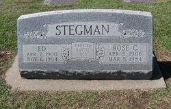
| Birth | : | 27 Jul 1912 Ford County, Kansas, USA |
| Death | : | 22 Oct 2006 Larned, Pawnee County, Kansas, USA |
| Burial | : | Larned Cemetery, Larned, Pawnee County, USA |
| Coordinate | : | 38.1861000, -99.1333008 |
| Description | : | Hutchinson News, The (KS) - Tuesday, October 24, 2006 LARNED - Frances Catherine "Pat" Struthers, 94, died Oct. 22, 2006, at Larned Health Care Center. She was born Aug. 27, 1912, in Ford County, the daughter of Adam and Catherine Urban Stegman. A lifetime resident of Pawnee County, she was a cook at the Sanford and Larned school districts and worked at Lloyd's Drive In. She was a member of Sacred Heart Catholic Church, Larned. On May 1, 1937, she married Cecil Kenneth Struthers. He died Aug. 29, 1976. Survivors include: a daughter, Sharon Lovitt, Ransom; two sisters, Agnes Burkhart, Hanston, and Leona Lampe, Spearville;... Read More |
frequently asked questions (FAQ):
-
Where is Frances Catherine “Pat” Stegman Struthers's memorial?
Frances Catherine “Pat” Stegman Struthers's memorial is located at: Larned Cemetery, Larned, Pawnee County, USA.
-
When did Frances Catherine “Pat” Stegman Struthers death?
Frances Catherine “Pat” Stegman Struthers death on 22 Oct 2006 in Larned, Pawnee County, Kansas, USA
-
Where are the coordinates of the Frances Catherine “Pat” Stegman Struthers's memorial?
Latitude: 38.1861000
Longitude: -99.1333008
Family Members:
Parent
Spouse
Siblings
Children
Flowers:
Nearby Cemetories:
1. Larned Cemetery
Larned, Pawnee County, USA
Coordinate: 38.1861000, -99.1333008
2. Larned State Hospital Cemetery
Larned, Pawnee County, USA
Coordinate: 38.1722800, -99.1566200
3. Fort Larned Cemetery
Larned, Pawnee County, USA
Coordinate: 38.1839100, -99.2163200
4. Pleasant Valley Cemetery
Larned, Pawnee County, USA
Coordinate: 38.0718994, -99.0955963
5. Ash Valley Cemetery
Pawnee County, USA
Coordinate: 38.2905998, -99.2174988
6. Pawnee Rock State Historic Site
Pawnee Rock, Barton County, USA
Coordinate: 38.2721800, -98.9815300
7. Pawnee Rock Cemetery
Pawnee Rock, Barton County, USA
Coordinate: 38.2771988, -98.9858017
8. Fertig Cemetery
Pawnee County, USA
Coordinate: 38.1458015, -98.9492035
9. Garfield Cemetery
Garfield, Pawnee County, USA
Coordinate: 38.0738983, -99.2667007
10. Bergthal Mennonite Cemetery
Pawnee Rock, Barton County, USA
Coordinate: 38.3053017, -98.9772034
11. Point View Cemetery
Pawnee County, USA
Coordinate: 38.1306000, -98.9131012
12. Pleasant Ridge Cemetery
Radium, Stafford County, USA
Coordinate: 38.2475014, -98.8758011
13. Peace Lutheran Cemetery
Timken, Rush County, USA
Coordinate: 38.3837600, -99.0330750
14. Rozel Cemetery
Rozel, Pawnee County, USA
Coordinate: 38.2042007, -99.4052963
15. Saint Pauls Lutheran Cemetery
Albert, Barton County, USA
Coordinate: 38.3770000, -99.0005900
16. Belpre Cemetery
Belpre, Edwards County, USA
Coordinate: 37.9528950, -99.1017510
17. Dundee Valley Cemetery
Great Bend, Barton County, USA
Coordinate: 38.3125130, -98.8778980
18. Fitch Family Cemetery
Nettleton, Edwards County, USA
Coordinate: 38.0007540, -99.3256550
19. Wayne Cemetery
Lewis, Edwards County, USA
Coordinate: 37.9550018, -99.2144012
20. Patterson Cemetery
Barton County, USA
Coordinate: 38.4019012, -98.9963989
21. Saint Francis Xavier Cemetery
Seward, Stafford County, USA
Coordinate: 38.2038994, -98.8193970
22. Albert Cemetery
Rush County, USA
Coordinate: 38.4213982, -99.0342026
23. Everett Cemetery
Barton County, USA
Coordinate: 38.3767014, -98.9092026
24. Bohemian Cemetery
Timken, Rush County, USA
Coordinate: 38.4441986, -99.1967010


