

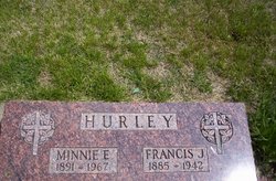
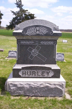
Francis Joseph “Frank” Hurley
| Birth | : | 18 May 1885 Glasco, Cloud County, Kansas, USA |
| Death | : | 11 May 1942 Glasco, Cloud County, Kansas, USA |
| Burial | : | Saint Marys Catholic Cemetery, Glasco, Cloud County, USA |
| Coordinate | : | 39.3574000, -97.8245000 |
| Description | : | Glasco Sun, May 14, 1942, page 3: FRANK HURLEY PASSED AWAY AT FARM HOME MONDAY Frank Hurley, prosperous farmer of the Glasco vicinity, passed away at his farm home, southeast of Glasco, on Monday morning, May 11. Mr. Hurley was 57 years old, and one of the substantial and thrifty farmers of the county. He had been in ill health for some time, and about a year ago suffered a physical and nervous breakdown and was in a hospital in Concordia for treatment. Mr. Hurley has lived most of his life in Cloud county, having been born at Glasco May 18, 1885. ... Read More |
frequently asked questions (FAQ):
-
Where is Francis Joseph “Frank” Hurley's memorial?
Francis Joseph “Frank” Hurley's memorial is located at: Saint Marys Catholic Cemetery, Glasco, Cloud County, USA.
-
When did Francis Joseph “Frank” Hurley death?
Francis Joseph “Frank” Hurley death on 11 May 1942 in Glasco, Cloud County, Kansas, USA
-
Where are the coordinates of the Francis Joseph “Frank” Hurley's memorial?
Latitude: 39.3574000
Longitude: -97.8245000
Family Members:
Parent
Spouse
Siblings


Children
Flowers:


Nearby Cemetories:
1. Saint Marys Catholic Cemetery
Glasco, Cloud County, USA
Coordinate: 39.3574000, -97.8245000
2. Glasco Cemetery
Glasco, Cloud County, USA
Coordinate: 39.3574000, -97.8265000
3. Bethel Cemetery
Meredith Township, Cloud County, USA
Coordinate: 39.3506000, -97.7029000
4. Simpson Cemetery
Simpson, Mitchell County, USA
Coordinate: 39.3633003, -97.9471970
5. Delphos Cemetery
Delphos, Ottawa County, USA
Coordinate: 39.2778015, -97.7416992
6. Saint Paul Cemetery
Delphos, Ottawa County, USA
Coordinate: 39.2677994, -97.7518997
7. Morrison Cemetery
Center Township, Cloud County, USA
Coordinate: 39.4817009, -97.7975006
8. Asherville Cemetery
Asherville, Mitchell County, USA
Coordinate: 39.4205000, -97.9672900
9. Summit Cemetery
Jamestown, Cloud County, USA
Coordinate: 39.4813200, -97.8628800
10. Hall Cemetery
Cloud County, USA
Coordinate: 39.4455986, -97.7033005
11. Green Mound Cemetery
Asherville, Mitchell County, USA
Coordinate: 39.3203011, -97.9858017
12. Coursen Grove Cemetery
Simpson, Mitchell County, USA
Coordinate: 39.3060989, -97.9792023
13. Saint Peters Cemetery
Miltonvale, Cloud County, USA
Coordinate: 39.3652350, -97.6483570
14. Bell-Bogardus Cemetery
Asherville, Mitchell County, USA
Coordinate: 39.4242410, -97.9919970
15. Bohemian National Cemetery
Ada, Ottawa County, USA
Coordinate: 39.2193870, -97.9054030
16. Wilcox Cemetery
Cloud County, USA
Coordinate: 39.4925003, -97.7313995
17. West Asher Cemetery
Scottsville, Mitchell County, USA
Coordinate: 39.4815000, -97.9661600
18. Baldwin Cemetery
Ottawa County, USA
Coordinate: 39.2061005, -97.9111023
19. Kindel Cemetery
Center Township, Cloud County, USA
Coordinate: 39.4519005, -97.6464005
20. Smith Cemetery
Asherville, Mitchell County, USA
Coordinate: 39.4516690, -98.0098850
21. Enterprise Cemetery
Cloud County, USA
Coordinate: 39.4230995, -97.6106033
22. McBride Cemetery
Beloit, Mitchell County, USA
Coordinate: 39.4808006, -97.9907990
23. Shiloh Cemetery
Beloit, Mitchell County, USA
Coordinate: 39.3574982, -98.0594025
24. Summit Cemetery #3
Macyville, Cloud County, USA
Coordinate: 39.5258330, -97.9194440