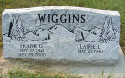
Frank Otis Wiggins
| Birth | : | 27 Nov 1941 Alliance, Box Butte County, Nebraska, USA |
| Death | : | 25 Sep 2000 Oshkosh, Garden County, Nebraska, USA |
| Burial | : | Acacia Park Cemetery, Beverly Hills, Oakland County, USA |
| Coordinate | : | 42.5217018, -83.2197037 |
| Plot | : | Block 10, Lot 103 |
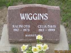
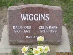
| Description | : | Married Lairie Cranmore on Oct 23, 1960 in Broadwater, Nebraska. === Garden County News (Oshkosh, Nebraska), Oct. 5, 2000, Page 2 Frank O. Wiggins, age 58 of Lewellen, formerly of Hemingford, died late Monday evening, September 25, 2000, at the Garden County Hospital. Funeral services were Friday. September 29, 2000, at the United Methodist Church in Oshkosh, with the Rev. Jerry Mercer officiating. A Memorial has been established to the Lewellen Rescue Unit. Holechek Funeral Home was in charge of the arrangements. Frank was born November 27, 1941, in Alliance, to Otis and Celia (Day) Wiggins. He graduated from Broadwater High School in 1959. On... Read More |
frequently asked questions (FAQ):
-
Where is Frank Otis Wiggins's memorial?
Frank Otis Wiggins's memorial is located at: Acacia Park Cemetery, Beverly Hills, Oakland County, USA.
-
When did Frank Otis Wiggins death?
Frank Otis Wiggins death on 25 Sep 2000 in Oshkosh, Garden County, Nebraska, USA
-
Where are the coordinates of the Frank Otis Wiggins's memorial?
Latitude: 42.5217018
Longitude: -83.2197037
Family Members:
Parent
Flowers:
Nearby Cemetories:
1. Acacia Park Cemetery
Beverly Hills, Oakland County, USA
Coordinate: 42.5217018, -83.2197037
2. Beekman Cemetery
Southfield, Oakland County, USA
Coordinate: 42.5098076, -83.2176285
3. Saint David Episcopal Church Columbarium
Southfield, Oakland County, USA
Coordinate: 42.5030990, -83.2096400
4. Saint James Episcopal Church Columbarium
Birmingham, Oakland County, USA
Coordinate: 42.5465088, -83.2179642
5. First United Methodist Church Memorial Garden
Birmingham, Oakland County, USA
Coordinate: 42.5454370, -83.2330870
6. Clover Hill Park Cemetery
Birmingham, Oakland County, USA
Coordinate: 42.5349998, -83.1885986
7. First Presbyterian Church Columbarium
Birmingham, Oakland County, USA
Coordinate: 42.5463380, -83.2351040
8. Lutheran Church of the Redeemer Columbarium
Birmingham, Oakland County, USA
Coordinate: 42.5463540, -83.2373950
9. Perrin Cemetery
Troy, Oakland County, USA
Coordinate: 42.5398254, -83.1857605
10. Greenwood Cemetery
Birmingham, Oakland County, USA
Coordinate: 42.5539017, -83.2238998
11. Roseland Park Cemetery
Berkley, Oakland County, USA
Coordinate: 42.5060997, -83.1797028
12. Northbrook Presbyterian Church Columbarium
Beverly Hills, Oakland County, USA
Coordinate: 42.5297550, -83.2657280
13. Southfield Reformed Cemetery
Southfield, Oakland County, USA
Coordinate: 42.4848420, -83.2405580
14. Christ Church Cranbrook Columbarium
Bloomfield Hills, Oakland County, USA
Coordinate: 42.5672188, -83.2440186
15. Pioneer Cemetery
Southfield, Oakland County, USA
Coordinate: 42.4749140, -83.2603170
16. Southfield Cemetery
Southfield, Oakland County, USA
Coordinate: 42.4749985, -83.2608032
17. Saint Andrews Memorial Garden
Clawson, Oakland County, USA
Coordinate: 42.5359612, -83.1460571
18. Saint Johns Episcopal Church Resurrection Garden
Royal Oak, Oakland County, USA
Coordinate: 42.4892970, -83.1574120
19. Gilbert Lake Cemetery (Defunct)
Bloomfield, Oakland County, USA
Coordinate: 42.5568800, -83.2799500
20. Royal Oak Cemetery
Royal Oak, Oakland County, USA
Coordinate: 42.5036011, -83.1442032
21. Saint Marys Cemetery
Royal Oak, Oakland County, USA
Coordinate: 42.5002430, -83.1444560
22. Oakview Cemetery
Royal Oak, Oakland County, USA
Coordinate: 42.5005989, -83.1393967
23. Dun Scotus - Franciscan Catholic Cemetery
Southfield, Oakland County, USA
Coordinate: 42.4609690, -83.2437940
24. Franklin Cemetery
Franklin, Oakland County, USA
Coordinate: 42.5224991, -83.3059921


