
| Birth | : | 25 Oct 1885 Glasco, Cloud County, Kansas, USA |
| Death | : | 25 Mar 1961 Glasco, Cloud County, Kansas, USA |
| Burial | : | Hainesburg Cemetery, Columbia, Warren County, USA |
| Coordinate | : | 40.9586487, -75.0571976 |
| Plot | : | 26W1 |
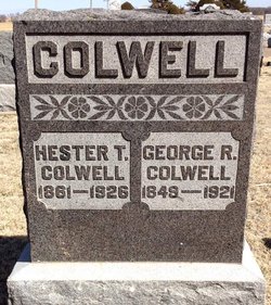
| Description | : | Concordia Blade-Empire, Cloud County, Kansas, March 27, 1961, page 1: Frank J. Colwell, 75, Dies of Heart Attack; Was Glasco Farmer Frank J. Colwell, farmer in the Glasco community, died enroute to the hospital Saturday evening following a heart attack at his home. He was 75. Mr. Colwell was born Oct. 25, 1885 on a farm four miles east of Glasco and had spent his entire life on the same farm. He was married to Anna Virgason on July 27, 1921. He was a member of the Glasco Masonic Lodge and the Concordia Elks lodge. Survivors are his wife; a daughter, Mrs. Kathryn... Read More |
frequently asked questions (FAQ):
-
Where is Franklin James Colwell's memorial?
Franklin James Colwell's memorial is located at: Hainesburg Cemetery, Columbia, Warren County, USA.
-
When did Franklin James Colwell death?
Franklin James Colwell death on 25 Mar 1961 in Glasco, Cloud County, Kansas, USA
-
Where are the coordinates of the Franklin James Colwell's memorial?
Latitude: 40.9586487
Longitude: -75.0571976
Family Members:
Parent

Spouse

Flowers:


Nearby Cemetories:
1. Hainesburg Cemetery
Columbia, Warren County, USA
Coordinate: 40.9586487, -75.0571976
2. Knowlton Presbyterian Church Cemetery
Knowlton, Warren County, USA
Coordinate: 40.9385986, -75.0227966
3. Fairview Cemetery
Columbia, Warren County, USA
Coordinate: 40.9288292, -75.0927505
4. Methodist Cemetery
Columbia, Warren County, USA
Coordinate: 40.9261131, -75.0923615
5. Riverview Cemetery
Portland, Northampton County, USA
Coordinate: 40.9300003, -75.1044006
6. Saint Vincent Cemetery
Portland, Northampton County, USA
Coordinate: 40.9303017, -75.1061020
7. Fairview Cemetery
Knowlton, Warren County, USA
Coordinate: 40.9206009, -75.0158005
8. Green Chapel Cemetery
Knowlton, Warren County, USA
Coordinate: 40.9268990, -74.9974976
9. Blairstown Pet Cemetery
Blairstown, Warren County, USA
Coordinate: 40.9736700, -74.9782200
10. Cedar Ridge Cemetery
Blairstown, Warren County, USA
Coordinate: 40.9864082, -74.9811630
11. Union Brick Cemetery
Blairstown, Warren County, USA
Coordinate: 40.9536018, -74.9705963
12. New Cedar Ridge Cemetery
Blairstown, Warren County, USA
Coordinate: 40.9913200, -74.9793200
13. Shawnee Presbyterian Church Cemetery
Shawnee on Delaware, Monroe County, USA
Coordinate: 41.0141000, -75.1085000
14. Saint Marks Church Cemetery
Delaware Water Gap, Monroe County, USA
Coordinate: 40.9979000, -75.1371000
15. Mount Bethel Presbyterian Cemetery
Mount Bethel, Northampton County, USA
Coordinate: 40.8999230, -75.1159790
16. Delaware Water Gap Cemetery
Delaware Water Gap, Monroe County, USA
Coordinate: 40.9882000, -75.1488000
17. Blairstown Cemetery
Blairstown, Warren County, USA
Coordinate: 40.9835014, -74.9616776
18. Old Beck Cemetery
Mount Bethel, Northampton County, USA
Coordinate: 40.8965000, -75.1177000
19. Ramsaysburg Cemetery
Knowlton, Warren County, USA
Coordinate: 40.8808975, -75.0574493
20. Moravian Cemetery
Hope, Warren County, USA
Coordinate: 40.9099998, -74.9705963
21. Zion Lutheran Church Cemetery
Shawnee on Delaware, Monroe County, USA
Coordinate: 41.0402000, -75.0384000
22. Aten Cemetery
Northampton County, USA
Coordinate: 40.8739500, -75.0571700
23. Centreville Cemetery
Upper Mount Bethel Township, Northampton County, USA
Coordinate: 40.8811790, -75.1122551
24. Swayze Cemetery
Hope, Warren County, USA
Coordinate: 40.8931007, -74.9785995