
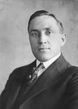

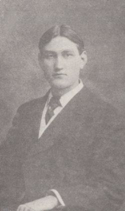
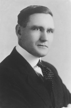
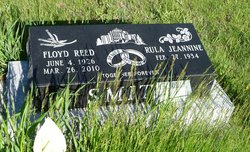
Franklin Reed “Frank” Smith
| Birth | : | 2 Jun 1887 Chesterfield, Caribou County, Idaho, USA |
| Death | : | 7 Nov 1928 Mountain View, Claresholm Census Division, Alberta, Canada |
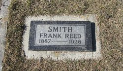
| Burial | : | Allen Township Cemetery, Williston, Ottawa County, USA |
| Coordinate | : | 41.6100006, -83.3396988 |
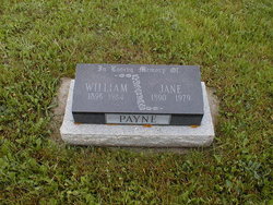
| Inscription | : | SMITH FRANK REED 1887 ~ 1928 |
| Description | : | Birthplace-Chesterfield, Bannock, Id |
frequently asked questions (FAQ):
-
Where is Franklin Reed “Frank” Smith's memorial?
Franklin Reed “Frank” Smith's memorial is located at: Allen Township Cemetery, Williston, Ottawa County, USA.
-
When did Franklin Reed “Frank” Smith death?
Franklin Reed “Frank” Smith death on 7 Nov 1928 in Mountain View, Claresholm Census Division, Alberta, Canada
-
Where are the coordinates of the Franklin Reed “Frank” Smith's memorial?
Latitude: 41.6100006
Longitude: -83.3396988
Family Members:
Parent
Spouse
Siblings
Children
Flowers:


Nearby Cemetories:
1. Allen Township Cemetery
Williston, Ottawa County, USA
Coordinate: 41.6100006, -83.3396988
2. Oak Wood Cemetery
Curtice, Lucas County, USA
Coordinate: 41.6242590, -83.3420000
3. Crane Creek Cemetery
Williston, Ottawa County, USA
Coordinate: 41.5802994, -83.3968964
4. Hillabrand Cemetery
Oregon, Lucas County, USA
Coordinate: 41.6200530, -83.4256350
5. Saint Ignatius Cemetery
Oregon, Lucas County, USA
Coordinate: 41.6564369, -83.4079895
6. Elliston Cemetery
Elliston, Ottawa County, USA
Coordinate: 41.5439987, -83.2679977
7. Lake Township Cemetery
Walbridge, Wood County, USA
Coordinate: 41.5892181, -83.4677124
8. Clay Township Cemetery
Genoa, Ottawa County, USA
Coordinate: 41.5092010, -83.3186035
9. Limestone Cemetery
Graytown, Ottawa County, USA
Coordinate: 41.5513000, -83.2164993
10. Beth Shalom Cemetery
Oregon, Lucas County, USA
Coordinate: 41.6603300, -83.4713200
11. North Oregon Cemetery
Oregon, Lucas County, USA
Coordinate: 41.6613998, -83.4705963
12. Saint Johns Lutheran Church Cemetery
Toledo, Lucas County, USA
Coordinate: 41.6519920, -83.4897530
13. Willow Cemetery
Oregon, Lucas County, USA
Coordinate: 41.6292000, -83.4997025
14. Rymers Cemetery
Elmore, Ottawa County, USA
Coordinate: 41.4833900, -83.2871690
15. Saint Joseph Cemetery
Locust Point, Ottawa County, USA
Coordinate: 41.5873560, -83.1641550
16. Restlawn Memorial Park
Perrysburg, Wood County, USA
Coordinate: 41.5133018, -83.4661026
17. Harrington Cemetery
Elmore, Ottawa County, USA
Coordinate: 41.4781990, -83.2903100
18. Manhattan Cemetery
Toledo, Lucas County, USA
Coordinate: 41.6878117, -83.4964925
19. Unnamed Cemetery #4 (Defunct)
Toledo, Lucas County, USA
Coordinate: 41.6434540, -83.5252720
20. Harris-Elmore Union Cemetery
Elmore, Ottawa County, USA
Coordinate: 41.4738998, -83.2789001
21. Woodville Cemetery
Woodville, Sandusky County, USA
Coordinate: 41.4641991, -83.3625031
22. Choate Burial Site
Toledo, Lucas County, USA
Coordinate: 41.7523900, -83.3911880
23. Woodville Catholic Cemetery
Woodville, Sandusky County, USA
Coordinate: 41.4621540, -83.3614250
24. Trinity Episcopal Columbarium
Toledo, Lucas County, USA
Coordinate: 41.6527470, -83.5331560