
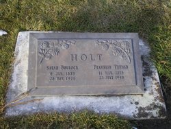
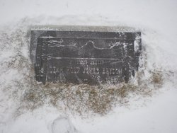
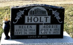
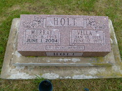
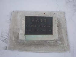
Franklin Truman Holt
| Birth | : | 11 Mar 1875 Washington County, Utah, USA |
| Death | : | 23 Jul 1940 Alberta, Canada |
| Burial | : | Temple Hill Cemetery, Raymond, Lethbridge Census Division, Canada |
| Coordinate | : | 49.4916300, -112.6605200 |
| Plot | : | lot 10 |
| Description | : | Lethbridge Herald July 23, 1940 HOLT-Passed away suddenly. Franklin T. Holt, aged 67, beloved husband of Sarah Holt of Raymond. Funeral services will be announced when arrangements are completed. Christensen Bros. in charge of arrangements. Lethbridge Herald July 23, 1940 Frank Holt well-known pioneer resident of Raymond, was found died in his car on the highway a short distance east off Hardieville about 1 a.m. on Tuesday. John Achtem and Elmer Goodman, driving on the highway, noticed Holt's Dodge sedan parked in the middle of the road, pointed west. They stopped to investigate and found that the driver was dead. He had apparently... Read More |
frequently asked questions (FAQ):
-
Where is Franklin Truman Holt's memorial?
Franklin Truman Holt's memorial is located at: Temple Hill Cemetery, Raymond, Lethbridge Census Division, Canada.
-
When did Franklin Truman Holt death?
Franklin Truman Holt death on 23 Jul 1940 in Alberta, Canada
-
Where are the coordinates of the Franklin Truman Holt's memorial?
Latitude: 49.4916300
Longitude: -112.6605200
Family Members:
Parent
Spouse

Siblings
Children
Flowers:


Nearby Cemetories:
1. Temple Hill Cemetery
Raymond, Lethbridge Census Division, Canada
Coordinate: 49.4916300, -112.6605200
2. Stirling Cemetery
Stirling, Lethbridge Census Division, Canada
Coordinate: 49.5093400, -112.5380000
3. Stirling Mennonite Church Cemetery
Stirling, Lethbridge Census Division, Canada
Coordinate: 49.4607570, -112.5387970
4. East Raymond Hutterite Colony Cemetery
Raymond, Lethbridge Census Division, Canada
Coordinate: 49.4185305, -112.5791329
5. Wolf Creek Hutterite Colony Cemetery
Stirling, Lethbridge Census Division, Canada
Coordinate: 49.4119142, -112.5163705
6. Wilson Siding Hutterite Cemetery
Wilson, Lethbridge Census Division, Canada
Coordinate: 49.6203914, -112.5781130
7. Hutterville Hutterite Cemetery
Magrath, Claresholm Census Division, Canada
Coordinate: 49.3503165, -112.7701038
8. Magrath Cemetery
Magrath, Claresholm Census Division, Canada
Coordinate: 49.3985700, -112.8648700
9. New York Hutterite Cemetery
Judson, Lethbridge Census Division, Canada
Coordinate: 49.5931870, -112.3956383
10. New Dayton Community Cemetery
New Dayton, Lethbridge Census Division, Canada
Coordinate: 49.4254300, -112.3601800
11. Rockport Colony Cemetery
Magrath, Claresholm Census Division, Canada
Coordinate: 49.3027780, -112.8136110
12. Mountain View Cemetery
Lethbridge, Lethbridge Census Division, Canada
Coordinate: 49.6800385, -112.8297729
13. Indian Battle Park
Lethbridge, Lethbridge Census Division, Canada
Coordinate: 49.6928200, -112.8582900
14. Coaldale Community Cemetery
Coaldale, Lethbridge Census Division, Canada
Coordinate: 49.7355600, -112.6242300
15. Coaldale Mennonite Cemetery
Coaldale, Lethbridge Census Division, Canada
Coordinate: 49.7355600, -112.6242300
16. Saint Patrick's Cemetery
Lethbridge, Lethbridge Census Division, Canada
Coordinate: 49.7084618, -112.8428726
17. Lakeside Hutterite Colony Cemetery
Cranford, Lethbridge Census Division, Canada
Coordinate: 49.6685448, -112.3586315
18. Archmount Cemetery
Lethbridge, Lethbridge Census Division, Canada
Coordinate: 49.7057900, -112.9017500
19. Royal View Memorial Cemetery
Lethbridge, Lethbridge Census Division, Canada
Coordinate: 49.7518540, -112.8242250
20. Rock Lake Colony Cemetery
Coaldale, Lethbridge Census Division, Canada
Coordinate: 49.6219440, -112.2750000
21. Spring Valley Hutterite Colony Cemetery
Spring Coulee, Claresholm Census Division, Canada
Coordinate: 49.3517043, -113.0551519
22. Spring Coulee Cemetery
Spring Coulee, Claresholm Census Division, Canada
Coordinate: 49.3412100, -113.0541400
23. Hillridge Hutterite Colony Cemetery
Cranford, Lethbridge Census Division, Canada
Coordinate: 49.7196094, -112.3393464
24. Diamond City Cemetery
Diamond City, Lethbridge Census Division, Canada
Coordinate: 49.7979150, -112.8326800