Freda K Bauer Wild
| Birth | : | 9 Jul 1922 Hildreth, Franklin County, Nebraska, USA |
| Death | : | 24 Feb 2011 Amherst, Buffalo County, Nebraska, USA |
| Burial | : | Woodlawn Cemetery, Deshler, Henry County, USA |
| Coordinate | : | 41.2261009, -83.9360962 |
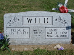
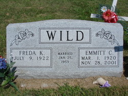
| Description | : | Freda K. Wild, 88, of Amherst died Thursday, Feb. 24, 2011, at her home. Freda was born July 9, 1922, in Hildreth to Fred and Katie (Westerbuhr) Bauer. On Jan. 25, 1953, she married Emmitt Wild in Hildreth. He preceded her in death. Survivors are: son, Kermit Wild of Amherst; daughters, Karen Bohac and her husband, Frank, of Kearney, Kaye Wild and her husband, Bruce Levy, of Cambridge, Mass., and Karla Wild of Kearney; sister, Violet Eberle of Hildreth; grandson, Chad Taubenheim and his wife, Melissa, of Kearney; granddaughters, Renea Wolf and her husband, Shannon, of Elm Creek, Ashley Bohac of Kearney... Read More |
frequently asked questions (FAQ):
-
Where is Freda K Bauer Wild's memorial?
Freda K Bauer Wild's memorial is located at: Woodlawn Cemetery, Deshler, Henry County, USA.
-
When did Freda K Bauer Wild death?
Freda K Bauer Wild death on 24 Feb 2011 in Amherst, Buffalo County, Nebraska, USA
-
Where are the coordinates of the Freda K Bauer Wild's memorial?
Latitude: 41.2261009
Longitude: -83.9360962
Family Members:
Flowers:
Nearby Cemetories:
1. Woodlawn Cemetery
Deshler, Henry County, USA
Coordinate: 41.2261009, -83.9360962
2. Saint John Lutheran Cemetery
Deshler, Henry County, USA
Coordinate: 41.2539600, -83.9411700
3. Peace Evangelical Lutheran Church Cemetery
Deshler, Henry County, USA
Coordinate: 41.2547700, -83.9602200
4. Jackson Township Cemetery
Jackson Township, Wood County, USA
Coordinate: 41.1822700, -83.8660500
5. Saint Pauls Cemetery
Hamler, Henry County, USA
Coordinate: 41.2392006, -84.0261002
6. West Belmore Cemetery
Belmore, Putnam County, USA
Coordinate: 41.1549988, -83.9614029
7. Richfield Cemetery
Henry County, USA
Coordinate: 41.2977982, -83.8985977
8. East Belmore Cemetery
Belmore, Putnam County, USA
Coordinate: 41.1464005, -83.9278030
9. Immanuel Lutheran Cemetery
Monroe Township, Henry County, USA
Coordinate: 41.2683900, -84.0370770
10. Saint Louis Cemetery Old
Custar, Wood County, USA
Coordinate: 41.2854660, -83.8388800
11. Hope Lutheran Cemetery
Hamler, Henry County, USA
Coordinate: 41.2539200, -84.0564600
12. Saint Louis Cemetery
Custar, Wood County, USA
Coordinate: 41.2839012, -83.8332977
13. Milton Township Cemetery
Custar, Wood County, USA
Coordinate: 41.2922700, -83.8416100
14. Angel Cemetery
Richfield Township, Henry County, USA
Coordinate: 41.3177986, -83.8902969
15. Marion Township Cemetery
Henry County, USA
Coordinate: 41.1955986, -84.0653000
16. Center Cemetery
Leipsic, Putnam County, USA
Coordinate: 41.1302986, -84.0539017
17. Grelton Cemetery
Grelton, Henry County, USA
Coordinate: 41.3474998, -84.0006027
18. Pottertown Cemetery
Weston, Wood County, USA
Coordinate: 41.3499985, -83.8696976
19. Old South Center Cemetery
West Leipsic, Putnam County, USA
Coordinate: 41.1258011, -84.0539017
20. Sugar Ridge Cemetery
Leipsic, Putnam County, USA
Coordinate: 41.0910988, -83.9661026
21. Saint Marys Cemetery
Leipsic, Putnam County, USA
Coordinate: 41.0905991, -83.9721985
22. Sacred Heart Catholic Cemetery
New Bavaria, Henry County, USA
Coordinate: 41.1917260, -84.1269220
23. McConnell Cemetery
Leipsic, Putnam County, USA
Coordinate: 41.0872002, -84.0111008
24. Saint John Reformed UCC Cemetery
Holgate, Henry County, USA
Coordinate: 41.2971550, -84.1150190


