
| Memorials | : | 3 |
| Location | : | Weston, Wood County, USA |
| Coordinate | : | 41.3499985, -83.8696976 |
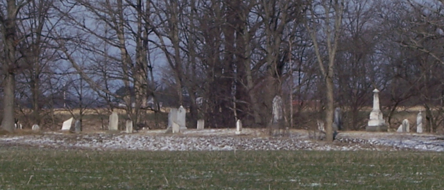
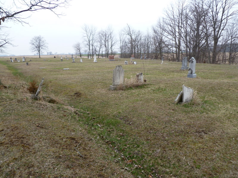
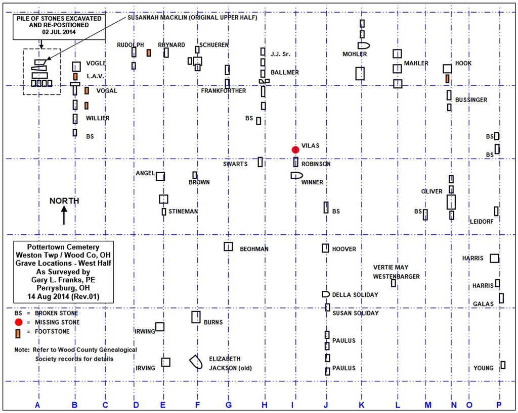
| Description | : | This Cemetery is hard to find.Its set back off the road along a farmers field.I have a Family Connection to two stones in this Cemetery.If I have it in here,Chances are I have a photo.so you might wanna contact me first prior to doing a photo request.I have several that i cant read even from the photo.More info could be gleaned by a grave rubbing.There was a pile of stones in the front and back of Cemetery.I tried to photograph all that were the least bit Legible.If you have any questions,feel free to contact me.I can make another trip out... Read More |
frequently asked questions (FAQ):
-
Where is Pottertown Cemetery?
Pottertown Cemetery is located at Wapakoneta Road (Township Road 189) Weston, Wood County ,Ohio , 43569USA.
-
Pottertown Cemetery cemetery's updated grave count on graveviews.com?
3 memorials
-
Where are the coordinates of the Pottertown Cemetery?
Latitude: 41.3499985
Longitude: -83.8696976
Nearby Cemetories:
1. Angel Cemetery
Richfield Township, Henry County, USA
Coordinate: 41.3177986, -83.8902969
2. Beaver Creek Cemetery
Grand Rapids, Wood County, USA
Coordinate: 41.3883018, -83.8463974
3. Hockman Cemetery
McClure, Henry County, USA
Coordinate: 41.3792240, -83.9333470
4. Richfield Cemetery
Henry County, USA
Coordinate: 41.2977982, -83.8985977
5. New Weston Cemetery
Weston, Wood County, USA
Coordinate: 41.3575800, -83.7923300
6. Old Weston Cemetery
Weston, Wood County, USA
Coordinate: 41.3578700, -83.7905600
7. Showman Cemetery
Napoleon, Henry County, USA
Coordinate: 41.4101260, -83.8778690
8. Milton Township Cemetery
Custar, Wood County, USA
Coordinate: 41.2922700, -83.8416100
9. Howard Cemetery
Grand Rapids, Wood County, USA
Coordinate: 41.4128342, -83.8638992
10. North Cemetery
McClure, Henry County, USA
Coordinate: 41.3863983, -83.9411011
11. Saint Louis Cemetery Old
Custar, Wood County, USA
Coordinate: 41.2854660, -83.8388800
12. Saint Louis Cemetery
Custar, Wood County, USA
Coordinate: 41.2839012, -83.8332977
13. Saint Patricks Cemetery
Providence, Lucas County, USA
Coordinate: 41.4268990, -83.8469009
14. Olive Branch Cemetery
McClure, Henry County, USA
Coordinate: 41.3833008, -83.9713974
15. Wiemer Cemetery
Henry County, USA
Coordinate: 41.4125970, -83.9611500
16. Grelton Cemetery
Grelton, Henry County, USA
Coordinate: 41.3474998, -84.0006027
17. Texas Cemetery
Texas, Henry County, USA
Coordinate: 41.4286003, -83.9539032
18. Washington Cemetery
Tontogany, Wood County, USA
Coordinate: 41.4227982, -83.7675018
19. Mount Pleasant Cemetery
Neapolis, Lucas County, USA
Coordinate: 41.4585700, -83.8778000
20. Saint John Lutheran Cemetery
Deshler, Henry County, USA
Coordinate: 41.2539600, -83.9411700
21. Kruger Cemetery
Liberty Center, Henry County, USA
Coordinate: 41.4036000, -84.0022000
22. Harris-Jones Cemetery
McClure, Henry County, USA
Coordinate: 41.3974940, -84.0072500
23. Otsego Cemetery
Tontogany, Wood County, USA
Coordinate: 41.4444008, -83.7827988
24. Peace Evangelical Lutheran Church Cemetery
Deshler, Henry County, USA
Coordinate: 41.2547700, -83.9602200