
| Memorials | : | 0 |
| Location | : | Custar, Wood County, USA |
| Coordinate | : | 41.2854660, -83.8388800 |
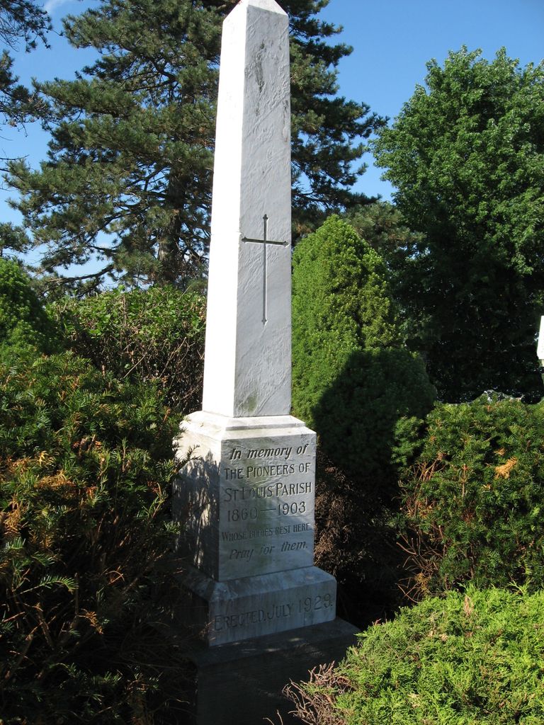
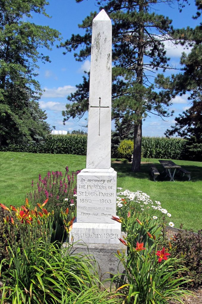
| Description | : | The Old St Louis Cemetery was behind the present St Louis School and was used until 1903. It was replaced that year by the present St Louis Cemetery which is a half mile east of this location because it was "low and wet and upkeep was difficult. ... The old cemetery monuments were removed and buried in a pond... Today there is one monument on the old Cemetery plot that tells and marks the graves of those buried there so long ago." (from the History of St Louis Church). There were no burials after 1903. Some of those initially ... Read More |
frequently asked questions (FAQ):
-
Where is Saint Louis Cemetery Old?
Saint Louis Cemetery Old is located at 22776 Defiance Pike Custar, Wood County ,Ohio , 43511USA.
-
Saint Louis Cemetery Old cemetery's updated grave count on graveviews.com?
0 memorials
-
Where are the coordinates of the Saint Louis Cemetery Old?
Latitude: 41.2854660
Longitude: -83.8388800
Nearby Cemetories:
1. Saint Louis Cemetery
Custar, Wood County, USA
Coordinate: 41.2839012, -83.8332977
2. Milton Township Cemetery
Custar, Wood County, USA
Coordinate: 41.2922700, -83.8416100
3. Richfield Cemetery
Henry County, USA
Coordinate: 41.2977982, -83.8985977
4. Angel Cemetery
Richfield Township, Henry County, USA
Coordinate: 41.3177986, -83.8902969
5. Pottertown Cemetery
Weston, Wood County, USA
Coordinate: 41.3499985, -83.8696976
6. New Weston Cemetery
Weston, Wood County, USA
Coordinate: 41.3575800, -83.7923300
7. Old Weston Cemetery
Weston, Wood County, USA
Coordinate: 41.3578700, -83.7905600
8. Saint John Lutheran Cemetery
Deshler, Henry County, USA
Coordinate: 41.2539600, -83.9411700
9. Wingston Cemetery
Weston, Wood County, USA
Coordinate: 41.2747002, -83.7256012
10. Woodlawn Cemetery
Deshler, Henry County, USA
Coordinate: 41.2261009, -83.9360962
11. Peace Evangelical Lutheran Church Cemetery
Deshler, Henry County, USA
Coordinate: 41.2547700, -83.9602200
12. Beaver Creek Cemetery
Grand Rapids, Wood County, USA
Coordinate: 41.3883018, -83.8463974
13. Jackson Township Cemetery
Jackson Township, Wood County, USA
Coordinate: 41.1822700, -83.8660500
14. Faylor Cemetery
Cygnet, Wood County, USA
Coordinate: 41.2332993, -83.7146988
15. Hockman Cemetery
McClure, Henry County, USA
Coordinate: 41.3792240, -83.9333470
16. Mercer Cemetery
Mermill, Wood County, USA
Coordinate: 41.3040860, -83.6770250
17. North Cemetery
McClure, Henry County, USA
Coordinate: 41.3863983, -83.9411011
18. Showman Cemetery
Napoleon, Henry County, USA
Coordinate: 41.4101260, -83.8778690
19. Howard Cemetery
Grand Rapids, Wood County, USA
Coordinate: 41.4128342, -83.8638992
20. Bethel Cemetery
Rudolph, Wood County, USA
Coordinate: 41.3003300, -83.6685400
21. Wood County Memory Gardens
Bowling Green, Wood County, USA
Coordinate: 41.3763800, -83.7083930
22. Grelton Cemetery
Grelton, Henry County, USA
Coordinate: 41.3474998, -84.0006027
23. Plain Township Cemetery
Bowling Green, Wood County, USA
Coordinate: 41.3861600, -83.7104900
24. Olive Branch Cemetery
McClure, Henry County, USA
Coordinate: 41.3833008, -83.9713974