
| Birth | : | 30 Jan 1919 Halstad, Norman County, Minnesota, USA |
| Death | : | 3 Jul 2012 Rockwell, Cerro Gordo County, Iowa, USA |
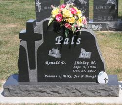
| Burial | : | Wayne Cemetery, McIntire, Mitchell County, USA |
| Coordinate | : | 43.4411011, -92.5744019 |
| Description | : | Garnet was born January 30, 1919 in Halstad, Minnesota, to George and Mary Decker. Garnet's father died of a heart attack when she was 5 years old and soon after that her mom and the family moved to the McIntire area. Garnet was united in marriage to Dale Duryee May 26, 1935. To this union 5 children were born. They lived in the McIntire area until 1949 when they moved to the Marble Rock area, where they lived until 1963. They returned to the McIntire area until 1992 when they moved to St. Ansgar. Garnet has lived in Iowa Falls... Read More |
frequently asked questions (FAQ):
-
Where is Garnet R Decker Duryee's memorial?
Garnet R Decker Duryee's memorial is located at: Wayne Cemetery, McIntire, Mitchell County, USA.
-
When did Garnet R Decker Duryee death?
Garnet R Decker Duryee death on 3 Jul 2012 in Rockwell, Cerro Gordo County, Iowa, USA
-
Where are the coordinates of the Garnet R Decker Duryee's memorial?
Latitude: 43.4411011
Longitude: -92.5744019
Family Members:
Parent

Spouse
Siblings
Children
Flowers:


Nearby Cemetories:
1. Wayne Cemetery
McIntire, Mitchell County, USA
Coordinate: 43.4411011, -92.5744019
2. Saint Patricks Church Cemetery
McIntire, Mitchell County, USA
Coordinate: 43.4771996, -92.6508026
3. Riverside Cemetery
Riceville, Mitchell County, USA
Coordinate: 43.3676834, -92.5576324
4. Robbins Cemetery
David (historical), Mitchell County, USA
Coordinate: 43.4150009, -92.6718979
5. Le Roy Cemetery
Le Roy, Mower County, USA
Coordinate: 43.5214005, -92.5227966
6. Saint Patricks Cemetery
Le Roy, Mower County, USA
Coordinate: 43.5217018, -92.5207977
7. Le Roy Lutheran Cemetery
Le Roy, Mower County, USA
Coordinate: 43.5217750, -92.5196340
8. Calvary Cemetery
Riceville, Mitchell County, USA
Coordinate: 43.3497009, -92.5550003
9. Sacred Heart Cemetery
Meyer, Mitchell County, USA
Coordinate: 43.4583282, -92.7011108
10. Liberty Cemetery
Little Cedar, Mitchell County, USA
Coordinate: 43.3856010, -92.7230988
11. Woodlawn Cemetery
Taopi, Mower County, USA
Coordinate: 43.5581017, -92.6292038
12. Beaver Creek Cemetery
Brownville, Mitchell County, USA
Coordinate: 43.3397217, -92.6727829
13. Saint Peters Lutheran Cemetery
Riceville, Mitchell County, USA
Coordinate: 43.3163986, -92.5547028
14. Chester Hill Cemetery
Chester, Howard County, USA
Coordinate: 43.4897003, -92.4072037
15. Bethany Lutheran Cemetery
Le Roy, Mower County, USA
Coordinate: 43.5588989, -92.4794006
16. Saratoga Township Cemetery
Saratoga, Howard County, USA
Coordinate: 43.3710000, -92.4023000
17. Visitation Catholic Cemetery
Stacyville, Mitchell County, USA
Coordinate: 43.4430618, -92.7813873
18. Saint Johns Cemetery
Johnsburg, Mower County, USA
Coordinate: 43.5055618, -92.7688904
19. Stacyville Cemetery
Stacyville, Mitchell County, USA
Coordinate: 43.4294014, -92.7908020
20. Bennington Pioneer Cemetery
Mower County, USA
Coordinate: 43.6013565, -92.5503693
21. Sacred Heart Cemetery
Adams, Mower County, USA
Coordinate: 43.5635986, -92.7221985
22. Saint Peters Cemetery
New Haven, Mitchell County, USA
Coordinate: 43.2858315, -92.6427765
23. Saint Pauls Lutheran Church Cemetery
Maple Leaf, Howard County, USA
Coordinate: 43.3217000, -92.4082000
24. Reckner Cemetery
Howard County, USA
Coordinate: 43.2743988, -92.5152969