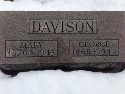
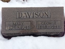
George C. Davison
| Birth | : | 1 Aug 1868 Tocsin, Wells County, Indiana, USA |
| Death | : | 9 Oct 1948 Bluffton, Wells County, Indiana, USA |
| Burial | : | St. Edmund's Churchyard, Southwold, Waveney District, England |
| Coordinate | : | 52.3282060, 1.6786390 |
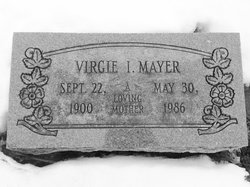
| Description | : | Bluffton News-Banner Monday October 11, 1948 Page 1, Column 6 GEORGE C. DAVISON DIES OF INJURIES George C. Davison, 80, two miles southwest of Tocsin, died Saturday at the Wells county hospital of internal injuries received when he was struck by a car Saturday, Oct. 2, in Villa North. The accident occurred as Mr. Davison was crossing highway 1 to visit a daughter, Mrs. Virgie Mayer. He was struck by a car driven by Robert R. Reinhart, of Paulding, O., and was hurled 30 feet by the impact. The decedent was born Aug. 1, 1868, in Tocsin, a son of John and Rebecca McKinsey Davison. Surviving... Read More |
frequently asked questions (FAQ):
-
Where is George C. Davison's memorial?
George C. Davison's memorial is located at: St. Edmund's Churchyard, Southwold, Waveney District, England.
-
When did George C. Davison death?
George C. Davison death on 9 Oct 1948 in Bluffton, Wells County, Indiana, USA
-
Where are the coordinates of the George C. Davison's memorial?
Latitude: 52.3282060
Longitude: 1.6786390
Family Members:
Parent
Spouse
Siblings
Children
Flowers:
Nearby Cemetories:
1. St. Edmund's Churchyard
Southwold, Waveney District, England
Coordinate: 52.3282060, 1.6786390
2. Southwold Cemetery
Southwold, Waveney District, England
Coordinate: 52.3457710, 1.6572730
3. St Margaret of Antioch Churchyard
Reydon, Waveney District, England
Coordinate: 52.3451350, 1.6556580
4. St. Lawrence's Churchyard
South Cove, Waveney District, England
Coordinate: 52.3689060, 1.6708800
5. Ss Peter and Paul Churchyard
Wangford, Waveney District, England
Coordinate: 52.3546610, 1.6197460
6. St. Andrew's Churchyard
Covehithe, Waveney District, England
Coordinate: 52.3761800, 1.7056300
7. Holy Trinity Churchyard
Blythburgh, Suffolk Coastal District, England
Coordinate: 52.3211920, 1.5947390
8. All Saints Churchyard
Frostenden, Waveney District, England
Coordinate: 52.3767750, 1.6430333
9. St Mary Churchyard
Uggeshall, Waveney District, England
Coordinate: 52.3665630, 1.6054470
10. St. James's Churchyard
Dunwich, Suffolk Coastal District, England
Coordinate: 52.2779090, 1.6261340
11. All Saints Churchyard
Dunwich, Suffolk Coastal District, England
Coordinate: 52.2752300, 1.6321940
12. Greyfriars Medieval Friary
Dunwich, Suffolk Coastal District, England
Coordinate: 52.2755000, 1.6307000
13. Black Friars Priory
Dunwich, Suffolk Coastal District, England
Coordinate: 52.2719920, 1.6395154
14. St. Nicholas' Churchyard
Wrentham, Waveney District, England
Coordinate: 52.3885730, 1.6565260
15. Wrentham New Cemetery
Wrentham, Waveney District, England
Coordinate: 52.3894110, 1.6561480
16. St Andrew's Churchyard
Sotherton, Waveney District, England
Coordinate: 52.3591930, 1.5837900
17. St. Margaret's Churchyard
Stoven, Waveney District, England
Coordinate: 52.3777910, 1.5951750
18. St. Michael's Churchyard
Benacre, Waveney District, England
Coordinate: 52.4003900, 1.6907680
19. Wrentham Municipal Cemetery
Wrentham, Waveney District, England
Coordinate: 52.4020520, 1.6676040
20. All Saints Churchyard
Blyford, Waveney District, England
Coordinate: 52.3351840, 1.5574440
21. Saint Peter's Churchyard
Thorington, Suffolk Coastal District, England
Coordinate: 52.3118310, 1.5534681
22. St. Peter's Churchyard
Brampton, Waveney District, England
Coordinate: 52.3776520, 1.5762500
23. St. Andrew's Churchyard
Westhall, Waveney District, England
Coordinate: 52.3683891, 1.5580100
24. Memorial Chapel Cemetery
Sotterley, Waveney District, England
Coordinate: 52.4022499, 1.6070140

