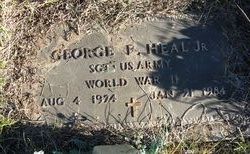
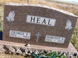
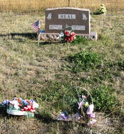
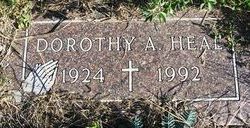
George Frederick Heal Jr.
| Birth | : | 4 Aug 1924 Simms, Cascade County, Montana, USA |
| Death | : | 21 Jan 1984 Great Falls, Cascade County, Montana, USA |
| Burial | : | Antioch Cemetery, Rufus, Rankin County, USA |
| Coordinate | : | 32.1777992, -89.7814026 |
| Inscription | : | SGT US ARMY WORLD WAR II |
frequently asked questions (FAQ):
-
Where is George Frederick Heal Jr.'s memorial?
George Frederick Heal Jr.'s memorial is located at: Antioch Cemetery, Rufus, Rankin County, USA.
-
When did George Frederick Heal Jr. death?
George Frederick Heal Jr. death on 21 Jan 1984 in Great Falls, Cascade County, Montana, USA
-
Where are the coordinates of the George Frederick Heal Jr.'s memorial?
Latitude: 32.1777992
Longitude: -89.7814026
Family Members:
Parent
Spouse
Siblings
Flowers:
Nearby Cemetories:
1. Antioch Cemetery
Rufus, Rankin County, USA
Coordinate: 32.1777992, -89.7814026
2. Walters Grove Cemetery
Pelahatchie, Rankin County, USA
Coordinate: 32.1831300, -89.7467100
3. New Prospect Cemetery
Brandon, Rankin County, USA
Coordinate: 32.1574900, -89.7320900
4. Concord Cemetery
Pelahatchie, Rankin County, USA
Coordinate: 32.2206001, -89.7391968
5. Silverena Cemetery
Rankin County, USA
Coordinate: 32.1293983, -89.8230972
6. Old Stubbs Cemetery
Polkville, Smith County, USA
Coordinate: 32.1876900, -89.7033900
7. Old Polkville Cemetery
Polkville, Smith County, USA
Coordinate: 32.1882500, -89.7028600
8. James Cemetery
Smith County, USA
Coordinate: 32.1516900, -89.7069400
9. Johns Cemetery
Brandon, Rankin County, USA
Coordinate: 32.1355900, -89.8469600
10. Crossroads Cemetery
Cross Roads, Rankin County, USA
Coordinate: 32.2482986, -89.7686005
11. Shiloh Cemetery
Pelahatchie, Rankin County, USA
Coordinate: 32.2360992, -89.8339005
12. Union Baptist Church Cemetery
Mayton, Rankin County, USA
Coordinate: 32.1067009, -89.7508011
13. Rock Bluff Cemetery
Daniel, Smith County, USA
Coordinate: 32.1251000, -89.7165400
14. Polkville Baptist Church Cemetery
Polkville, Smith County, USA
Coordinate: 32.1917700, -89.6925200
15. Cooperville Baptist Church Cemetery
Scott County, USA
Coordinate: 32.2403200, -89.7118450
16. Mount Zion Cemetery
Rankin County, USA
Coordinate: 32.1563988, -89.8799973
17. Old Mount Zion Cemetery
Rankin County, USA
Coordinate: 32.1727982, -89.8835983
18. Burnham Cemetery
Puckett, Rankin County, USA
Coordinate: 32.0910988, -89.7574997
19. Thornhill Cemetery
Cross Roads, Rankin County, USA
Coordinate: 32.2639008, -89.7521973
20. Jack Gray Family Cemetery
Polkville, Smith County, USA
Coordinate: 32.1933920, -89.6725290
21. Puckett Cemetery
Puckett, Rankin County, USA
Coordinate: 32.0839005, -89.7761002
22. One Way Cemetery
Rankin County, USA
Coordinate: 32.1533430, -89.8916390
23. Mountain Ridge Cemetery
Brandon, Rankin County, USA
Coordinate: 32.2346992, -89.8747025
24. Oak Grove Church of God Cemetery
Raleigh, Smith County, USA
Coordinate: 32.1742210, -89.6655850

