
| Birth | : | 22 Oct 1894 Akron, Plymouth County, Iowa, USA |
| Death | : | 20 Nov 1969 Akron, Plymouth County, Iowa, USA |
| Burial | : | Riverside Cemetery, Akron, Plymouth County, USA |
| Coordinate | : | 42.8367004, -96.5453033 |
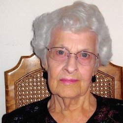
| Description | : | Former Mayor of Akron Dies; Rites Saturday AKRON, Iowa – Special: Vinton Adams, 75, a former mayor of Akron, died unexpectedly at his home Thursday morning. Mr. Adams, an implement dealer in Akron from 1942 until his retirement in 1951, served two terms as mayor and also as a councilman. He was commander of Hoschler Post, American Legion for many years. He was a 50-year member and past master of Freedom Lodge 434 AF & AM, a member of the Akron Eastern Star, and a 50-year member of the Sioux city Consistory,... Read More |
frequently asked questions (FAQ):
-
Where is George Vinton “(Vinton)” Adams's memorial?
George Vinton “(Vinton)” Adams's memorial is located at: Riverside Cemetery, Akron, Plymouth County, USA.
-
When did George Vinton “(Vinton)” Adams death?
George Vinton “(Vinton)” Adams death on 20 Nov 1969 in Akron, Plymouth County, Iowa, USA
-
Where are the coordinates of the George Vinton “(Vinton)” Adams's memorial?
Latitude: 42.8367004
Longitude: -96.5453033
Family Members:
Parent

Spouse
Siblings
Children
Flowers:


Nearby Cemetories:
1. Riverside Cemetery
Akron, Plymouth County, USA
Coordinate: 42.8367004, -96.5453033
2. Saint Patricks Cemetery
Akron, Plymouth County, USA
Coordinate: 42.8232300, -96.5374800
3. Mount Hope Cemetery
Union County, USA
Coordinate: 42.8885994, -96.5667038
4. Union Creek Cemetery
Union County, USA
Coordinate: 42.8911018, -96.5863037
5. Gores Bluff Cemetery
Union County, USA
Coordinate: 42.8035069, -96.6260468
6. Westfield Township Cemetery
Westfield, Plymouth County, USA
Coordinate: 42.7510986, -96.5914001
7. Richland Cemetery
Richland, Union County, USA
Coordinate: 42.7682991, -96.6624985
8. Pleasant Hill Cemetery
Spink, Union County, USA
Coordinate: 42.8741000, -96.6876000
9. Big Springs Cemetery
Big Springs, Union County, USA
Coordinate: 42.9379000, -96.6090000
10. Old Big Springs Cemetery
Big Springs, Union County, USA
Coordinate: 42.9455986, -96.5868988
11. Saint Johns Lutheran Church Cemetery
Ruble, Plymouth County, USA
Coordinate: 42.8372000, -96.3799000
12. Mills Family Cemetery
Westfield, Plymouth County, USA
Coordinate: 42.7188460, -96.6019280
13. First Brule Creek Cemetery
Elk Point, Union County, USA
Coordinate: 42.7943993, -96.7069016
14. Pleasant Hill Cemetery Old
Spink, Union County, USA
Coordinate: 42.8588462, -96.7215592
15. Brule Creek Cemetery
Spink Township, Union County, USA
Coordinate: 42.8346510, -96.7324350
16. Pleasant Valley Cemetery
Adaville, Plymouth County, USA
Coordinate: 42.7494011, -96.4005966
17. Saint Paul Cemetery
Elk Point, Union County, USA
Coordinate: 42.7641983, -96.7061005
18. Union County Poor Farm Cemetery
Union County, USA
Coordinate: 42.7649210, -96.7077580
19. Nora Cemetery
Union County, USA
Coordinate: 42.9314003, -96.7061005
20. Plymouth Presbyterian Cemetery
Brunsville, Plymouth County, USA
Coordinate: 42.8208760, -96.3318410
21. Ahlsborg Lutheran Cemetery
Union County, USA
Coordinate: 42.8228000, -96.7612000
22. Saint Joseph Cemetery
Johnson Township, Plymouth County, USA
Coordinate: 42.7416992, -96.3707962
23. Peace Lutheran Cemetery
Union County, USA
Coordinate: 42.9805984, -96.6481018
24. Saint Johns Cemetery
Craig, Plymouth County, USA
Coordinate: 42.8939018, -96.3225021