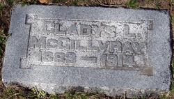
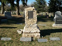
Gladys Lucy Fry McGillvray
| Birth | : | 1 Nov 1889 Kansas, USA |
| Death | : | 7 Nov 1914 Bennett, Adams County, Colorado, USA |
| Burial | : | Forest Lawn Memorial Park, Omaha, Douglas County, USA |
| Coordinate | : | 41.3272018, -95.9847031 |
| Description | : | Mrs. Gladys McGillvray, wife of Clark McGillvray, died at 7 o'clock this morning at her home at Bennett, Colorado, after less than two weeks illness of pneumonia. The deceased was very popular in Boulder, coming here with her parents, Mr. and Mrs. John [sic] Fry, now of Denver, seven years ago from Kansas. Two years later she was married to Mr. Clark McGillvray, a son of A.D. McGillvray, a well-known farmer living east of Boulder on Valley Road. The remains will be brought to Boulder for interment by Mr. Tippett who left for Bennett this morning. The two... Read More |
frequently asked questions (FAQ):
-
Where is Gladys Lucy Fry McGillvray's memorial?
Gladys Lucy Fry McGillvray's memorial is located at: Forest Lawn Memorial Park, Omaha, Douglas County, USA.
-
When did Gladys Lucy Fry McGillvray death?
Gladys Lucy Fry McGillvray death on 7 Nov 1914 in Bennett, Adams County, Colorado, USA
-
Where are the coordinates of the Gladys Lucy Fry McGillvray's memorial?
Latitude: 41.3272018
Longitude: -95.9847031
Family Members:
Parent
Siblings
Children
Flowers:
Nearby Cemetories:
1. Forest Lawn Memorial Park
Omaha, Douglas County, USA
Coordinate: 41.3272018, -95.9847031
2. Potter Field
Omaha, Douglas County, USA
Coordinate: 41.3320274, -95.9902878
3. Pleasant Hill Jewish Cemetery
Omaha, Douglas County, USA
Coordinate: 41.3185997, -95.9766998
4. Mormon Pioneer Cemetery
Omaha, Douglas County, USA
Coordinate: 41.3348450, -95.9663720
5. Golden Hill Cemetery
Omaha, Douglas County, USA
Coordinate: 41.3050003, -95.9744034
6. Springwell Cemetery
Omaha, Douglas County, USA
Coordinate: 41.3114014, -96.0096970
7. Mount Sinai Cemetery
Omaha, Douglas County, USA
Coordinate: 41.3116989, -96.0314026
8. Servants of Mary Cemetery
Omaha, Douglas County, USA
Coordinate: 41.3017170, -96.0258260
9. Mount Hope Cemetery
Omaha, Douglas County, USA
Coordinate: 41.3041992, -96.0310974
10. Prospect Hill Cemetery
Omaha, Douglas County, USA
Coordinate: 41.2780991, -95.9593964
11. Nash Chapel Crypt
Omaha, Douglas County, USA
Coordinate: 41.2665090, -95.9721790
12. Union Memorial Cemetery
Omaha, Douglas County, USA
Coordinate: 41.3512611, -96.0620193
13. Shipley Cemetery
Washington County, USA
Coordinate: 41.3932991, -95.9828033
14. First Central Congregational Columbarium
Omaha, Douglas County, USA
Coordinate: 41.2563456, -95.9658365
15. Holy Sepulchre Cemetery
Omaha, Douglas County, USA
Coordinate: 41.2543983, -95.9875031
16. All Saints Episcopal Church Columbarium
Omaha, Douglas County, USA
Coordinate: 41.2785000, -96.0579000
17. Trinity Cathedral Columbarium
Omaha, Douglas County, USA
Coordinate: 41.2603900, -95.9393660
18. Douglas County Poor Farm Cemetery
Omaha, Douglas County, USA
Coordinate: 41.2437240, -95.9723480
19. Bohemian Cemetery
Omaha, Douglas County, USA
Coordinate: 41.2388992, -95.9955978
20. Ak-Sar-Ben Racetrack Grounds
Omaha, Douglas County, USA
Coordinate: 41.2414703, -96.0159607
21. Saint Andrews Episcopal Church Columbarium
Omaha, Douglas County, USA
Coordinate: 41.2492500, -96.0427500
22. Countryside Community Church Columbarium
Omaha, Douglas County, USA
Coordinate: 41.2483660, -96.0500270
23. Westlawn-Hillcrest Memorial Park
Omaha, Douglas County, USA
Coordinate: 41.2346992, -95.9966965
24. Evergreen Memorial Park Cemetery
Omaha, Douglas County, USA
Coordinate: 41.2393990, -96.0355988


