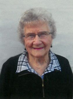
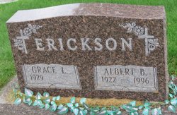
Grace Louise Van Gorder Erickson
| Birth | : | 31 Dec 1929 Rossville, Allamakee County, Iowa, USA |
| Death | : | 25 Feb 2018 Elkader, Clayton County, Iowa, USA |
| Burial | : | Giard Cemetery, Farmersburg, Clayton County, USA |
| Coordinate | : | 42.9933014, -91.3080978 |
| Description | : | Grace Louise Erickson, 88, of Farmersburg, Iowa died Sunday, February 25, 2018 at the Elkader Care Center, Elkader, Iowa. Grace Louise was born December 31, 1929, near Rossville, Iowa, to Sankey George and Minnie (Haman) Van Gorder. She was educated at Jefferson No. 8 Country School in Allamakee County and Waukon Public School. She was baptized and confirmed at St. Paul Methodist Church in Waukon, Iowa. Grace was united in marriage with Albert Berdine Erickson Jr. on August 12, 1944 by Rev. Paul Kitterer at the Peace United Church Parsonage in Elkader, Iowa. To this union two... Read More |
frequently asked questions (FAQ):
-
Where is Grace Louise Van Gorder Erickson's memorial?
Grace Louise Van Gorder Erickson's memorial is located at: Giard Cemetery, Farmersburg, Clayton County, USA.
-
When did Grace Louise Van Gorder Erickson death?
Grace Louise Van Gorder Erickson death on 25 Feb 2018 in Elkader, Clayton County, Iowa, USA
-
Where are the coordinates of the Grace Louise Van Gorder Erickson's memorial?
Latitude: 42.9933014
Longitude: -91.3080978
Family Members:
Parent
Spouse
Siblings
Flowers:
Nearby Cemetories:
1. Giard Cemetery
Farmersburg, Clayton County, USA
Coordinate: 42.9933014, -91.3080978
2. Bismark Cemetery
Farmersburg, Clayton County, USA
Coordinate: 42.9790000, -91.3500000
3. Railroad Employee Cemetery
Giard, Clayton County, USA
Coordinate: 43.0305395, -91.3140229
4. National Cemetery
National, Clayton County, USA
Coordinate: 42.9536018, -91.2902985
5. Farmersburg-Wagner Cemetery
Farmersburg, Clayton County, USA
Coordinate: 42.9481010, -91.3700027
6. Eastman Cemetery
McGregor, Clayton County, USA
Coordinate: 43.0010000, -91.2190000
7. Saint Wenceslaus Cemetery
McGregor, Clayton County, USA
Coordinate: 43.0593987, -91.3142014
8. Council Hill Cemetery
Monona, Clayton County, USA
Coordinate: 43.0718994, -91.3000031
9. Saint Paul Lutheran Cemetery
Monona, Clayton County, USA
Coordinate: 43.0494385, -91.3847198
10. Saint Patricks Cemetery
Monona, Clayton County, USA
Coordinate: 43.0496000, -91.3850000
11. Monona Cemetery
Monona, Clayton County, USA
Coordinate: 43.0531006, -91.3799973
12. Gooding Cemetery
Wagner Township, Clayton County, USA
Coordinate: 42.9869490, -91.4191570
13. Buell Park Cemetery
Mendon Township, Clayton County, USA
Coordinate: 43.0168226, -91.1999590
14. Moody Cemetery
McGregor, Clayton County, USA
Coordinate: 43.0030594, -91.1886063
15. Pleasant Grove Cemetery
McGregor, Clayton County, USA
Coordinate: 43.0266991, -91.1949997
16. Pioneer Cemetery
Monona, Clayton County, USA
Coordinate: 43.0149994, -91.4274979
17. Walton Cemetery
McGregor, Clayton County, USA
Coordinate: 43.0216270, -91.1909350
18. Knapp Cemetery
McGregor, Clayton County, USA
Coordinate: 43.0635000, -91.2213000
19. Saint Marys Catholic Church Cemetery
McGregor, Clayton County, USA
Coordinate: 43.0213735, -91.1834632
20. First Evangelical Lutheran Church Cemetery
McGregor, Clayton County, USA
Coordinate: 42.9718000, -91.1760000
21. Norwegian Church Cemetery
McGregor, Clayton County, USA
Coordinate: 42.9644400, -91.1764100
22. County Home Cemetery
Clayton Center, Clayton County, USA
Coordinate: 42.8916702, -91.3499985
23. Norway Lutheran Church Cemetery
Saint Olaf, Clayton County, USA
Coordinate: 42.9352798, -91.4302826
24. Baylis Cemetery
McGregor, Clayton County, USA
Coordinate: 43.0633160, -91.1959630


