
| Birth | : | Mar 1887 Surry County, North Carolina, USA |
| Death | : | 23 Jan 1930 Surry County, North Carolina, USA |
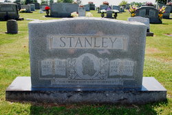
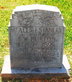
| Burial | : | Sand Fork Cemetery, Gilmer County, USA |
| Coordinate | : | 38.9158890, -80.7480520 |
| Description | : | Paternal grandparents were Jesse and Sarah "Sallie" Wilmoth Stanley. Maternal grandparents were John and Elizabeth Anne Quinn White. (Recorded by: K. Ned Beasley, h/o Teresa Sizemore Beasley, 2nd cousin 3 times removed). |
frequently asked questions (FAQ):
-
Where is Grover Cleveland “Cleve” Stanley's memorial?
Grover Cleveland “Cleve” Stanley's memorial is located at: Sand Fork Cemetery, Gilmer County, USA.
-
When did Grover Cleveland “Cleve” Stanley death?
Grover Cleveland “Cleve” Stanley death on 23 Jan 1930 in Surry County, North Carolina, USA
-
Where are the coordinates of the Grover Cleveland “Cleve” Stanley's memorial?
Latitude: 38.9158890
Longitude: -80.7480520
Family Members:
Parent

Spouse
Siblings
Children
Flowers:


Nearby Cemetories:
1. Sand Fork Cemetery
Gilmer County, USA
Coordinate: 38.9158890, -80.7480520
2. Killingsworth Cemetery
Sand Fork, Gilmer County, USA
Coordinate: 38.9169640, -80.7249834
3. Isaac B. Garrett Burial Site
Sand Fork, Gilmer County, USA
Coordinate: 38.8934000, -80.7443200
4. Varner Cemetery
Sand Fork, Gilmer County, USA
Coordinate: 38.9254709, -80.7212012
5. Dusk Camp United Methodist Church Cemetery
Gilmer County, USA
Coordinate: 38.8961140, -80.7325440
6. Conrad Cemetery
Sand Fork, Gilmer County, USA
Coordinate: 38.9364014, -80.7296982
7. Smith Cemetery
Stouts Mills, Gilmer County, USA
Coordinate: 38.8901800, -80.7333800
8. McHenry Cemetery #1
Sand Fork, Gilmer County, USA
Coordinate: 38.9353310, -80.7162630
9. Stout Cemetery
Stouts Mills, Gilmer County, USA
Coordinate: 38.8863000, -80.7341000
10. McHenry Cemetery
Gilmer County, USA
Coordinate: 38.9341870, -80.7130200
11. Dyer Cemetery
Gilmer County, USA
Coordinate: 38.9319000, -80.7110977
12. Conrad Cemetery
Stouts Mills, Gilmer County, USA
Coordinate: 38.8869019, -80.7264023
13. Self Family Cemetery
Glenville, Gilmer County, USA
Coordinate: 38.8852270, -80.7660100
14. Johns-Shiflet Cemetery
Stouts Mills, Gilmer County, USA
Coordinate: 38.8850100, -80.7658300
15. Otterbein Cemetery
Glenville, Gilmer County, USA
Coordinate: 38.9298550, -80.7916820
16. Putnam Cemetery
Gilmer County, USA
Coordinate: 38.8813700, -80.7721830
17. Snyder Cemetery
Gilmer County, USA
Coordinate: 38.9006004, -80.6964035
18. Hays Cemetery
Truebada, Gilmer County, USA
Coordinate: 38.9294400, -80.8026800
19. Canfield Cemetery
Gilmer, Gilmer County, USA
Coordinate: 38.9071999, -80.6900024
20. Unity Memorial Garden
Eastover, Richland County, USA
Coordinate: 38.8840220, -80.7040760
21. Rogers Cemetery
Gilmer County, USA
Coordinate: 38.9406013, -80.6936035
22. Locust Knob Cemetery
Stouts Mills, Gilmer County, USA
Coordinate: 38.8990000, -80.6880000
23. Snyder Cemetery Stewarts Creek
Glenville, Gilmer County, USA
Coordinate: 38.9577800, -80.7836100
24. Longshoal Cemetery
Gilmer, Gilmer County, USA
Coordinate: 38.8774030, -80.7055340