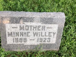
Hannah Diethardt Nanninga
| Birth | : | 14 May 1857 Hamswehrum, Landkreis Aurich, Lower Saxony (Niedersachsen), Germany |
| Death | : | 19 May 1935 Ireton, Sioux County, Iowa, USA |
| Burial | : | Montgomery Center Cemetery, Montgomery, Franklin County, USA |
| Coordinate | : | 44.8826900, -72.6129900 |
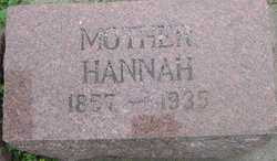
| Inscription | : | MOTHER / HANNAH / 1857 - 1935 |
| Description | : | Hannah Nanninga, a pioneer citizen of this community and one of Ireton's most respected citizens, passed to her eternal reward at 9:30 A. M. Sunday while eating breakfast with members of her son's family who resided with her. Mrs. Nanninga had been in her usual health and was about the home the day before and visited with neighbors and friends, and her end came suddenly, presumably the result of a heart ailment During her many years in this community Mrs. Nanninga was an ideal citizen, a kind mother and a good neighbor and friend, kindly and considerate of her fellow... Read More |
frequently asked questions (FAQ):
-
Where is Hannah Diethardt Nanninga's memorial?
Hannah Diethardt Nanninga's memorial is located at: Montgomery Center Cemetery, Montgomery, Franklin County, USA.
-
When did Hannah Diethardt Nanninga death?
Hannah Diethardt Nanninga death on 19 May 1935 in Ireton, Sioux County, Iowa, USA
-
Where are the coordinates of the Hannah Diethardt Nanninga's memorial?
Latitude: 44.8826900
Longitude: -72.6129900
Family Members:
Parent
Spouse
Siblings
Children
Flowers:
Nearby Cemetories:
1. Montgomery Center Cemetery
Montgomery, Franklin County, USA
Coordinate: 44.8826900, -72.6129900
2. Saint Isidore Catholic Cemetery
Franklin County, USA
Coordinate: 44.8800600, -72.6037000
3. Old Montgomery Cemetery
Montgomery, Franklin County, USA
Coordinate: 44.9004900, -72.6368500
4. Montgomery Village Cemetery
Montgomery, Franklin County, USA
Coordinate: 44.9020000, -72.6366600
5. Hill West Cemetery
Montgomery, Franklin County, USA
Coordinate: 44.8562480, -72.6572540
6. South Richford Cemetery
South Richford, Franklin County, USA
Coordinate: 44.9328200, -72.6514700
7. East Berkshire Congregational Cemetery
East Berkshire, Franklin County, USA
Coordinate: 44.9316200, -72.7037600
8. East Berkshire Episcopal Cemetery
East Berkshire, Franklin County, USA
Coordinate: 44.9312000, -72.7170600
9. East Enosburgh Cemetery
East Enosburg, Franklin County, USA
Coordinate: 44.8542560, -72.7352210
10. Richford Center Cemetery
Richford, Franklin County, USA
Coordinate: 44.9737800, -72.6502900
11. Enosburgh Center Cemetery
Enosburg Center, Franklin County, USA
Coordinate: 44.8720200, -72.7549000
12. Cook Cemetery
Bakersfield, Franklin County, USA
Coordinate: 44.8178400, -72.7310200
13. Stevens Ferry Cemetery
Enosburg, Franklin County, USA
Coordinate: 44.9209700, -72.7535500
14. Burroughs Family Cemetery
Belvidere, Lamoille County, USA
Coordinate: 44.7736702, -72.6120300
15. All Saints Catholic Cemetery
Richford, Franklin County, USA
Coordinate: 44.9886700, -72.6793300
16. Troy Street Cemetery
Richford, Franklin County, USA
Coordinate: 44.9913800, -72.6715400
17. Barnett Monument Cemetery
Richford, Franklin County, USA
Coordinate: 45.0011562, -72.6134585
18. West Jay Cemetery
Jay, Orleans County, USA
Coordinate: 44.9968990, -72.5509210
19. Hillside Cemetery
Richford, Franklin County, USA
Coordinate: 45.0017000, -72.6590100
20. Saint John the Baptist Cemetery New
Enosburg Falls, Franklin County, USA
Coordinate: 44.9026200, -72.7890600
21. East Richford Cemetery
East Richford, Franklin County, USA
Coordinate: 45.0111500, -72.5831400
22. North Hill Cemetery
Westfield, Orleans County, USA
Coordinate: 44.9056800, -72.4309800
23. Westfield Association Cemetery
Westfield, Orleans County, USA
Coordinate: 44.8793800, -72.4266900
24. Missisquoi Cemetery
Enosburg Falls, Franklin County, USA
Coordinate: 44.9091200, -72.7963700

