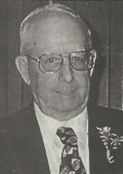
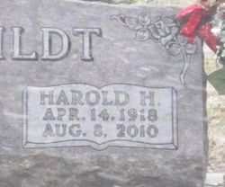
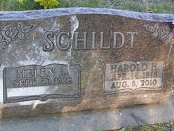
Harold Henry Schildt
| Birth | : | 14 Apr 1918 Seward County, Nebraska, USA |
| Death | : | 8 Aug 2010 Seward, Seward County, Nebraska, USA |
| Burial | : | St. Mary's Berkley, Berkley, Mendip District, England |
| Coordinate | : | 51.2435080, -2.2720990 |
| Plot | : | Addition: 4th, Lot: 102, Space: 3 |
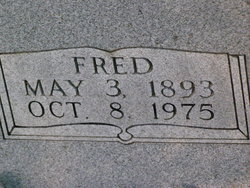
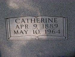
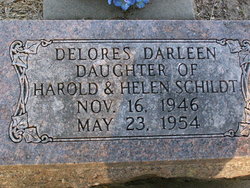
| Description | : | Parents: Fred and Catherine (Woebbecke) Schildt Baptized at St. Paul Lutheran Church in Milford on May 5, 1918 and confirmed on March 20, 1932 at Immanuel Lutheran Church. His family moved to a farm near Pleasant Dale and he attended Christian Day School at Immanuel Lutheran School. Married Helen Louise Ahrens in Pleasant Dale, Nebraska on September 21, 1942. Was engaged in farming and lived most of their married life on the farm west of Malcolm. He was a member of Immanuel Lutheran Church where he held many positions within the church and school. Hobbies/Interests: polka music, watching wrestling on television and... Read More |
frequently asked questions (FAQ):
-
Where is Harold Henry Schildt's memorial?
Harold Henry Schildt's memorial is located at: St. Mary's Berkley, Berkley, Mendip District, England.
-
When did Harold Henry Schildt death?
Harold Henry Schildt death on 8 Aug 2010 in Seward, Seward County, Nebraska, USA
-
Where are the coordinates of the Harold Henry Schildt's memorial?
Latitude: 51.2435080
Longitude: -2.2720990
Family Members:
Parent
Spouse
Siblings
Children
Flowers:
Nearby Cemetories:
1. St. Mary's Berkley
Berkley, Mendip District, England
Coordinate: 51.2435080, -2.2720990
2. All Saints Churchyard
Rodden, Mendip District, England
Coordinate: 51.2283600, -2.2892740
3. Beckington Baptist Chapel Burial Ground
Beckington, Mendip District, England
Coordinate: 51.2610760, -2.2897000
4. St George Churchyard
Beckington, Mendip District, England
Coordinate: 51.2635260, -2.2856810
5. East Hill
Frome St Quintin, West Dorset District, England
Coordinate: 51.2272132, -2.3024896
6. East Hill Cemetery
Frome, Mendip District, England
Coordinate: 51.2275940, -2.3030250
7. St. Margaret Churchyard Extension
Corsley, Wiltshire Unitary Authority, England
Coordinate: 51.2191491, -2.2469419
8. Frome Dissenters' Cemetery
Frome, Mendip District, England
Coordinate: 51.2317000, -2.3215000
9. St. John the Baptist Churchyard
Frome, Mendip District, England
Coordinate: 51.2296780, -2.3209480
10. All Saints Churchyard
Lullington, Mendip District, England
Coordinate: 51.2661940, -2.3121800
11. Sheppards Barton Meeting House Burial Ground
Frome, Mendip District, England
Coordinate: 51.2300570, -2.3247620
12. St Lawrence Churchyard
Rode, Mendip District, England
Coordinate: 51.2792750, -2.2765370
13. Holy Trinity Church
Frome, Mendip District, England
Coordinate: 51.2341720, -2.3275820
14. Christ Church Churchyard
Frome, Mendip District, England
Coordinate: 51.2295340, -2.3260130
15. St Mary the Virgin Churchyard
Orchardleigh, Mendip District, England
Coordinate: 51.2576210, -2.3259440
16. Penknap Providence Baptist Chapelyard
Dilton Marsh, Wiltshire Unitary Authority, England
Coordinate: 51.2467910, -2.2059510
17. Christ Church Churchyard
Rode, Mendip District, England
Coordinate: 51.2861620, -2.2790890
18. St Mary's Churchyard
Laverton, Mendip District, England
Coordinate: 51.2757380, -2.3195910
19. St. Lawrence Churchyard
Woolverton, Mendip District, England
Coordinate: 51.2851540, -2.3021790
20. St. Katherine's Churchyard
Frome, Mendip District, England
Coordinate: 51.1957520, -2.3012529
21. Saint Michael & All Angels Churchyard
Buckland Dinham, Mendip District, England
Coordinate: 51.2600540, -2.3522580
22. All Saints Churchyard
Tellisford, Mendip District, England
Coordinate: 51.2997270, -2.2877180
23. Saint Mary Magdalene Churchyard
Great Elm, Mendip District, England
Coordinate: 51.2426040, -2.3647230
24. St Leonard Church
Marston Magna, South Somerset District, England
Coordinate: 51.2058070, -2.3488020

