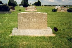
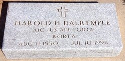
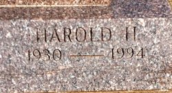
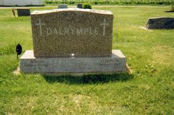
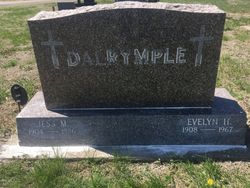
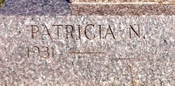
Harold Herbert Dalrymple
| Birth | : | 11 Aug 1930 Glasco, Cloud County, Kansas, USA |
| Death | : | 10 Jul 1994 Urbana, Champaign County, Illinois, USA |
| Burial | : | St Bartholomews Churchyard, Eastoft, North Lincolnshire Unitary Authority, England |
| Coordinate | : | 53.6397700, -0.7823500 |
| Description | : | OBITUARY, The Glasco Sun, Glasco, Kansas Harold H. Dalrymple, 63, Urbana, IL., died Sunday, July 10, 1994, at the Carle Hospital, Urbana, IL. Mr. Dalrymple was born Aug. 11, 1930, at Glasco, KS., and was a resident of Urbana for nearly 23 years. He was an Air Force veteran of the Korean War. He was an electrical engineer for the University of Illinois and a member of the St. Matthew Lutheran Church, Urbana. Survivors include his wife, Patricia of the home; two daughters, Lana J. Cullen, Phoenix, and Rugh A. Torbert, Temple, TX.; and two grandchildren. The service... Read More |
frequently asked questions (FAQ):
-
Where is Harold Herbert Dalrymple's memorial?
Harold Herbert Dalrymple's memorial is located at: St Bartholomews Churchyard, Eastoft, North Lincolnshire Unitary Authority, England.
-
When did Harold Herbert Dalrymple death?
Harold Herbert Dalrymple death on 10 Jul 1994 in Urbana, Champaign County, Illinois, USA
-
Where are the coordinates of the Harold Herbert Dalrymple's memorial?
Latitude: 53.6397700
Longitude: -0.7823500
Family Members:
Parent
Spouse
Flowers:
Nearby Cemetories:
1. St Bartholomews Churchyard
Eastoft, North Lincolnshire Unitary Authority, England
Coordinate: 53.6397700, -0.7823500
2. St Oswald Church
Luddington, North Lincolnshire Unitary Authority, England
Coordinate: 53.6448740, -0.7387490
3. Crowle Cemetery
Crowle, North Lincolnshire Unitary Authority, England
Coordinate: 53.6090660, -0.8285680
4. Crowle Baptist Church
Crowle, North Lincolnshire Unitary Authority, England
Coordinate: 53.6093970, -0.8317350
5. St Oswald Churchyard
Crowle, North Lincolnshire Unitary Authority, England
Coordinate: 53.6077330, -0.8353940
6. St Mary the Virgin Church
Fockerby, North Lincolnshire Unitary Authority, England
Coordinate: 53.6613050, -0.7138730
7. St Marks Church
Amcotts, North Lincolnshire Unitary Authority, England
Coordinate: 53.6166950, -0.7088900
8. All Saints Churchyard
Adlingfleet, East Riding of Yorkshire Unitary Authority, England
Coordinate: 53.6786760, -0.7238110
9. St Andrew's Church
Burton upon Stather, North Lincolnshire Unitary Authority, England
Coordinate: 53.6501180, -0.6850550
10. All Saints' Churchyard
Flixborough, North Lincolnshire Unitary Authority, England
Coordinate: 53.6247100, -0.6819480
11. All Saints Churchyard Old
Flixborough, North Lincolnshire Unitary Authority, England
Coordinate: 53.6178950, -0.6754930
12. St Oswald Churchyard
Althorpe, North Lincolnshire Unitary Authority, England
Coordinate: 53.5765570, -0.7408910
13. St John The Baptist Churchyard Extension
Burringham, North Lincolnshire Unitary Authority, England
Coordinate: 53.5708230, -0.7439800
14. Holy Trinity Churchyard
Blacktoft, East Riding of Yorkshire Unitary Authority, England
Coordinate: 53.7082510, -0.7271700
15. Alkborough Cemetery
Alkborough, North Lincolnshire Unitary Authority, England
Coordinate: 53.6816460, -0.6686090
16. St Peter Churchyard and Church Cemetery
Laxton, East Riding of Yorkshire Unitary Authority, England
Coordinate: 53.7196250, -0.8000900
17. Goole Cemetery
Goole, East Riding of Yorkshire Unitary Authority, England
Coordinate: 53.7105940, -0.8513370
18. Crosby Cemetery
Scunthorpe, North Lincolnshire Unitary Authority, England
Coordinate: 53.5978800, -0.6639600
19. St. John the Evangelist Churchyard
Goole, East Riding of Yorkshire Unitary Authority, England
Coordinate: 53.7024600, -0.8719260
20. Woodlands Cemetery and Crematorium
Scunthorpe, North Lincolnshire Unitary Authority, England
Coordinate: 53.5810900, -0.6744900
21. St Mary the Virgin Churchyard
Hook, East Riding of Yorkshire Unitary Authority, England
Coordinate: 53.7207270, -0.8510590
22. Scunthorpe Cemetery
Scunthorpe, North Lincolnshire Unitary Authority, England
Coordinate: 53.5932400, -0.6512140
23. Hook Cemetery
Hook, East Riding of Yorkshire Unitary Authority, England
Coordinate: 53.7204300, -0.8525380
24. St Lawrence Churchyard
Scunthorpe, North Lincolnshire Unitary Authority, England
Coordinate: 53.5864180, -0.6554010

