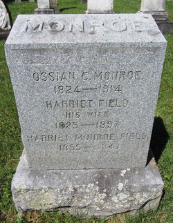
Harriet Monroe Field
| Birth | : | 19 Feb 1855 Poultney, Rutland County, Vermont, USA |
| Death | : | 24 Dec 1943 Chester, Windsor County, Vermont, USA |
| Burial | : | St. Peter's Churchyard, Dunton, North Norfolk District, England |
| Coordinate | : | 52.8375460, 0.7887910 |
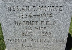
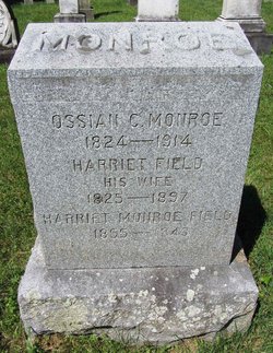
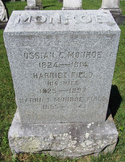
| Inscription | : | HARRIET MONROE FIELD 1855 - 1943 |
| Description | : | Daughter of Ossian Califf Monroe and Harriet Field. . Wife of Edward M. Field, whom she married on Sept. 26, 1900, in Fair Haven, Rutland, VT. . |
frequently asked questions (FAQ):
-
Where is Harriet Monroe Field's memorial?
Harriet Monroe Field's memorial is located at: St. Peter's Churchyard, Dunton, North Norfolk District, England.
-
When did Harriet Monroe Field death?
Harriet Monroe Field death on 24 Dec 1943 in Chester, Windsor County, Vermont, USA
-
Where are the coordinates of the Harriet Monroe Field's memorial?
Latitude: 52.8375460
Longitude: 0.7887910
Family Members:
Parent
Spouse
Flowers:
Nearby Cemetories:
1. St. Peter's Churchyard
Dunton, North Norfolk District, England
Coordinate: 52.8375460, 0.7887910
2. Fakenham Creake Road Cemetery
Fakenham, North Norfolk District, England
Coordinate: 52.8403170, 0.8348050
3. All Saint's Churchyard
Helhoughton, North Norfolk District, England
Coordinate: 52.8038639, 0.7713343
4. St Peter & St Paul Churchyard
Fakenham, North Norfolk District, England
Coordinate: 52.8308090, 0.8474920
5. Fakenham Cemetery
Fakenham, North Norfolk District, England
Coordinate: 52.8324060, 0.8500670
6. Assumption of the Blessed Virgin Mary Churchyard
Barsham, North Norfolk District, England
Coordinate: 52.8667710, 0.8283940
7. St Mary Churchyard
East Raynham, North Norfolk District, England
Coordinate: 52.7946530, 0.7864240
8. All Saints Churchyard
East Barsham, North Norfolk District, England
Coordinate: 52.8666620, 0.8459870
9. St. Mary's Churchyard
Syderstone, Kings Lynn and West Norfolk Borough, England
Coordinate: 52.8603000, 0.7214000
10. St Mary the Virgin Churchyard
Colkirk, Breckland Borough, England
Coordinate: 52.8021610, 0.8433730
11. All Saints Churchyard Waterden
South Creake, Kings Lynn and West Norfolk Borough, England
Coordinate: 52.8866500, 0.7997600
12. Saint Mary's Churchyard
East Rudham, Kings Lynn and West Norfolk Borough, England
Coordinate: 52.8210400, 0.7106100
13. All Saints Churchyard
Oxwick, Breckland Borough, England
Coordinate: 52.7917630, 0.8316080
14. All Saints Churchyard
North Barsham, North Norfolk District, England
Coordinate: 52.8777330, 0.8451480
15. St. Mary's Churchyard
South Creake, Kings Lynn and West Norfolk Borough, England
Coordinate: 52.8914540, 0.7565120
16. St. Peter's Churchyard
West Rudham, Kings Lynn and West Norfolk Borough, England
Coordinate: 52.8155500, 0.6984470
17. St Giles Churchyard
Barsham, North Norfolk District, England
Coordinate: 52.8813000, 0.8574300
18. St Mary Churchyard
North Creake, Kings Lynn and West Norfolk Borough, England
Coordinate: 52.9034150, 0.7565120
19. St Andrew Churchyard
Little Snoring, North Norfolk District, England
Coordinate: 52.8551400, 0.8990400
20. St Mary The Virgin Churchyard
Great Snoring, North Norfolk District, England
Coordinate: 52.8736000, 0.8914000
21. Saint Mary & All Saints Churchyard
Little Walsingham, North Norfolk District, England
Coordinate: 52.8910800, 0.8748300
22. Our Lady of Walsingham Chapel
Little Walsingham, North Norfolk District, England
Coordinate: 52.8936750, 0.8755360
23. St. Mary Churchyard
Bagthorpe, Kings Lynn and West Norfolk Borough, England
Coordinate: 52.8575650, 0.6657910
24. St. Martin’s Churchyard
Houghton, Kings Lynn and West Norfolk Borough, England
Coordinate: 52.8231250, 0.6605550


