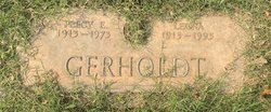
Harvey Leland Gerholdt
| Birth | : | 16 Dec 1908 Butte County, California, USA |
| Death | : | 13 May 1982 Chico, Butte County, California, USA |
| Burial | : | Desert Lawn Memorial Park, Palmdale, Los Angeles County, USA |
| Coordinate | : | 34.5525890, -118.0900880 |
| Description | : | Chico Enterprise-Record, Friday, May 14, 1982: "Harvey Gerholdt. A rosary will be said at 7 p.m. Sunday in the Brusie Funeral Home for Harvey Leland Gerholdt, 73, of Chico, who died Thursday in a Chico hospital. A mass will be said at 10 a.m. Monday at St. John's Catholic Church. "Gerholdt was born Dec. 16, 1908, to Fred and Florence Gerholdt in Magalia. He attended grammar school in Pentz, Stirling City and Durham, and he graduated from Durham High School. "Gerholdt served in the Army during World War II between July of 1942 and September of 1945. On July 5, 1942, he... Read More |
frequently asked questions (FAQ):
-
Where is Harvey Leland Gerholdt's memorial?
Harvey Leland Gerholdt's memorial is located at: Desert Lawn Memorial Park, Palmdale, Los Angeles County, USA.
-
When did Harvey Leland Gerholdt death?
Harvey Leland Gerholdt death on 13 May 1982 in Chico, Butte County, California, USA
-
Where are the coordinates of the Harvey Leland Gerholdt's memorial?
Latitude: 34.5525890
Longitude: -118.0900880
Family Members:
Parent
Spouse
Siblings
Flowers:
Nearby Cemetories:
1. Desert Lawn Memorial Park
Palmdale, Los Angeles County, USA
Coordinate: 34.5525890, -118.0900880
2. Palmdale Cemetery
Palmdale, Los Angeles County, USA
Coordinate: 34.5592003, -118.0916977
3. Acton Community Cemetery
Acton, Los Angeles County, USA
Coordinate: 34.4791985, -118.2007980
4. Mount Gleason Ranch Cemetery
Acton, Los Angeles County, USA
Coordinate: 34.4410480, -118.1980720
5. Joshua Memorial Park
Lancaster, Los Angeles County, USA
Coordinate: 34.6958008, -118.1141968
6. Lancaster Cemetery
Lancaster, Los Angeles County, USA
Coordinate: 34.6977806, -118.1286087
7. Good Shepherd Catholic Cemetery
Lancaster, Los Angeles County, USA
Coordinate: 34.6656400, -118.2541300
8. Vasquez Rocks Natural Area County Park Burial Site
Agua Dulce, Los Angeles County, USA
Coordinate: 34.4886600, -118.3214500
9. Loomis Family Cemetery
Mount Wilson, Los Angeles County, USA
Coordinate: 34.3470200, -118.0488700
10. Saint Andrews Abbey Cemetery
Valyermo, Los Angeles County, USA
Coordinate: 34.4521217, -117.8681335
11. Llano Del Rio Cemetery
Llano, Los Angeles County, USA
Coordinate: 34.4851000, -117.8092100
12. Colby Ranch Cemetery
Palmdale, Los Angeles County, USA
Coordinate: 34.2986200, -118.1115100
13. Mitchell-Dyer Family Cemetery
Santa Clarita, Los Angeles County, USA
Coordinate: 34.4210200, -118.4309600
14. Sand Canyon Ranch Burial Site
Santa Clarita, Los Angeles County, USA
Coordinate: 34.3766880, -118.4105940
15. Verdugo Hills Cemetery
Tujunga, Los Angeles County, USA
Coordinate: 34.2619019, -118.2822037
16. Glen Haven Memorial Park
Sylmar, Los Angeles County, USA
Coordinate: 34.3085130, -118.3768380
17. Brown Mountain Grave Site
Altadena, Los Angeles County, USA
Coordinate: 34.2161400, -118.1612160
18. Sholom Memorial Park
Sylmar, Los Angeles County, USA
Coordinate: 34.3051630, -118.3763500
19. Islamic Cemetery and Masjid
Rosamond, Kern County, USA
Coordinate: 34.8385340, -118.3402240
20. Saint Georges Church Peace Garden
La Cañada Flintridge, Los Angeles County, USA
Coordinate: 34.2021700, -118.1960800
21. Mountain View Cemetery and Mausoleum
Altadena, Los Angeles County, USA
Coordinate: 34.1861000, -118.1481018
22. Pioneer Memorial Cemetery
Sylmar, Los Angeles County, USA
Coordinate: 34.3209305, -118.4481125
23. Ruiz-Perea Family Cemetery
Santa Clarita, Los Angeles County, USA
Coordinate: 34.4889170, -118.5458940
24. Mater Dolorosa Passionist Retreat Center Cemetery
Sierra Madre, Los Angeles County, USA
Coordinate: 34.1709633, -118.0647049

