
| Birth | : | 23 Dec 1863 Ohio, USA |
| Death | : | 30 Jul 1943 Russellville, Brown County, Ohio, USA |
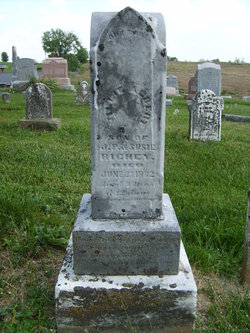
| Burial | : | St Marys Parish Churchyard, Broughton Astley, Harborough District, England |
| Coordinate | : | 52.5287810, -1.2253600 |
frequently asked questions (FAQ):
-
Where is Hattie Richey Hook's memorial?
Hattie Richey Hook's memorial is located at: St Marys Parish Churchyard, Broughton Astley, Harborough District, England.
-
When did Hattie Richey Hook death?
Hattie Richey Hook death on 30 Jul 1943 in Russellville, Brown County, Ohio, USA
-
Where are the coordinates of the Hattie Richey Hook's memorial?
Latitude: 52.5287810
Longitude: -1.2253600
Family Members:
Parent
Spouse

Siblings
Children
Flowers:


Nearby Cemetories:
1. St Marys Parish Churchyard
Broughton Astley, Harborough District, England
Coordinate: 52.5287810, -1.2253600
2. Broughton Astley Cemetery
Broughton Astley, Harborough District, England
Coordinate: 52.5259830, -1.2325190
3. Sutton Elms Baptist Chapelyard
Broughton Astley, Harborough District, England
Coordinate: 52.5389370, -1.2328020
4. St Peters Churchyard
Leire, Harborough District, England
Coordinate: 52.5053690, -1.2266430
5. Church of All Saints
Dunton Bassett, Harborough District, England
Coordinate: 52.5091000, -1.1946000
6. Saint Nicholas Churchyard
Frolesworth, Harborough District, England
Coordinate: 52.5112740, -1.2599970
7. St Michael and All Angels Churchyard
Cosby, Blaby District, England
Coordinate: 52.5488260, -1.1933700
8. Cosby Cemetery
Cosby, Blaby District, England
Coordinate: 52.5560490, -1.1962970
9. St Michael & All Angels
Croft, Blaby District, England
Coordinate: 52.5593821, -1.2484472
10. All Saints
Sapcote, Blaby District, England
Coordinate: 52.5344520, -1.2810440
11. St Peter Churchyard
Ashby Parva, Harborough District, England
Coordinate: 52.4930340, -1.2272720
12. Sapcote Cemetery
Sapcote, Blaby District, England
Coordinate: 52.5336420, -1.2842020
13. St Michael's Churchyard
Stoney Stanton, Blaby District, England
Coordinate: 52.5487420, -1.2794980
14. St Helen
Sharnford, Blaby District, England
Coordinate: 52.5228440, -1.2886350
15. Nock Verges Cemetery
Stoney Stanton, Blaby District, England
Coordinate: 52.5492300, -1.2807020
16. St Mary's Churchyard
Willoughby Waterleys, Harborough District, England
Coordinate: 52.5270920, -1.1532770
17. All Saints Churchyard
Narborough, Blaby District, England
Coordinate: 52.5730420, -1.2038480
18. Huncote Cemetery
Huncote, Blaby District, England
Coordinate: 52.5764090, -1.2391220
19. St. Peter's Churchyard
Claybrooke Parva, Harborough District, England
Coordinate: 52.4868640, -1.2708550
20. Claybrooke Cemetery
Claybrooke Parva, Harborough District, England
Coordinate: 52.4862230, -1.2724990
21. Whetstone Cemetery
Whetstone, Blaby District, England
Coordinate: 52.5722900, -1.1779200
22. Saint Peter's Churchyard
Whetstone, Blaby District, England
Coordinate: 52.5727910, -1.1788510
23. St Peter's Church
Aston Flamville, Blaby District, England
Coordinate: 52.5307260, -1.3187510
24. All Saints Churchyard
Gilmorton, Harborough District, England
Coordinate: 52.4855900, -1.1604900