
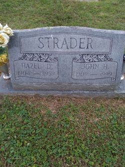
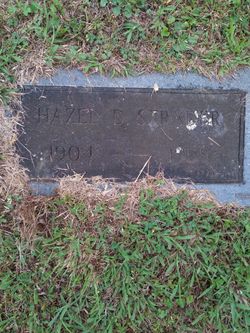
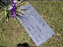
Hazel Dell Hitt Strader
| Birth | : | 4 Oct 1904 Leading Creek, Lewis County, West Virginia, USA |
| Death | : | 30 Aug 1959 Weston, Lewis County, West Virginia, USA |
| Burial | : | Rock Grove Cemetery, Latonia, Gilmer County, USA |
| Coordinate | : | 39.0125008, -80.7018967 |
| Description | : | Hazel Dell Hitt was born 14 Oct 1904 (per Birth Record) in Leading Creek, WV to James William Hitt and "Nora" Brady. Hazel's Certificate of Death gives Date of Birth as 4 Oct 1904. Hazel married Richard Thomas Fincham on 23 Mar 1934 in Lewis County, WV. Richard died 6 years later on 19 Jun 1940 in Copen, Braxton County, WV. Richard was the son of John Lewis Fincham and Rosie Z. Hitt. Hazel later married Mr. Strader - believed to be John H. Strader, informant on Hazel's Death Certificate on date: unknown. Hazel died from a Cerebral Vascular Accident... Read More |
frequently asked questions (FAQ):
-
Where is Hazel Dell Hitt Strader's memorial?
Hazel Dell Hitt Strader's memorial is located at: Rock Grove Cemetery, Latonia, Gilmer County, USA.
-
When did Hazel Dell Hitt Strader death?
Hazel Dell Hitt Strader death on 30 Aug 1959 in Weston, Lewis County, West Virginia, USA
-
Where are the coordinates of the Hazel Dell Hitt Strader's memorial?
Latitude: 39.0125008
Longitude: -80.7018967
Family Members:
Parent
Spouse

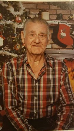
Siblings
Flowers:


Nearby Cemetories:
1. Rock Grove Cemetery
Latonia, Gilmer County, USA
Coordinate: 39.0125008, -80.7018967
2. Moneypenny Cemetery
Alum Bridge, Lewis County, USA
Coordinate: 39.0281466, -80.6809317
3. Woofter Cemetery
Alum Bridge, Lewis County, USA
Coordinate: 39.0299988, -80.6808014
4. Farnsworth Cemetery
Linn, Gilmer County, USA
Coordinate: 39.0177994, -80.7378006
5. Pickerel Cemetery
Baldwin, Gilmer County, USA
Coordinate: 38.9891200, -80.7289800
6. Carder Cemetery
Vadis, Lewis County, USA
Coordinate: 39.0433006, -80.7142029
7. Old Field Fork Cemetery
Lewis County, USA
Coordinate: 38.9827995, -80.6710968
8. Troy IOOF Community Cemetery
Troy, Gilmer County, USA
Coordinate: 39.0281170, -80.7679560
9. Hiney Hill Cemetery
Linn, Gilmer County, USA
Coordinate: 38.9676950, -80.7405600
10. Keith Cemetery
Gilmer County, USA
Coordinate: 38.9561005, -80.6986008
11. Messenger Cemetery
Gilmer County, USA
Coordinate: 38.9714012, -80.7572021
12. Saint Boniface Catholic Cemetery
Camden, Lewis County, USA
Coordinate: 39.0342580, -80.6288680
13. Hurst Cemetery
Lewis County, USA
Coordinate: 39.0741997, -80.6999969
14. Boilon Cemetery
Gilmer County, USA
Coordinate: 38.9519005, -80.6718979
15. Walnut Fork Cemetery
Lewis County, USA
Coordinate: 39.0706910, -80.6644980
16. Schoonover-Dawson Cemetery
Donlan, Gilmer County, USA
Coordinate: 38.9461770, -80.6854790
17. Halderman Cemetery
Lewis County, USA
Coordinate: 39.0821991, -80.7039032
18. Straight Run Cemetery
Hurst, Lewis County, USA
Coordinate: 39.0802994, -80.6774979
19. Rogers Cemetery
Gilmer County, USA
Coordinate: 38.9406013, -80.6936035
20. McHenry Cemetery #1
Sand Fork, Gilmer County, USA
Coordinate: 38.9353310, -80.7162630
21. McHenry Cemetery
Gilmer County, USA
Coordinate: 38.9341870, -80.7130200
22. Conrad Cemetery
Sand Fork, Gilmer County, USA
Coordinate: 38.9364014, -80.7296982
23. Big Run Cemetery
Gilmer County, USA
Coordinate: 39.0802994, -80.7585983
24. Dyer Cemetery
Gilmer County, USA
Coordinate: 38.9319000, -80.7110977