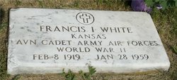
| Birth | : | 7 Jan 1923 Ada, Ottawa County, Kansas, USA |
| Death | : | 5 Jul 2020 Olathe, Johnson County, Kansas, USA |
| Burial | : | Lane Cemetery, Lane, Franklin County, USA |
| Coordinate | : | 38.4411011, -95.0699997 |
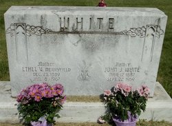
| Description | : | HELEN LOUISE BELT Helen Louise, the daughter of John J. and Ethel Merryfield White, was born January 7, 1923 near Ada, Kansas. She died July 5, 2020 at Olathe Medical Center at the age of 97 with her family by her side. Helen grew up in the Ada community, moving to Manhattan in 1938 where she graduated from high school and attended one year at Kansas State University to pursue a career in nursing. Her passion for helping others spilled over into every facet of her life. On August 11, 1941, she and George R.... Read More |
frequently asked questions (FAQ):
-
Where is Helen Louise White Belt's memorial?
Helen Louise White Belt's memorial is located at: Lane Cemetery, Lane, Franklin County, USA.
-
When did Helen Louise White Belt death?
Helen Louise White Belt death on 5 Jul 2020 in Olathe, Johnson County, Kansas, USA
-
Where are the coordinates of the Helen Louise White Belt's memorial?
Latitude: 38.4411011
Longitude: -95.0699997
Family Members:
Parent
Spouse
Siblings
Flowers:
Nearby Cemetories:
1. Lane Cemetery
Lane, Franklin County, USA
Coordinate: 38.4411011, -95.0699997
2. Myers Cemetery
Lane, Franklin County, USA
Coordinate: 38.4578820, -95.0935150
3. Green Valley Cemetery
Miami County, USA
Coordinate: 38.4700012, -95.0472031
4. Spring Grove Quaker Cemetery
Miami County, USA
Coordinate: 38.4409600, -95.0185100
5. Sturgeon Cemetery
Lane, Franklin County, USA
Coordinate: 38.4376100, -95.1254100
6. Pottawatomie Baptist Mission Cemetery
Lane, Franklin County, USA
Coordinate: 38.4049500, -95.1028200
7. Baker Cemetery
Lane, Franklin County, USA
Coordinate: 38.4371986, -95.1333008
8. Needham Cemetery
Lane, Franklin County, USA
Coordinate: 38.4700012, -95.1231003
9. Lanter Family Cemetery
Anderson County, USA
Coordinate: 38.3827100, -95.1059000
10. Chandler Family Cemetery
Beagle, Miami County, USA
Coordinate: 38.4057600, -94.9951200
11. Lockhart Cemetery
Beagle, Miami County, USA
Coordinate: 38.4112400, -94.9828500
12. Shively Cemetery
Rantoul, Franklin County, USA
Coordinate: 38.5159500, -95.0747400
13. Crescent Hill Cemetery
Osawatomie, Miami County, USA
Coordinate: 38.4513700, -94.9705800
14. Greeley City Cemetery
Greeley, Anderson County, USA
Coordinate: 38.3752327, -95.1258011
15. Mound Creek Cemetery
Beagle, Miami County, USA
Coordinate: 38.3958015, -94.9760971
16. Smith Cemetery
Richmond, Franklin County, USA
Coordinate: 38.4253700, -95.1785950
17. Indianapolis Cemetery
Osawatomie, Miami County, USA
Coordinate: 38.5046997, -94.9931030
18. Wait Cemetery
Parker, Linn County, USA
Coordinate: 38.3527985, -95.0378036
19. Saint Johns Cemetery
Greeley, Anderson County, USA
Coordinate: 38.3546982, -95.1256027
20. Beagle Cemetery
Beagle, Miami County, USA
Coordinate: 38.4178300, -94.9493400
21. Ray Cemetery
Franklin County, USA
Coordinate: 38.4927140, -95.1754620
22. Berea Cemetery
Franklin County, USA
Coordinate: 38.3981018, -95.1849976
23. Stanton Cemetery
Stanton, Miami County, USA
Coordinate: 38.5426000, -95.0596100
24. Brown Cemetery
Osawatomie, Miami County, USA
Coordinate: 38.4980300, -94.9566500

