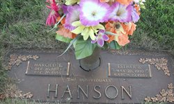
| Birth | : | 1870 Union County, South Dakota, USA |
| Death | : | 27 Jul 1932 Union County, South Dakota, USA |
| Burial | : | Richland Cemetery, Richland, Union County, USA |
| Coordinate | : | 42.7682991, -96.6624985 |
| Plot | : | Section 2, Block 25, Lot 2, Grave 3 |
| Description | : | Henry Hanson, aged 62, a well known farmer of Brule township, Union County, S.D, died on Wednesday afternoon of last week after a lingering Illness. His parents homesteaded the farm on which he was born and died. He is survived by his widow and five sons. Funeral services were held in the M. E. church in Elk Point, Saturday afternoon, and interment was in the Richland cemetery. [Source: The Akron Register Tribune; Akron, Plymouth, Iowa, USA; Thursday, August 4, 1932; Volume 46, Number 2] |
frequently asked questions (FAQ):
-
Where is Henry Hanson's memorial?
Henry Hanson's memorial is located at: Richland Cemetery, Richland, Union County, USA.
-
When did Henry Hanson death?
Henry Hanson death on 27 Jul 1932 in Union County, South Dakota, USA
-
Where are the coordinates of the Henry Hanson's memorial?
Latitude: 42.7682991
Longitude: -96.6624985
Family Members:
Spouse
Children
Flowers:
Nearby Cemetories:
1. Richland Cemetery
Richland, Union County, USA
Coordinate: 42.7682991, -96.6624985
2. Saint Paul Cemetery
Elk Point, Union County, USA
Coordinate: 42.7641983, -96.7061005
3. Union County Poor Farm Cemetery
Union County, USA
Coordinate: 42.7649210, -96.7077580
4. First Brule Creek Cemetery
Elk Point, Union County, USA
Coordinate: 42.7943993, -96.7069016
5. Gores Bluff Cemetery
Union County, USA
Coordinate: 42.8035069, -96.6260468
6. Westfield Township Cemetery
Westfield, Plymouth County, USA
Coordinate: 42.7510986, -96.5914001
7. Mills Family Cemetery
Westfield, Plymouth County, USA
Coordinate: 42.7188460, -96.6019280
8. Brule Creek Cemetery
Spink Township, Union County, USA
Coordinate: 42.8346510, -96.7324350
9. Elk Point Cemetery
Elk Point, Union County, USA
Coordinate: 42.6794586, -96.6794586
10. Saint Joseph Cemetery
Elk Point, Union County, USA
Coordinate: 42.6794014, -96.6797028
11. Ahlsborg Lutheran Cemetery
Union County, USA
Coordinate: 42.8228000, -96.7612000
12. Pleasant Hill Cemetery Old
Spink, Union County, USA
Coordinate: 42.8588462, -96.7215592
13. Saint Patricks Cemetery
Akron, Plymouth County, USA
Coordinate: 42.8232300, -96.5374800
14. Pleasant Hill Cemetery
Spink, Union County, USA
Coordinate: 42.8741000, -96.6876000
15. Dowlin Cemetery
Burbank, Clay County, USA
Coordinate: 42.7789001, -96.8107986
16. Riverside Cemetery
Akron, Plymouth County, USA
Coordinate: 42.8367004, -96.5453033
17. Saint Mary Cemetery
Union County, USA
Coordinate: 42.8520584, -96.7877502
18. Union Creek Cemetery
Union County, USA
Coordinate: 42.8911018, -96.5863037
19. Saint Agnes Cemetery
Vermillion, Clay County, USA
Coordinate: 42.7872009, -96.8499985
20. Mount Hope Cemetery
Union County, USA
Coordinate: 42.8885994, -96.5667038
21. Ionia Cemetery
Newcastle, Dixon County, USA
Coordinate: 42.6893997, -96.8300018
22. Dewitt Cemetery
Ponca, Dixon County, USA
Coordinate: 42.6248000, -96.7437500
23. Gibb's Cemetery
Newcastle, Dixon County, USA
Coordinate: 42.6985100, -96.8518400
24. Elmwood Cemetery
Elk Point, Union County, USA
Coordinate: 42.6036700, -96.6881900


