
| Birth | : | 25 Sep 1879 Hooper, Dodge County, Nebraska, USA |
| Death | : | 30 May 1909 Hooper, Dodge County, Nebraska, USA |
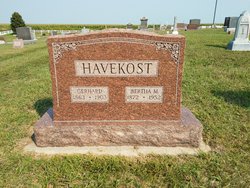
| Burial | : | Pleasington Priory, Pleasington, Blackburn with Darwen Unitary Authority, England |
| Coordinate | : | 53.7348590, -2.5433060 |
| Description | : | Obituary The Hooper Sentinel June 3, 1909 Herman F. Havekost Dead The community was greatly shocked to learn of the death of Herman F. Havekost, one of our most prosperous and prominent young farmers, at his home east of Hooper Sunday afternoon. He was fist taken sick last Wednesday evening, he grew much worse Thursday and after a consultation of doctors a surgeon was summoned from Omaha and he was operated upon for appendicitis Friday evening. The case was a very critical one and no hopes were entertained for his recovery, although everything medical skill could do was resorted to that his life might be saved. Mr. Havekost was born, Sept. 25,... Read More |
frequently asked questions (FAQ):
-
Where is Herman Friedrich Havekost's memorial?
Herman Friedrich Havekost's memorial is located at: Pleasington Priory, Pleasington, Blackburn with Darwen Unitary Authority, England.
-
When did Herman Friedrich Havekost death?
Herman Friedrich Havekost death on 30 May 1909 in Hooper, Dodge County, Nebraska, USA
-
Where are the coordinates of the Herman Friedrich Havekost's memorial?
Latitude: 53.7348590
Longitude: -2.5433060
Family Members:
Parent

Spouse
Siblings
Children


Nearby Cemetories:
1. Pleasington Priory
Pleasington, Blackburn with Darwen Unitary Authority, England
Coordinate: 53.7348590, -2.5433060
2. Pleasington Cemetery and Crematorium
Blackburn, Blackburn with Darwen Unitary Authority, England
Coordinate: 53.7388880, -2.5368710
3. Holy Trinity Churchyard
Hoghton, Chorley Borough, England
Coordinate: 53.7279300, -2.5848550
4. St. Josephs Roman Catholic Churchyard
Brindle, Chorley Borough, England
Coordinate: 53.7350780, -2.5880640
5. New Row Methodist Church
Blackburn with Darwen Unitary Authority, England
Coordinate: 53.7208950, -2.5023720
6. St Stephen Churchyard
Tockholes, Blackburn with Darwen Unitary Authority, England
Coordinate: 53.7058350, -2.5169320
7. St. Peter's Churchyard
Blackburn, Blackburn with Darwen Unitary Authority, England
Coordinate: 53.7448110, -2.4865070
8. St Paul's
Blackburn, Blackburn with Darwen Unitary Authority, England
Coordinate: 53.7491222, -2.4891266
9. Independent Chapel Churchyard
Blackburn, Blackburn with Darwen Unitary Authority, England
Coordinate: 53.7454960, -2.4864460
10. Wesleyan Methodist Chapel Chapelyard
Blackburn, Blackburn with Darwen Unitary Authority, England
Coordinate: 53.7464910, -2.4848380
11. Blackburn Cathedral
Blackburn, Blackburn with Darwen Unitary Authority, England
Coordinate: 53.7472960, -2.4820020
12. St. Mary's Churchyard
Mellor, Ribble Valley Borough, England
Coordinate: 53.7728600, -2.5312400
13. St Paul's Churchyard
Withnell, Chorley Borough, England
Coordinate: 53.6970740, -2.5592150
14. Mellor Methodist Churchyard
Blackburn, Blackburn with Darwen Unitary Authority, England
Coordinate: 53.7742950, -2.5255060
15. Mount St Presbyterian Chapelyard
Blackburn, Blackburn with Darwen Unitary Authority, England
Coordinate: 53.7478000, -2.4775000
16. Holy Trinity Church
Blackburn with Darwen Unitary Authority, England
Coordinate: 53.7511727, -2.4747178
17. St James's Churchyard
Brindle, Chorley Borough, England
Coordinate: 53.7133333, -2.6086111
18. St Alban's Churchyard
Blackburn, Blackburn with Darwen Unitary Authority, England
Coordinate: 53.7530090, -2.4748540
19. St Mary's R.C. Church Cemetery
Osbaldeston, Ribble Valley Borough, England
Coordinate: 53.7816970, -2.5350240
20. St James Churchyard
Lower Darwen, Blackburn with Darwen Unitary Authority, England
Coordinate: 53.7245510, -2.4634700
21. St Leonard Churchyard
Balderstone, Ribble Valley Borough, England
Coordinate: 53.7860070, -2.5609380
22. Blackburn Cemetery
Blackburn, Blackburn with Darwen Unitary Authority, England
Coordinate: 53.7662430, -2.4726050
23. St. Mary's and St. John RC Churchyard, Southworth
Samlesbury, South Ribble Borough, England
Coordinate: 53.7676690, -2.6183400
24. St. Leonard the Less Churchyard
Samlesbury, South Ribble Borough, England
Coordinate: 53.7680000, -2.6237000