
| Memorials | : | 20 |
| Location | : | Samlesbury, South Ribble Borough, England |
| Coordinate | : | 53.7680000, -2.6237000 |
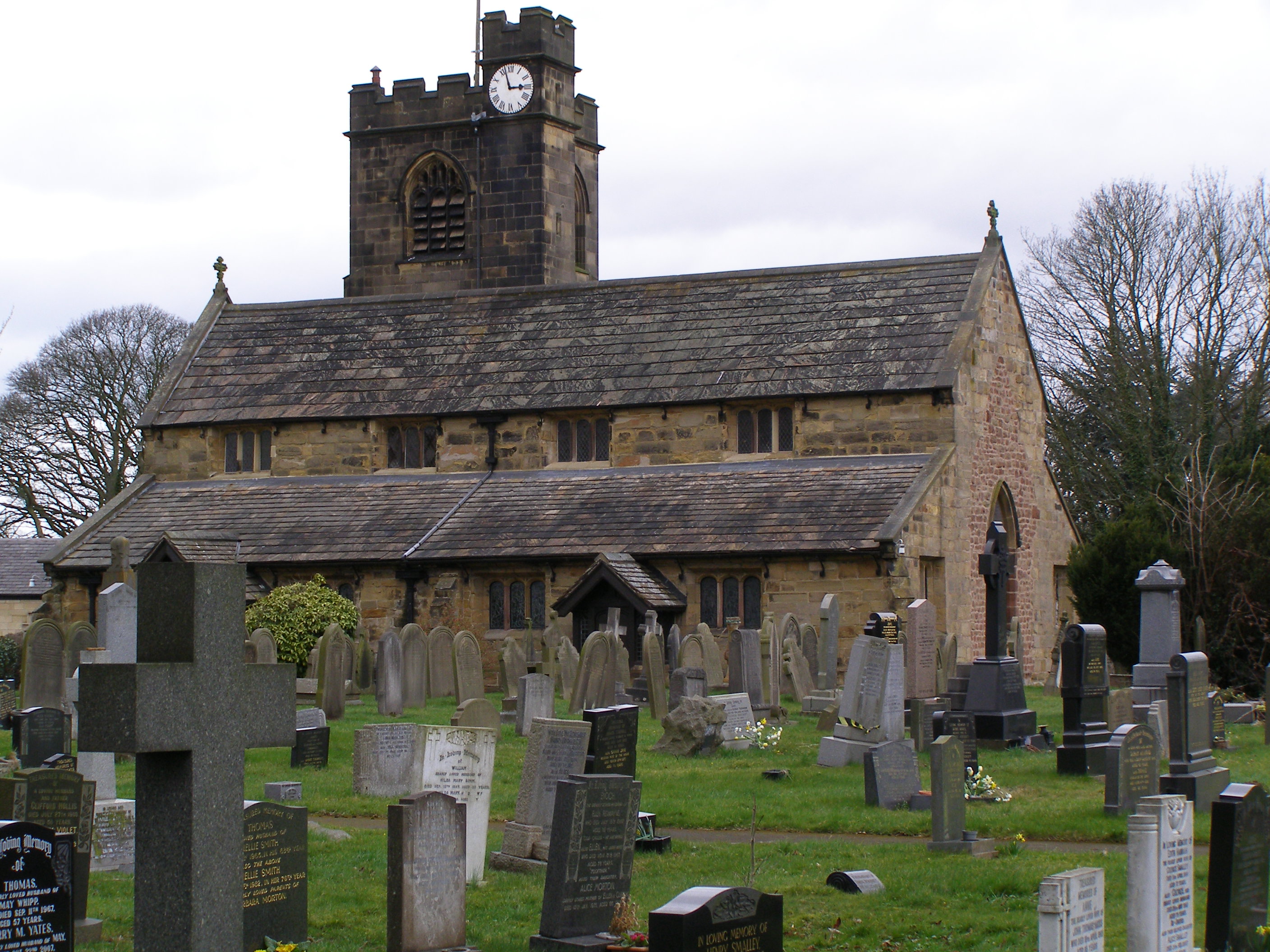
| Description | : | There has been a church (or chapel) on the site since the 12th century, traces of which can be seen in the present structure. The chapel may have been rebuilt in the 14th century. It was substantially rebuilt in 1558, by Edward Stanley, 3rd Earl of Derby and was restored in 1885. The tower was added in 1899–1900 by James Bertwistle of Blackburn. The church was designated a Grade I listed building by English Heritage on November 11, 1966. The Grade I listing is for buildings "of exceptional interest, sometimes considered to be internationally important" |
frequently asked questions (FAQ):
-
Where is St. Leonard the Less Churchyard?
St. Leonard the Less Churchyard is located at Samlesbury, South Ribble Borough ,Lancashire ,England.
-
St. Leonard the Less Churchyard cemetery's updated grave count on graveviews.com?
20 memorials
-
Where are the coordinates of the St. Leonard the Less Churchyard?
Latitude: 53.7680000
Longitude: -2.6237000
Nearby Cemetories:
1. St. Mary's and St. John RC Churchyard, Southworth
Samlesbury, South Ribble Borough, England
Coordinate: 53.7676690, -2.6183400
2. Preston Crematorium
Preston, City of Preston, England
Coordinate: 53.7863750, -2.6340170
3. Preston Old Cemetery
Ribbleton, City of Preston, England
Coordinate: 53.7686352, -2.6623154
4. Preston New Cemetery
Ribbleton, City of Preston, England
Coordinate: 53.7717400, -2.6620900
5. All Saints Churchyard
Walton-le-Dale, South Ribble Borough, England
Coordinate: 53.7407250, -2.6408280
6. Our Lady and St Patrick's Church
Walton-le-Dale, South Ribble Borough, England
Coordinate: 53.7407250, -2.6408280
7. St. Michael's Churchyard
Grimsargh, City of Preston, England
Coordinate: 53.7990710, -2.6352530
8. St Leonard Churchyard
Walton-le-Dale, South Ribble Borough, England
Coordinate: 53.7476530, -2.6666950
9. St. Josephs Roman Catholic Churchyard
Brindle, Chorley Borough, England
Coordinate: 53.7350780, -2.5880640
10. St Leonard Churchyard
Balderstone, Ribble Valley Borough, England
Coordinate: 53.7860070, -2.5609380
11. Our Lady and St. Michael Roman Catholic Churchyard
Longridge, Ribble Valley Borough, England
Coordinate: 53.8088040, -2.6133470
12. St Augustine of Canterbury
Preston, City of Preston, England
Coordinate: 53.7560420, -2.6912650
13. St. Paul Churchyard
Preston, City of Preston, England
Coordinate: 53.7625360, -2.6947080
14. St. James' Churchyard
Preston, City of Preston, England
Coordinate: 53.7566010, -2.6941110
15. St. Ignatius RC Churchyard
Preston, City of Preston, England
Coordinate: 53.7635270, -2.6965870
16. St John Churchyard
Preston, City of Preston, England
Coordinate: 53.7582080, -2.6959750
17. St Mary's Churchyard Brownedge
Bamber Bridge, South Ribble Borough, England
Coordinate: 53.7305472, -2.6669416
18. St. Mary's Churchyard
Preston, City of Preston, England
Coordinate: 53.8010830, -2.6779600
19. Holy Trinity Churchyard
Hoghton, Chorley Borough, England
Coordinate: 53.7279300, -2.5848550
20. Holy Trinity
Preston, City of Preston, England
Coordinate: 53.7613030, -2.7030580
21. Friends Meeting House Burial Ground (Defunct)
Preston, City of Preston, England
Coordinate: 53.7610250, -2.7030380
22. St. George the Martyr
Preston, City of Preston, England
Coordinate: 53.7591220, -2.7025660
23. Christ Church Churchyard
Fulwood, City of Preston, England
Coordinate: 53.7771920, -2.7028700
24. St. Wilfrid's Catholic Cemetery
Preston, City of Preston, England
Coordinate: 53.7581670, -2.7044930