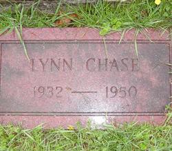
Hubert Lynn Chase
| Birth | : | 2 Feb 1932 Asbury, Greenbrier County, West Virginia, USA |
| Death | : | 10 Aug 1950 Lewisburg, Greenbrier County, West Virginia, USA |
| Burial | : | Saint John Crossens Churchyard, Crossens, Metropolitan Borough of Sefton, England |
| Coordinate | : | 53.6733410, -2.9478740 |
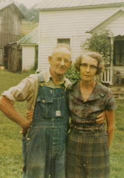
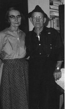
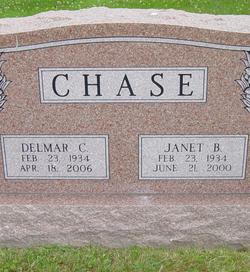
| Description | : | Known to family and friends alike as Lynn, he was the eldest of the four children born to Cosmo & Lora Chase. He grew up on a small family farm on Muddy Creek Mountain where he developed a great love for agriculture, and especially for horticulture. He was always ordering berries and fruit trees from the Stark Bros Nursery and not only planting and nurturing these but also budding and grafting fruit trees, skills which he learned from his father. He attended Fry Elementary School, about a mile from his home, through the 8th grade. He was always an excellent... Read More |
frequently asked questions (FAQ):
-
Where is Hubert Lynn Chase's memorial?
Hubert Lynn Chase's memorial is located at: Saint John Crossens Churchyard, Crossens, Metropolitan Borough of Sefton, England.
-
When did Hubert Lynn Chase death?
Hubert Lynn Chase death on 10 Aug 1950 in Lewisburg, Greenbrier County, West Virginia, USA
-
Where are the coordinates of the Hubert Lynn Chase's memorial?
Latitude: 53.6733410
Longitude: -2.9478740
Family Members:
Parent
Siblings
Flowers:
Nearby Cemetories:
1. Saint John Crossens Churchyard
Crossens, Metropolitan Borough of Sefton, England
Coordinate: 53.6733410, -2.9478740
2. St Cuthberts Churchyard
Southport, Metropolitan Borough of Sefton, England
Coordinate: 53.6603230, -2.9620310
3. St. Stephen's Churchyard
North Meols, West Lancashire District, England
Coordinate: 53.6813720, -2.9248140
4. Emmanuel Parish Church
Southport, Metropolitan Borough of Sefton, England
Coordinate: 53.6604534, -2.9748117
5. Emmanuel Church Garden of Remembrance
North Meols, West Lancashire District, England
Coordinate: 53.6607130, -2.9753420
6. Holy Trinity Church
Southport, Metropolitan Borough of Sefton, England
Coordinate: 53.6503800, -2.9969150
7. St. Marie on the Sands
Southport, Metropolitan Borough of Sefton, England
Coordinate: 53.6524320, -3.0023440
8. Christ Church Churchyard
Southport, Metropolitan Borough of Sefton, England
Coordinate: 53.6327778, -2.9953770
9. Duke Street Cemetery
Southport, Metropolitan Borough of Sefton, England
Coordinate: 53.6343536, -2.9993131
10. Ardwick Cemetery
Ardwick, Metropolitan Borough of Manchester, England
Coordinate: 53.6302778, -2.9900000
11. Southport Crematorium
Scarisbrick, West Lancashire District, England
Coordinate: 53.6235810, -2.9600210
12. St. Mark Churchyard
Scarisbrick, West Lancashire District, England
Coordinate: 53.6134600, -2.9403800
13. St. Elizabeth's Churchyard
Scarisbrick, West Lancashire District, England
Coordinate: 53.6124460, -2.9206340
14. St John the Divine
Lytham Saint Annes, Fylde Borough, England
Coordinate: 53.7367060, -2.9548070
15. St. Cuthbert Churchyard
Lytham Saint Annes, Fylde Borough, England
Coordinate: 53.7376560, -2.9761270
16. All Saints Churchyard
Hesketh with Becconsall, West Lancashire District, England
Coordinate: 53.7028189, -2.8400142
17. Saltcoates Roman Catholic Cemetery
Lytham Saint Annes, Fylde Borough, England
Coordinate: 53.7463000, -2.9448940
18. St. Mary's Churchyard
Tarleton, West Lancashire District, England
Coordinate: 53.6746100, -2.8239200
19. Becconsall Old Church Churchyard
Hesketh with Becconsall, West Lancashire District, England
Coordinate: 53.7023610, -2.8314810
20. Liverpool Road Cemetery
Birkdale, Metropolitan Borough of Sefton, England
Coordinate: 53.6083620, -3.0257140
21. Sacred Heart RC Cemetery
Birkdale, Metropolitan Borough of Sefton, England
Coordinate: 53.6066100, -3.0270100
22. St. Michael and All Angel Churchyard
Much Hoole, South Ribble Borough, England
Coordinate: 53.6942950, -2.8143830
23. Lytham Park Cemetery and Crematorium
Lytham Saint Annes, Fylde Borough, England
Coordinate: 53.7534410, -2.9825790
24. Parish Church of St. Paul
Warton, Fylde Borough, England
Coordinate: 53.7502621, -2.8932641


