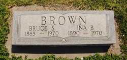
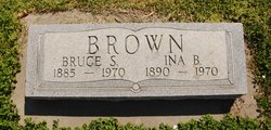
Ina Blanche Smith Brown
| Birth | : | 1 Jan 1890 Iowa, USA |
| Death | : | 1970 Kansas, USA |
| Burial | : | Atheys Chapel Cemetery, Rome, Daviess County, USA |
| Coordinate | : | 37.7227800, -87.1815980 |
| Plot | : | Sec. 140, Blk. 1, Lot 17, Sp. 3. |
frequently asked questions (FAQ):
-
Where is Ina Blanche Smith Brown's memorial?
Ina Blanche Smith Brown's memorial is located at: Atheys Chapel Cemetery, Rome, Daviess County, USA.
-
When did Ina Blanche Smith Brown death?
Ina Blanche Smith Brown death on 1970 in Kansas, USA
-
Where are the coordinates of the Ina Blanche Smith Brown's memorial?
Latitude: 37.7227800
Longitude: -87.1815980
Family Members:
Parent
Spouse
Siblings
Flowers:
Nearby Cemetories:
1. Atheys Chapel Cemetery
Rome, Daviess County, USA
Coordinate: 37.7227800, -87.1815980
2. Harold Cemetery
Sorgho, Daviess County, USA
Coordinate: 37.7473602, -87.1791942
3. Barbour Cemetery
Owensboro, Daviess County, USA
Coordinate: 37.7485000, -87.1730160
4. Pleasant Grove Baptist Church Cemetery
Sorgho, Daviess County, USA
Coordinate: 37.7552300, -87.2037700
5. Worthington Family Cemetery
Daviess County, USA
Coordinate: 37.7611480, -87.1728200
6. Crabtree Cemetery
Sorgho, Daviess County, USA
Coordinate: 37.7560000, -87.2120000
7. Sands Cemetery
Daviess County, USA
Coordinate: 37.7651960, -87.1794200
8. Bosley Family Cemetery
Owensboro, Daviess County, USA
Coordinate: 37.7547900, -87.1314700
9. Saint Raphael Original Log Church and Cemetery
West Louisville, Daviess County, USA
Coordinate: 37.7009600, -87.2442900
10. Mater Dolorosa Cemetery
Owensboro, Daviess County, USA
Coordinate: 37.7628600, -87.1330200
11. Saint Raphael Cemetery
West Louisville, Daviess County, USA
Coordinate: 37.7033900, -87.2489000
12. Trinity Episcopal Columbarium
Owensboro, Daviess County, USA
Coordinate: 37.7545630, -87.1184650
13. Saint Mary Magdalene Catholic Cemetery
Sorgho, Daviess County, USA
Coordinate: 37.7503050, -87.2487870
14. Fern Hill Cemetery
Owensboro, Daviess County, USA
Coordinate: 37.7835999, -87.1872025
15. Early Settler Cemetery
Owensboro, Daviess County, USA
Coordinate: 37.7671400, -87.1202600
16. Sorgho Baptist Church Cemetery
Sorgho, Daviess County, USA
Coordinate: 37.7552700, -87.2588600
17. Lancaster Cemetery
Owensboro, Daviess County, USA
Coordinate: 37.7921400, -87.2015000
18. Mount Zion Methodist Episcopal Church Cemetery
Panther, Daviess County, USA
Coordinate: 37.6638700, -87.2325500
19. Hitchcock Family Cemetery
Sorgho, Daviess County, USA
Coordinate: 37.7423261, -87.2686245
20. Nickel Ridge Cemetery
Panther, Daviess County, USA
Coordinate: 37.6505400, -87.2037100
21. Rosehill Elmwood Cemetery
Owensboro, Daviess County, USA
Coordinate: 37.7543983, -87.0942001
22. Hix Cemetery
Sutherland, Daviess County, USA
Coordinate: 37.6716580, -87.1088040
23. Hix Cemetery
Pettit, Daviess County, USA
Coordinate: 37.6716995, -87.1085968
24. Little Flock Baptist Cemetery
Sorgho, Daviess County, USA
Coordinate: 37.7573600, -87.2687700

