
| Birth | : | unknown |
| Death | : | unknown |
| Burial | : | St Paul's Churchyard, Withnell, Chorley Borough, England |
| Coordinate | : | 53.6970740, -2.5592150 |
| Plot | : | Section D, Row 15 |
frequently asked questions (FAQ):
-
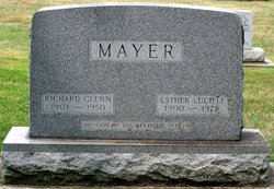
Where is Infant Mayer's memorial?
Infant Mayer's memorial is located at: St Paul's Churchyard, Withnell, Chorley Borough, England.
-
When did Infant Mayer death?
Infant Mayer death on unknown in
-
Where are the coordinates of the Infant Mayer's memorial?
Latitude: 53.6970740
Longitude: -2.5592150
Family Members:
Parent

Siblings

Flowers:


Nearby Cemetories:
1. St Paul's Churchyard
Withnell, Chorley Borough, England
Coordinate: 53.6970740, -2.5592150
2. St Stephen Churchyard
Tockholes, Blackburn with Darwen Unitary Authority, England
Coordinate: 53.7058350, -2.5169320
3. St Barnabas Churchyard
Heapey, Chorley Borough, England
Coordinate: 53.6792520, -2.6043310
4. St James's Churchyard
Brindle, Chorley Borough, England
Coordinate: 53.7133333, -2.6086111
5. Holy Trinity Churchyard
Hoghton, Chorley Borough, England
Coordinate: 53.7279300, -2.5848550
6. St. Chad's South Hill Churchyard
Wheelton, Chorley Borough, England
Coordinate: 53.6826040, -2.6125010
7. Pleasington Priory
Pleasington, Blackburn with Darwen Unitary Authority, England
Coordinate: 53.7348590, -2.5433060
8. New Row Methodist Church
Blackburn with Darwen Unitary Authority, England
Coordinate: 53.7208950, -2.5023720
9. St. Josephs Roman Catholic Churchyard
Brindle, Chorley Borough, England
Coordinate: 53.7350780, -2.5880640
10. Pleasington Cemetery and Crematorium
Blackburn, Blackburn with Darwen Unitary Authority, England
Coordinate: 53.7388880, -2.5368710
11. St. Bedes Churchyard
Clayton-le-Woods, Chorley Borough, England
Coordinate: 53.7079260, -2.6390320
12. St John the Evangelist Churchyard
Whittle-le-Woods, Chorley Borough, England
Coordinate: 53.6883280, -2.6400320
13. St Peters Churchyard
Chorley, Chorley Borough, England
Coordinate: 53.6607430, -2.6232100
14. St Peters Churchyard
Darwen, Blackburn with Darwen Unitary Authority, England
Coordinate: 53.6955520, -2.4648090
15. St Laurence's Church
Chorley, Chorley Borough, England
Coordinate: 53.6546880, -2.6327020
16. St George's Churchyard
Chorley, Chorley Borough, England
Coordinate: 53.6521460, -2.6295520
17. Darwen Cemetery
Darwen, Blackburn with Darwen Unitary Authority, England
Coordinate: 53.6781400, -2.4598300
18. St James Churchyard
Lower Darwen, Blackburn with Darwen Unitary Authority, England
Coordinate: 53.7245510, -2.4634700
19. St. Saviour's Churchyard
Bamber Bridge, South Ribble Borough, England
Coordinate: 53.7197301, -2.6598985
20. St. Peter's Churchyard
Blackburn, Blackburn with Darwen Unitary Authority, England
Coordinate: 53.7448110, -2.4865070
21. Independent Chapel Churchyard
Blackburn, Blackburn with Darwen Unitary Authority, England
Coordinate: 53.7454960, -2.4864460
22. Darwen Eastern Cemetery
Darwen, Blackburn with Darwen Unitary Authority, England
Coordinate: 53.6769300, -2.4547700
23. All Saints Churchyard
Walton-le-Dale, South Ribble Borough, England
Coordinate: 53.7407250, -2.6408280
24. Our Lady and St Patrick's Church
Walton-le-Dale, South Ribble Borough, England
Coordinate: 53.7407250, -2.6408280