
| Memorials | : | 1018 |
| Location | : | Walton-le-Dale, South Ribble Borough, England |
| Phone | : | 01772 253709 |
| Website | : | www.ourladyandstpatrick.org.uk/ |
| Coordinate | : | 53.7407250, -2.6408280 |
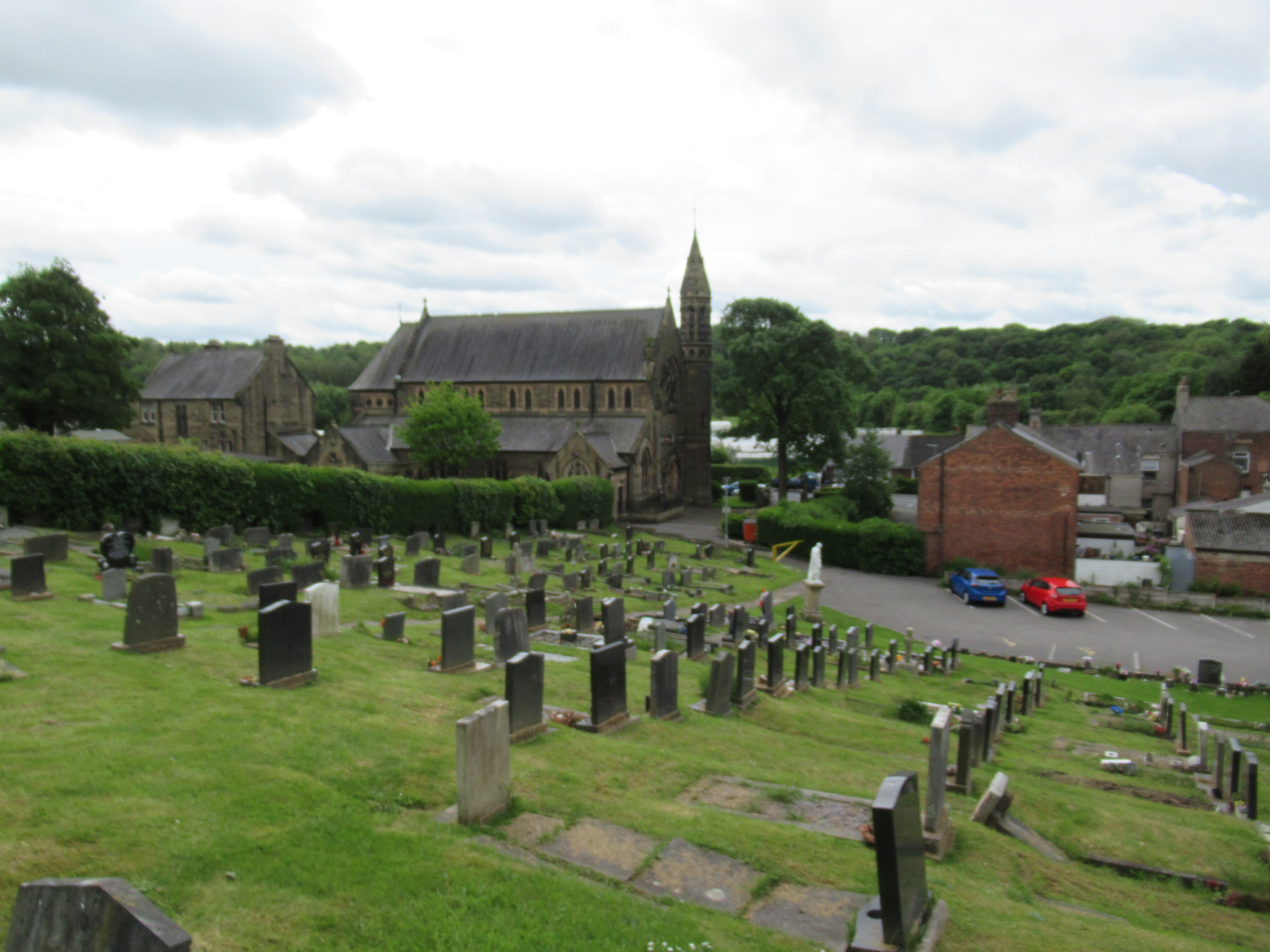
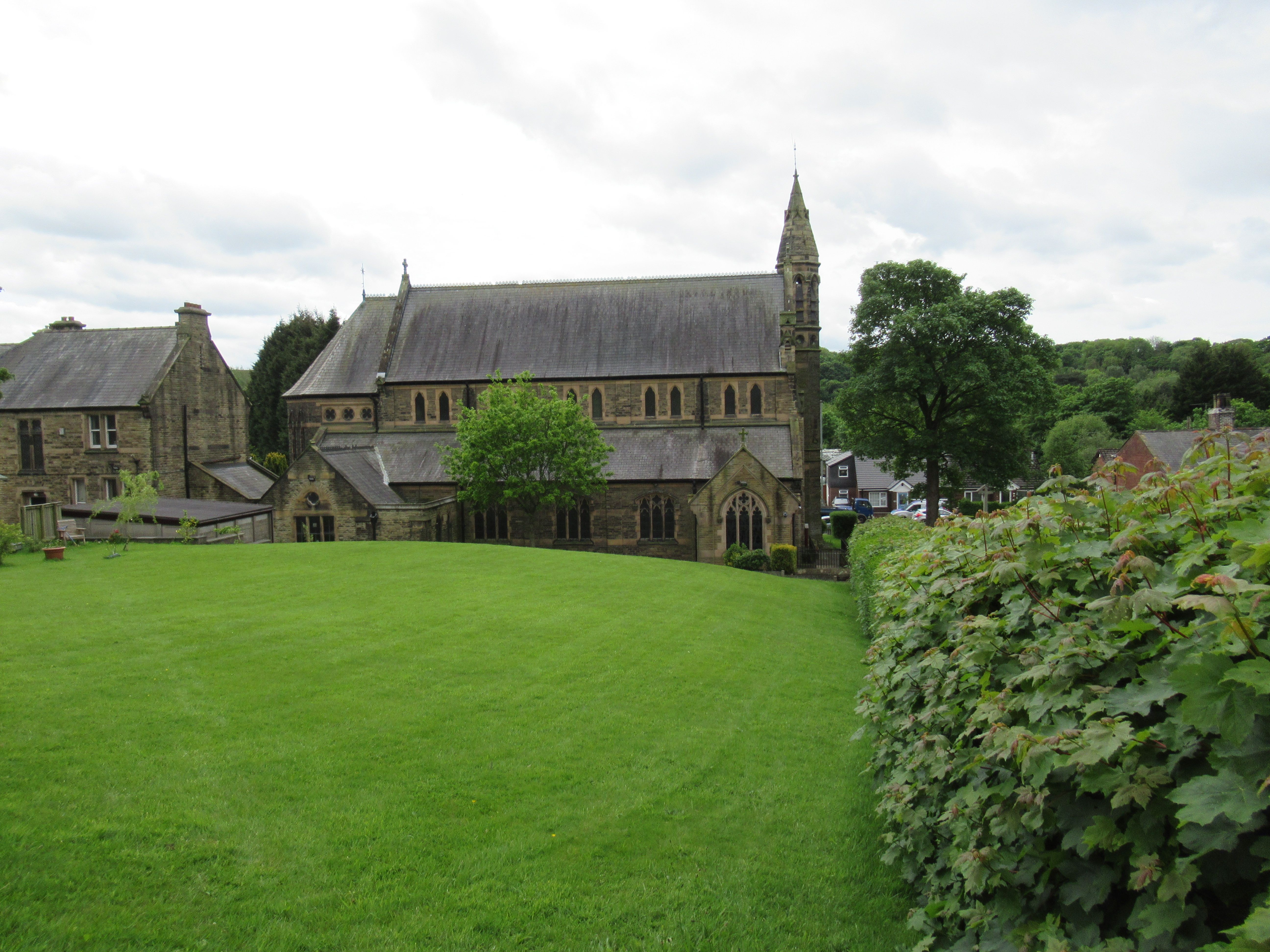
| Description | : | Originally formed in 1855 by the Benedictine order, the Parish of Our Lady and St Patrick (originally the Mission of St Patrick) includes both The Pugin Church of Our Lady and St Patrick and St Patrick's RC Primary School and has served Walton-le-Dale and surrounding area for over 150 years. |
frequently asked questions (FAQ):
-
Where is Our Lady and St Patrick's Church?
Our Lady and St Patrick's Church is located at 121 Higher Walton Rd Walton-le-Dale, South Ribble Borough ,Lancashire , PR5 4HDEngland.
-
Our Lady and St Patrick's Church cemetery's updated grave count on graveviews.com?
1018 memorials
-
Where are the coordinates of the Our Lady and St Patrick's Church?
Latitude: 53.7407250
Longitude: -2.6408280
Nearby Cemetories:
1. All Saints Churchyard
Walton-le-Dale, South Ribble Borough, England
Coordinate: 53.7407250, -2.6408280
2. St Leonard Churchyard
Walton-le-Dale, South Ribble Borough, England
Coordinate: 53.7476530, -2.6666950
3. St Mary's Churchyard Brownedge
Bamber Bridge, South Ribble Borough, England
Coordinate: 53.7305472, -2.6669416
4. St. Saviour's Churchyard
Bamber Bridge, South Ribble Borough, England
Coordinate: 53.7197301, -2.6598985
5. St. Leonard the Less Churchyard
Samlesbury, South Ribble Borough, England
Coordinate: 53.7680000, -2.6237000
6. St. Mary's and St. John RC Churchyard, Southworth
Samlesbury, South Ribble Borough, England
Coordinate: 53.7676690, -2.6183400
7. Preston Old Cemetery
Ribbleton, City of Preston, England
Coordinate: 53.7686352, -2.6623154
8. St. Josephs Roman Catholic Churchyard
Brindle, Chorley Borough, England
Coordinate: 53.7350780, -2.5880640
9. St. Bedes Churchyard
Clayton-le-Woods, Chorley Borough, England
Coordinate: 53.7079260, -2.6390320
10. Our Lady and Saint Gerards Churchyard
Lostock Hall, South Ribble Borough, England
Coordinate: 53.7279090, -2.6921460
11. St James's Churchyard
Brindle, Chorley Borough, England
Coordinate: 53.7133333, -2.6086111
12. Preston New Cemetery
Ribbleton, City of Preston, England
Coordinate: 53.7717400, -2.6620900
13. St Augustine of Canterbury
Preston, City of Preston, England
Coordinate: 53.7560420, -2.6912650
14. St. James' Churchyard
Preston, City of Preston, England
Coordinate: 53.7566010, -2.6941110
15. Holy Trinity Churchyard
Hoghton, Chorley Borough, England
Coordinate: 53.7279300, -2.5848550
16. St John Churchyard
Preston, City of Preston, England
Coordinate: 53.7582080, -2.6959750
17. St. Paul Churchyard
Preston, City of Preston, England
Coordinate: 53.7625360, -2.6947080
18. St. Ignatius RC Churchyard
Preston, City of Preston, England
Coordinate: 53.7635270, -2.6965870
19. St. George the Martyr
Preston, City of Preston, England
Coordinate: 53.7591220, -2.7025660
20. St. Wilfrid's Catholic Cemetery
Preston, City of Preston, England
Coordinate: 53.7581670, -2.7044930
21. St Paul Churchyard
Farington, South Ribble Borough, England
Coordinate: 53.7199900, -2.7017200
22. Friends Meeting House Burial Ground (Defunct)
Preston, City of Preston, England
Coordinate: 53.7610250, -2.7030380
23. Holy Trinity
Preston, City of Preston, England
Coordinate: 53.7613030, -2.7030580
24. Christ Church Churchyard
Preston, City of Preston, England
Coordinate: 53.7573210, -2.7103080