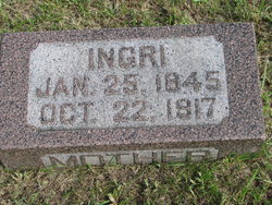
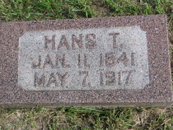
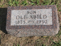
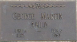
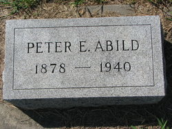
Ingrid Olson “Ingri” Ellefson Abild
| Birth | : | 25 Apr 1845 |
| Death | : | 22 Oct 1917 |
| Burial | : | West Liss Cemetery, Liss, East Hampshire District, England |
| Coordinate | : | 51.0518102, -0.9022678 |
| Plot | : | Lot # 139 |
frequently asked questions (FAQ):
-
Where is Ingrid Olson “Ingri” Ellefson Abild's memorial?
Ingrid Olson “Ingri” Ellefson Abild's memorial is located at: West Liss Cemetery, Liss, East Hampshire District, England.
-
When did Ingrid Olson “Ingri” Ellefson Abild death?
Ingrid Olson “Ingri” Ellefson Abild death on 22 Oct 1917 in
-
Where are the coordinates of the Ingrid Olson “Ingri” Ellefson Abild's memorial?
Latitude: 51.0518102
Longitude: -0.9022678
Family Members:
Spouse
Children
Flowers:
Nearby Cemetories:
1. West Liss Cemetery
Liss, East Hampshire District, England
Coordinate: 51.0518102, -0.9022678
2. St. Peter's Churchyard
Liss, East Hampshire District, England
Coordinate: 51.0521900, -0.9021700
3. St Mary Churchyard
Liss, East Hampshire District, England
Coordinate: 51.0453200, -0.8953100
4. St John the Baptist Churchyard
Greatham, East Hampshire District, England
Coordinate: 51.0678810, -0.8973600
5. St. Peter and St. Paul's Churchyard
Hawkley, East Hampshire District, England
Coordinate: 51.0569000, -0.9374400
6. Holy Rood Churchyard
Empshott, East Hampshire District, England
Coordinate: 51.0755690, -0.9257970
7. All Saints Churchyard
Steep, East Hampshire District, England
Coordinate: 51.0225500, -0.9379500
8. Priors Dean Churchyard
Priors Dean, East Hampshire District, England
Coordinate: 51.0611725, -0.9627250
9. St Matthew Churchyard
Blackmoor, East Hampshire District, England
Coordinate: 51.0960560, -0.8869250
10. Blackmoor War Memorial
Blackmoor, East Hampshire District, England
Coordinate: 51.0962620, -0.8873910
11. Petersfield Cemetery
Petersfield, East Hampshire District, England
Coordinate: 51.0096893, -0.9325990
12. St Luke Churchyard
Milland, Chichester District, England
Coordinate: 51.0476460, -0.8243960
13. St Lawrence Roman Catholic Church
Petersfield, East Hampshire District, England
Coordinate: 51.0069170, -0.9395500
14. St Mary Churchyard
Selborne, East Hampshire District, England
Coordinate: 51.0985300, -0.9428850
15. St Peter Churchyard
Petersfield, East Hampshire District, England
Coordinate: 51.0031000, -0.9372700
16. Dureford Abbey
Rogate, Chichester District, England
Coordinate: 51.0080000, -0.8510000
17. St. Bartholomew's Churchyard
Rogate, Chichester District, England
Coordinate: 51.0079500, -0.8503200
18. St Peter Churchyard
Froxfield, East Hampshire District, England
Coordinate: 51.0338380, -0.9855080
19. St Mary Churchyard
Newton Valence, East Hampshire District, England
Coordinate: 51.0901700, -0.9671400
20. St Peters Churchyard Terwick
Rogate, Chichester District, England
Coordinate: 51.0051950, -0.8357230
21. St. Peter-on-the-Green Churchyard
Froxfield, East Hampshire District, England
Coordinate: 51.0247600, -0.9978400
22. St. James' Churchyard
East Tisted, East Hampshire District, England
Coordinate: 51.0853500, -1.0002000
23. Whitehill Cemetery
Whitehill, East Hampshire District, England
Coordinate: 51.1110500, -0.8425800
24. Bordon Military Cemetery
Bordon, East Hampshire District, England
Coordinate: 51.1201668, -0.8753040

