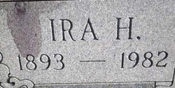
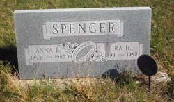
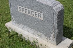
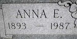
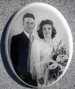
Ira Hugh Spencer
| Birth | : | 7 Jun 1893 Penokee, Graham County, Kansas, USA |
| Death | : | 22 Jan 1982 Cottonwood Falls, Chase County, Kansas, USA |
| Burial | : | Elmdale Cemetery, Elmdale, Chase County, USA |
| Coordinate | : | 38.3778000, -96.6628036 |
| Plot | : | Northwest quadrant of main area |
| Inscription | : | Married August 19, 1918 |
frequently asked questions (FAQ):
-
Where is Ira Hugh Spencer's memorial?
Ira Hugh Spencer's memorial is located at: Elmdale Cemetery, Elmdale, Chase County, USA.
-
When did Ira Hugh Spencer death?
Ira Hugh Spencer death on 22 Jan 1982 in Cottonwood Falls, Chase County, Kansas, USA
-
Where are the coordinates of the Ira Hugh Spencer's memorial?
Latitude: 38.3778000
Longitude: -96.6628036
Family Members:
Parent
Spouse
Siblings
Children
Flowers:
Nearby Cemetories:
1. Elmdale Cemetery
Elmdale, Chase County, USA
Coordinate: 38.3778000, -96.6628036
2. McDowall Cemetery
Strong City, Chase County, USA
Coordinate: 38.4059860, -96.6022720
3. Simmons Cemetery
Strong City, Chase County, USA
Coordinate: 38.3988991, -96.5849991
4. Lawless Cemetery
Strong City, Chase County, USA
Coordinate: 38.4496700, -96.6630200
5. Prairie Grove Cemetery
Cottonwood Falls, Chase County, USA
Coordinate: 38.3741989, -96.5639038
6. Saint Anthony Cemetery
Strong City, Chase County, USA
Coordinate: 38.4056015, -96.5547028
7. Clements Cemetery
Clements, Chase County, USA
Coordinate: 38.3040900, -96.7438800
8. Elk Cemetery
Elmdale, Chase County, USA
Coordinate: 38.4138985, -96.7844009
9. Strong Township Cemetery
Strong City, Chase County, USA
Coordinate: 38.3983002, -96.5222015
10. Ice Cemetery
Chase County, USA
Coordinate: 38.2924800, -96.7594600
11. Boenitz Cemetery
Elmdale, Chase County, USA
Coordinate: 38.5052986, -96.7016983
12. Diamond Creek Cemetery
Chase County, USA
Coordinate: 38.5071983, -96.7136002
13. Miller Cemetery
Cottonwood Falls, Chase County, USA
Coordinate: 38.3471985, -96.4916992
14. Bazaar Cemetery
Bazaar, Chase County, USA
Coordinate: 38.2717018, -96.5449982
15. Montgomery Cemetery
Chase County, USA
Coordinate: 38.3196983, -96.8364029
16. Drinkwater Cemetery
Cedar Point, Chase County, USA
Coordinate: 38.2619019, -96.8236008
17. Grant Cemetery
Marion, Marion County, USA
Coordinate: 38.3619003, -96.8843994
18. Sharps Creek Cemetery
Bazaar, Chase County, USA
Coordinate: 38.2481400, -96.5123400
19. Homestead Cemetery
Chase County, USA
Coordinate: 38.2022018, -96.6952972
20. Diamond Springs Cemetery
Diamond Springs, Morris County, USA
Coordinate: 38.5547028, -96.7410507
21. Cedar Point Cemetery
Cedar Point, Chase County, USA
Coordinate: 38.2397003, -96.8253021
22. Peyton Family Cemetery
Toledo Township, Chase County, USA
Coordinate: 38.3819210, -96.4209340
23. Griffith Cemetery
Chase County, USA
Coordinate: 38.1913986, -96.8118973
24. Harter Cemetery
Marion, Marion County, USA
Coordinate: 38.3699989, -96.9483032

